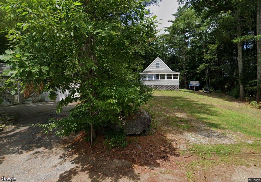
433 Bow Lake Rd Northwood, NH 03261
Estimated Value: $462,837 - $628,000
1
Bed
2
Baths
1,510
Sq Ft
$344/Sq Ft
Est. Value
About This Home
This home is located at 433 Bow Lake Rd, Northwood, NH 03261 and is currently estimated at $519,209, approximately $343 per square foot. 433 Bow Lake Rd is a home located in Rockingham County with nearby schools including Northwood Elementary School and Coe-Brown Northwood Academy.
Ownership History
Date
Name
Owned For
Owner Type
Purchase Details
Closed on
Jan 7, 2005
Sold by
Hopwood Rodney A and Hopwood Linea A
Bought by
Gershuny Ian and Gershuny Linda
Current Estimated Value
Purchase Details
Closed on
Dec 17, 2004
Sold by
Hendrick Jon B
Bought by
Hopwood Rodney A and Hopwood Linea A
Create a Home Valuation Report for This Property
The Home Valuation Report is an in-depth analysis detailing your home's value as well as a comparison with similar homes in the area
Home Values in the Area
Average Home Value in this Area
Purchase History
| Date | Buyer | Sale Price | Title Company |
|---|---|---|---|
| Gershuny Ian | $20,000 | -- | |
| Hopwood Rodney A | $20,000 | -- |
Source: Public Records
Mortgage History
| Date | Status | Borrower | Loan Amount |
|---|---|---|---|
| Open | Hopwood Rodney A | $165,500 | |
| Closed | Hopwood Rodney A | $212,000 |
Source: Public Records
Tax History Compared to Growth
Tax History
| Year | Tax Paid | Tax Assessment Tax Assessment Total Assessment is a certain percentage of the fair market value that is determined by local assessors to be the total taxable value of land and additions on the property. | Land | Improvement |
|---|---|---|---|---|
| 2024 | $5,412 | $347,600 | $166,800 | $180,800 |
| 2023 | $4,797 | $347,600 | $166,800 | $180,800 |
| 2022 | $4,373 | $347,600 | $166,800 | $180,800 |
| 2021 | $3,843 | $248,400 | $112,400 | $136,000 |
| 2020 | $4,414 | $248,400 | $112,400 | $136,000 |
| 2019 | $3,943 | $175,100 | $66,000 | $109,100 |
| 2018 | $4,497 | $175,100 | $66,000 | $109,100 |
| 2016 | $4,199 | $175,100 | $66,000 | $109,100 |
| 2015 | $4,461 | $178,600 | $66,000 | $112,600 |
| 2014 | $4,481 | $187,500 | $91,800 | $95,700 |
| 2012 | $4,350 | $187,500 | $91,800 | $95,700 |
Source: Public Records
Map
Nearby Homes
- 133 & 137 Browns Pasture Rd
- 207 Long Pond Rd
- Map 219 Lot 6-8 Ridge Rd
- 8 Bow Lake Rd
- 0 1st New Hampshire Turnpike Unit 5026030
- 0 1st New Hampshire Turnpike Unit 5013320
- 150A 1st New Hampshire Turnpike
- 129 Water St
- Map 102 Lot 9 Kramas Ln
- 51 Kelsey Mill Rd
- 64 Kelsey Mill Rd
- 6 Pine St
- 11 Drake Hill Rd
- 17 Brook Circle Rd
- 21 Quimby Dr
- 20 Quimby Dr
- 10 Sunset Dr
- 152 Olde Canterbury Rd
- 49 Tasker Shore Dr
- 16 Deer Run Ln
- 429 Bow Lake Rd
- 438 Bow Lake Rd
- 430 Bow Lake Rd
- 427 Bow Lake Rd
- 441 Bow Lake Rd
- 426 Bow Lake Rd
- 442 Bow Lake Rd
- 421 Bow Lake Rd
- 10 Friendship Cove Dr
- 12 Mclarren Dr
- 422 Bow Lake Rd
- 419 Bow Lake Rd
- 457 Bow Lake Rd
- 447 Bow Lake Rd
- 5 Mclarren Dr
- 14 Mclarren Dr
- 415 Bow Lake Rd
- 10 Simpson Ln
- 13 Corson Dr
- 21 Mclarren Dr