Estimated Value: $41,000 - $111,000
4
Beds
1
Bath
1,472
Sq Ft
$53/Sq Ft
Est. Value
About This Home
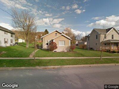
This home is located at 433 Colerain St, Sligo, PA 16255 and is currently estimated at $78,576, approximately $53 per square foot. 433 Colerain St is a home located in Clarion County with nearby schools including Sligo Elementary School, Rimersburg El School, and Union High School.
Ownership History
Date
Name
Owned For
Owner Type
Purchase Details
Closed on
Apr 19, 2024
Sold by
Vogle Daniel Adam and Vogle Samantha Jo
Bought by
Weidenhof Devon L
Current Estimated Value
Purchase Details
Closed on
Dec 8, 2017
Sold by
Lytle Belinda D
Bought by
Vogle Daniel Adam
Home Financials for this Owner
Home Financials are based on the most recent Mortgage that was taken out on this home.
Original Mortgage
$62,448
Interest Rate
4.4%
Mortgage Type
FHA
Purchase Details
Closed on
Dec 10, 2010
Sold by
Craig Carrie E and Craig Craig
Bought by
Lytle Belinda D
Home Financials for this Owner
Home Financials are based on the most recent Mortgage that was taken out on this home.
Original Mortgage
$3,000
Interest Rate
4.17%
Mortgage Type
Second Mortgage Made To Cover Down Payment
Create a Home Valuation Report for This Property
The Home Valuation Report is an in-depth analysis detailing your home's value as well as a comparison with similar homes in the area
Home Values in the Area
Average Home Value in this Area
Purchase History
| Date | Buyer | Sale Price | Title Company |
|---|---|---|---|
| Weidenhof Devon L | $50,000 | None Listed On Document | |
| Vogle Daniel Adam | $63,600 | Paradigm Abstract | |
| Lytle Belinda D | $51,800 | -- |
Source: Public Records
Mortgage History
| Date | Status | Borrower | Loan Amount |
|---|---|---|---|
| Previous Owner | Vogle Daniel Adam | $62,448 | |
| Previous Owner | Lytle Belinda D | $3,000 | |
| Previous Owner | Lytle Belinda D | $50,486 |
Source: Public Records
Tax History Compared to Growth
Tax History
| Year | Tax Paid | Tax Assessment Tax Assessment Total Assessment is a certain percentage of the fair market value that is determined by local assessors to be the total taxable value of land and additions on the property. | Land | Improvement |
|---|---|---|---|---|
| 2025 | $1,009 | $10,360 | $1,350 | $9,010 |
| 2024 | $961 | $10,360 | $1,350 | $9,010 |
| 2023 | $939 | $10,360 | $1,350 | $9,010 |
| 2022 | $917 | $10,360 | $1,350 | $9,010 |
| 2021 | $907 | $10,360 | $1,350 | $9,010 |
| 2020 | $889 | $10,360 | $1,350 | $9,010 |
| 2019 | $886 | $10,360 | $1,350 | $9,010 |
| 2018 | $866 | $10,360 | $1,350 | $9,010 |
| 2017 | $866 | $10,360 | $1,350 | $9,010 |
| 2016 | $866 | $10,360 | $1,350 | $9,010 |
| 2014 | -- | $10,360 | $1,350 | $9,010 |
Source: Public Records
Map
Nearby Homes
- 451 Colerain St
- 0 Walker Farm Rd
- 0 Mount Airy Rd
- N/A Mount Airy Rd
- 1106 Huey Rd
- 61 Rankin Rd
- 3684 Huck Hucklebrry Ridge
- 0 T-377
- 00 Borovick Rd
- 66 Ray's Ln
- 69 Carwick Rd
- 0 Mauthe Rd
- 725 River Bends Dr
- 3480 Canoe Ripple Rd
- 518 Craig St
- 3765/3905
- 0 Monterey Rd Unit 1670611
- 346 Lawsonham St
- 131 Baker St
- 684 Lawsonham Rd