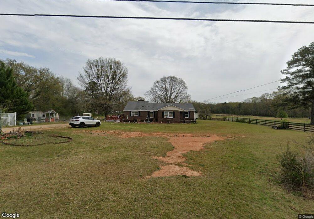
433 Cooley Rd Lagrange, GA 30241
Estimated Value: $177,000 - $220,690
3
Beds
2
Baths
2,081
Sq Ft
$94/Sq Ft
Est. Value
About This Home
This home is located at 433 Cooley Rd, Lagrange, GA 30241 and is currently estimated at $194,923, approximately $93 per square foot. 433 Cooley Rd is a home with nearby schools including Whitesville Road Elementary School, Berta Weathersbee Elementary School, and Rosemont Elementary School.
Ownership History
Date
Name
Owned For
Owner Type
Purchase Details
Closed on
Sep 21, 2012
Sold by
Kelley David Dillion Donov
Bought by
Vaughan Raymon and Vaughan Jerrell
Current Estimated Value
Purchase Details
Closed on
Jun 2, 2003
Sold by
Ruth Orr Gilstrap
Bought by
Susan Elaine Gilstrap
Purchase Details
Closed on
Mar 30, 1981
Sold by
Gilstrap David P
Bought by
Ruth Orr Gilstrap
Purchase Details
Closed on
Aug 5, 1975
Sold by
Frost Mary D
Bought by
Gilstrap David P
Purchase Details
Closed on
Jan 1, 1954
Sold by
Williamson Dual
Bought by
Frost Mary D
Purchase Details
Closed on
Nov 1, 1938
Sold by
Stagg Daisy
Bought by
Williamson Dual
Create a Home Valuation Report for This Property
The Home Valuation Report is an in-depth analysis detailing your home's value as well as a comparison with similar homes in the area
Purchase History
| Date | Buyer | Sale Price | Title Company |
|---|---|---|---|
| Vaughan Raymon | $6,000 | -- | |
| Susan Elaine Gilstrap | $1,000 | -- | |
| Ruth Orr Gilstrap | -- | -- | |
| Gilstrap David P | $36,000 | -- | |
| Frost Mary D | -- | -- | |
| Williamson Dual | -- | -- |
Source: Public Records
Tax History
| Year | Tax Paid | Tax Assessment Tax Assessment Total Assessment is a certain percentage of the fair market value that is determined by local assessors to be the total taxable value of land and additions on the property. | Land | Improvement |
|---|---|---|---|---|
| 2025 | $1,772 | $70,584 | $11,120 | $59,464 |
| 2024 | $1,593 | $60,400 | $11,120 | $49,280 |
| 2023 | $709 | $45,888 | $11,120 | $34,768 |
| 2022 | $1,154 | $43,328 | $11,120 | $32,208 |
| 2021 | $883 | $31,276 | $7,280 | $23,996 |
| 2020 | $883 | $31,276 | $7,280 | $23,996 |
| 2019 | $912 | $32,224 | $7,280 | $24,944 |
| 2018 | $843 | $29,936 | $7,280 | $22,656 |
| 2017 | $843 | $29,936 | $7,280 | $22,656 |
| 2016 | $865 | $30,654 | $7,280 | $23,374 |
| 2015 | $866 | $30,654 | $7,280 | $23,374 |
| 2014 | $861 | $30,426 | $7,280 | $23,146 |
| 2013 | -- | $31,988 | $7,280 | $24,708 |
Source: Public Records
Map
Nearby Homes
Your Personal Tour Guide
Ask me questions while you tour the home.