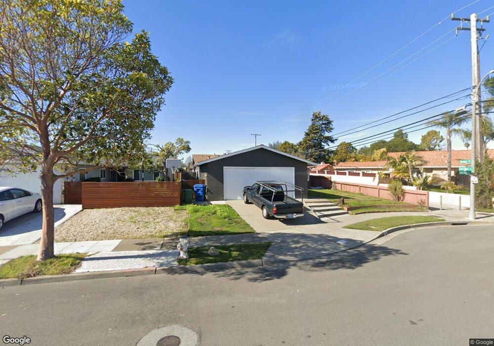
433 Coral Reef Rd Alameda, CA 94501
South Shore NeighborhoodEstimated Value: $1,203,000 - $1,250,523
4
Beds
2
Baths
1,393
Sq Ft
$879/Sq Ft
Est. Value
About This Home
This home is located at 433 Coral Reef Rd, Alameda, CA 94501 and is currently estimated at $1,224,131, approximately $878 per square foot. 433 Coral Reef Rd is a home located in Alameda County with nearby schools including William G. Paden Elementary School, Will C. Wood Middle School, and Encinal Junior/Senior High.
Ownership History
Date
Name
Owned For
Owner Type
Purchase Details
Closed on
Jul 14, 2023
Sold by
Isidora Lazo Family Revocable Trust
Bought by
Lazo Adolfo Luis
Current Estimated Value
Purchase Details
Closed on
Mar 12, 2004
Sold by
Lazo Isidora
Bought by
Lazo Isidora and Isidora Lazo Family Rev Trust
Create a Home Valuation Report for This Property
The Home Valuation Report is an in-depth analysis detailing your home's value as well as a comparison with similar homes in the area
Home Values in the Area
Average Home Value in this Area
Purchase History
| Date | Buyer | Sale Price | Title Company |
|---|---|---|---|
| Lazo Adolfo Luis | -- | None Listed On Document | |
| Lazo Isidora | -- | None Available |
Source: Public Records
Tax History
| Year | Tax Paid | Tax Assessment Tax Assessment Total Assessment is a certain percentage of the fair market value that is determined by local assessors to be the total taxable value of land and additions on the property. | Land | Improvement |
|---|---|---|---|---|
| 2025 | $19,209 | $1,443,300 | $432,990 | $1,010,310 |
| 2024 | $19,209 | $1,415,000 | $424,500 | $990,500 |
| 2023 | $4,450 | $277,611 | $172,456 | $105,155 |
| 2022 | $4,338 | $265,169 | $169,075 | $103,094 |
| 2021 | $4,226 | $259,832 | $165,760 | $101,072 |
| 2020 | $4,167 | $264,097 | $164,061 | $100,036 |
| 2019 | $4,062 | $258,919 | $160,844 | $98,075 |
| 2018 | $3,956 | $253,843 | $157,691 | $96,152 |
| 2017 | $3,785 | $248,866 | $154,599 | $94,267 |
| 2016 | $3,769 | $243,987 | $151,568 | $92,419 |
| 2015 | $3,747 | $240,323 | $149,292 | $91,031 |
| 2014 | $3,539 | $235,616 | $146,368 | $89,248 |
Source: Public Records
Map
Nearby Homes
- 955 Shorepoint Ct Unit 216
- 960 Shorepoint Ct Unit 215
- 1122 Bay St
- 325 Kitty Hawk Rd Unit 207
- 933 Shoreline Dr Unit 203
- 1003 Morton St
- 1822 Clinton Ave
- 2000 Clinton Ave
- 2031 Otis Dr Unit H
- 610 Grand St
- 1203 Benton St
- 1211 Paru St
- 2106 Otis Dr Unit A
- 1500 Alameda Ave Unit G
- 1000 Central Ave
- 1401 Cottage St Unit D
- 2137 Otis Dr Unit 111
- 1512 Mozart St
- 1523 Verdi St
- 2050 Central Ave
- 429 Coral Reef Rd
- 1201 Coral Reef Place
- 432 Harbor Light Rd
- 425 Coral Reef Rd
- 428 Harbor Light Rd
- 1205 Coral Reef Place
- 424 Harbor Light Rd
- 421 Coral Reef Rd
- 1209 Coral Reef Place
- 428 Coral Reef Rd
- 420 Harbor Light Rd
- 1165 Sand Beach Place
- 424 Coral Reef Rd
- 417 Coral Reef Rd
- 1220 Rosewood Way
- 1224 Rosewood Way
- 1213 Coral Reef Place
- 1216 Rosewood Way
- 1228 Rosewood Way
- 416 Harbor Light Rd
Your Personal Tour Guide
Ask me questions while you tour the home.