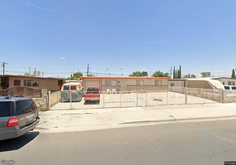
433 Mccarthy Ave El Paso, TX 79915
Thomas Manor NeighborhoodEstimated Value: $154,000 - $183,000
--
Bed
1
Bath
1,368
Sq Ft
$123/Sq Ft
Est. Value
About This Home
This home is located at 433 Mccarthy Ave, El Paso, TX 79915 and is currently estimated at $168,264, approximately $123 per square foot. 433 Mccarthy Ave is a home located in El Paso County with nearby schools including Thomas Manor, Riverside Middle School, and Riverside High School.
Ownership History
Date
Name
Owned For
Owner Type
Purchase Details
Closed on
Dec 11, 2024
Sold by
Pizarro William David
Bought by
Depizarro Rosa Maria Boliva
Current Estimated Value
Purchase Details
Closed on
Oct 17, 2011
Sold by
Pizarro Mario and Pizarro Rosa
Bought by
Pizarro William David
Purchase Details
Closed on
Jul 11, 1986
Sold by
Eggert William F and Eggert Sebastiana
Bought by
Pizarro Mario and Pizarro Rosa
Create a Home Valuation Report for This Property
The Home Valuation Report is an in-depth analysis detailing your home's value as well as a comparison with similar homes in the area
Home Values in the Area
Average Home Value in this Area
Purchase History
| Date | Buyer | Sale Price | Title Company |
|---|---|---|---|
| Depizarro Rosa Maria Boliva | -- | None Listed On Document | |
| Pizarro William David | -- | None Available | |
| Pizarro Mario | -- | -- |
Source: Public Records
Tax History Compared to Growth
Tax History
| Year | Tax Paid | Tax Assessment Tax Assessment Total Assessment is a certain percentage of the fair market value that is determined by local assessors to be the total taxable value of land and additions on the property. | Land | Improvement |
|---|---|---|---|---|
| 2025 | $4,197 | $166,684 | $25,465 | $141,219 |
| 2024 | $4,197 | $152,819 | $11,600 | $141,219 |
| 2023 | $4,197 | $141,368 | $11,600 | $129,768 |
| 2022 | $4,209 | $135,528 | $11,600 | $123,928 |
| 2021 | $3,438 | $105,755 | $11,600 | $94,155 |
| 2020 | $2,534 | $80,238 | $11,600 | $68,638 |
| 2018 | $2,521 | $81,058 | $11,600 | $69,458 |
| 2017 | $2,492 | $81,531 | $11,600 | $69,931 |
| 2016 | $2,492 | $81,531 | $11,600 | $69,931 |
| 2015 | $2,390 | $81,531 | $11,600 | $69,931 |
| 2014 | $2,390 | $83,519 | $11,600 | $71,919 |
Source: Public Records
Map
Nearby Homes
- 310 Kelvin Ave
- 222 Kelvin Ave
- 223 Kelvin Ave
- 205 Kelvin Ave
- 7874 Broadway Dr
- 104 Chip Way
- 7860 Porche St
- 7807 Porche St
- 7925 Broadway Dr
- 7920 Porche St
- 7952 Broadway Dr
- 7632 Franklin Dr Unit 1-2
- 8041 Broadway Dr
- 151 Aspen Rd
- 217 Papaya St
- 7798 Rosedale St
- 443 Cadwallader Dr
- 7327 Mimosa Ave
- 7907 Alameda Ave
- 208 Arbor Place
- 437 Mccarthy Ave
- 429 Mccarthy Ave
- 441 Mccarthy Ave
- 432 Gladys Ave
- 425 Mccarthy Ave
- 436 Gladys Ave
- 428 Gladys Ave
- 440 Gladys Ave
- 424 Gladys Ave
- 421 Mccarthy Ave
- 445 Mccarthy Ave
- 432 Mccarthy Ave
- 436 Mccarthy Ave
- 428 Mccarthy Ave
- 444 Gladys Ave
- 440 Mccarthy Ave
- 420 Gladys Ave
- 424 Mccarthy Ave
- 417 Mccarthy Ave
- 449 Mccarthy Ave