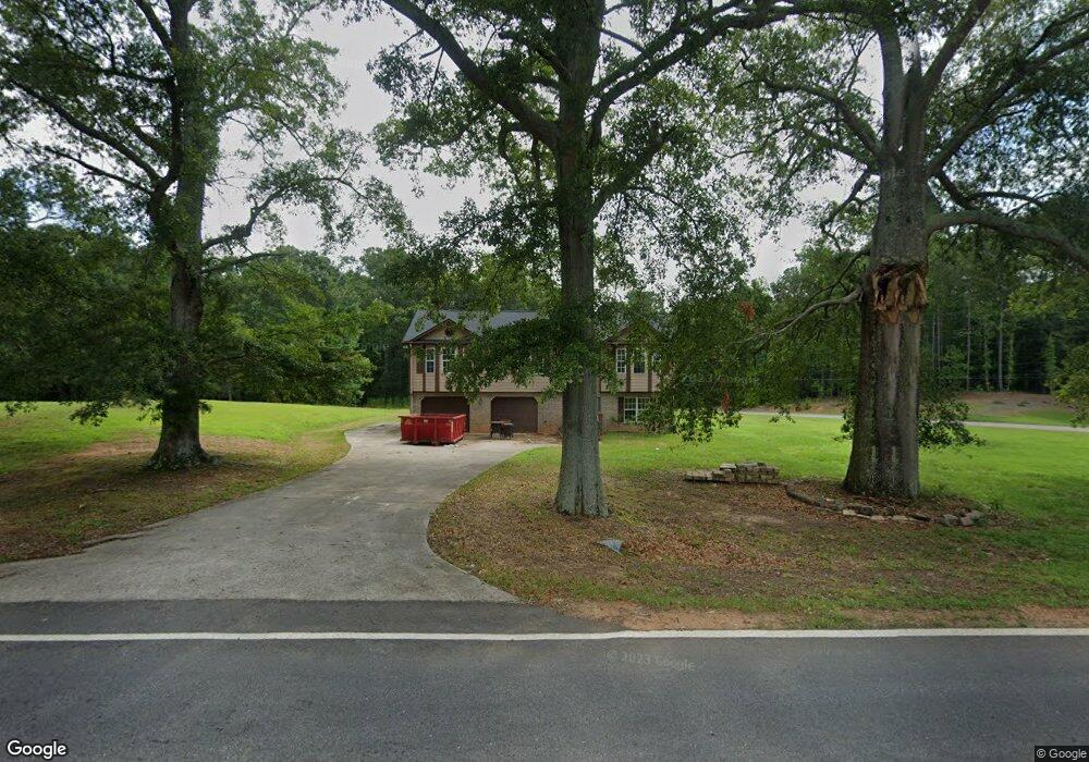
433 Miles Patrick Rd Winder, GA 30680
Estimated Value: $285,000 - $376,000
Studio
3
Baths
2,184
Sq Ft
$146/Sq Ft
Est. Value
About This Home
This home is located at 433 Miles Patrick Rd, Winder, GA 30680 and is currently estimated at $318,002, approximately $145 per square foot. 433 Miles Patrick Rd is a home located in Barrow County with nearby schools including County Line Elementary School, Russell Middle School, and Winder-Barrow High School.
Ownership History
Date
Name
Owned For
Owner Type
Purchase Details
Closed on
Feb 21, 2025
Sold by
Maxwell Robert Lawson
Bought by
Maxwell Callie Shane and Maxwell Robert Lawson
Current Estimated Value
Home Financials for this Owner
Home Financials are based on the most recent Mortgage that was taken out on this home.
Original Mortgage
$243,000
Outstanding Balance
$240,939
Interest Rate
6.96%
Mortgage Type
New Conventional
Estimated Equity
$77,063
Purchase Details
Closed on
Sep 22, 2023
Sold by
Uprite Llc
Bought by
Lawson Maxwell Robert
Purchase Details
Closed on
Apr 28, 2021
Sold by
Patrick Carolyn Mitchell Estate
Bought by
Uprite Llc
Create a Home Valuation Report for This Property
The Home Valuation Report is an in-depth analysis detailing your home's value as well as a comparison with similar homes in the area
Home Values in the Area
Average Home Value in this Area
Purchase History
| Date | Buyer | Sale Price | Title Company |
|---|---|---|---|
| Maxwell Callie Shane | -- | -- | |
| Lawson Maxwell Robert | $196,500 | -- | |
| Uprite Llc | $292,500 | -- |
Source: Public Records
Mortgage History
| Date | Status | Borrower | Loan Amount |
|---|---|---|---|
| Open | Maxwell Callie Shane | $243,000 |
Source: Public Records
Tax History
| Year | Tax Paid | Tax Assessment Tax Assessment Total Assessment is a certain percentage of the fair market value that is determined by local assessors to be the total taxable value of land and additions on the property. | Land | Improvement |
|---|---|---|---|---|
| 2025 | $2,396 | $90,200 | $11,200 | $79,000 |
| 2024 | $2,406 | $87,928 | $11,200 | $76,728 |
| 2023 | $2,490 | $87,928 | $11,200 | $76,728 |
| 2022 | $2,161 | $62,591 | $11,200 | $51,391 |
| 2021 | $2,293 | $62,591 | $11,200 | $51,391 |
| 2020 | $2,183 | $62,591 | $11,200 | $51,391 |
| 2019 | $2,021 | $56,780 | $10,000 | $46,780 |
| 2018 | $2,016 | $56,780 | $10,000 | $46,780 |
| 2017 | $1,486 | $49,820 | $10,000 | $39,820 |
| 2016 | $1,645 | $48,287 | $10,000 | $38,287 |
| 2015 | $1,647 | $48,287 | $10,000 | $38,287 |
Source: Public Records
Map
Nearby Homes
- 27 Creekside Dr
- 538 Valleyview Dr
- 421 N 5th Ave
- 223 Lacey Ln
- 222 Ryan Rd
- 236 Hidden Ct
- 326 Miles Patrick Rd
- 2050 Whispering Way
- 0 E Northcrest Dr Unit 10648147
- 154 Williamsburg Way
- 197 Buena Vista St
- 326 Fayette Dr
- 403 Ryan Cir
- 128 Northridge Dr
- 469 Plantation Dr
- 845 Idlewood Rd
- 318 Ryan Rd
- 436 Northcrest Dr
- 303 Rocky Point Ct
- 5 Olevia St
- 27 Creekside Dr Unit 2
- 517 Valley View Dr
- 515 Valley View Dr
- 13 Creekside Dr
- 13 Creekside Dr Unit 3
- 515 Valleyview Dr
- 519 Valley View Dr
- 519 Valley View Dr Unit 3
- 519 Valleyview Dr
- 449 Miles Patrick Rd
- 521 Valley View Dr
- 513 Valley View Dr
- 427 Miles Patrick Rd
- 426 Miles Patrick Rd
- 511 Valley View Dr
- 514 Valley View Dr
- 523 Valley View Dr
- 142 Evergreen Ln
- 423 Miles Patrick Rd Unit 5
- 509 Valley View Dr
Your Personal Tour Guide
Ask me questions while you tour the home.