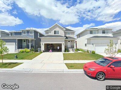
433 N 100 W Vineyard, UT 84059
Estimated Value: $570,779 - $643,000
4
Beds
4
Baths
1,913
Sq Ft
$318/Sq Ft
Est. Value
About This Home
This home is located at 433 N 100 W, Vineyard, UT 84059 and is currently estimated at $608,695, approximately $318 per square foot. 433 N 100 W is a home with nearby schools including Orem Junior High School, Mountain View High School, and Freedom Preparatory Academy - Vineyard.
Ownership History
Date
Name
Owned For
Owner Type
Purchase Details
Closed on
Nov 4, 2021
Sold by
Thorny Bosquet and Bosquet Elizabeth A
Bought by
Lewis Dillan
Current Estimated Value
Home Financials for this Owner
Home Financials are based on the most recent Mortgage that was taken out on this home.
Original Mortgage
$427,500
Outstanding Balance
$401,006
Interest Rate
2.88%
Mortgage Type
New Conventional
Purchase Details
Closed on
Jun 30, 2017
Sold by
Bosquet Thomy
Bought by
Bosquet Thomy and Bosquet Elizabeth A
Home Financials for this Owner
Home Financials are based on the most recent Mortgage that was taken out on this home.
Original Mortgage
$285,030
Interest Rate
4.02%
Mortgage Type
New Conventional
Create a Home Valuation Report for This Property
The Home Valuation Report is an in-depth analysis detailing your home's value as well as a comparison with similar homes in the area
Home Values in the Area
Average Home Value in this Area
Purchase History
| Date | Buyer | Sale Price | Title Company |
|---|---|---|---|
| Lewis Dillan | -- | North American Title | |
| Bosquet Thomy | -- | Select Title Ins Agency | |
| Bosquet Thomy | -- | Select Title Ins Agency |
Source: Public Records
Mortgage History
| Date | Status | Borrower | Loan Amount |
|---|---|---|---|
| Open | Lewis Dillan | $427,500 | |
| Previous Owner | Basquet Thomy | $324,000 | |
| Previous Owner | Bosquet Thomy | $285,030 | |
| Previous Owner | Construction Partners Llc | $10,000,000 |
Source: Public Records
Tax History Compared to Growth
Tax History
| Year | Tax Paid | Tax Assessment Tax Assessment Total Assessment is a certain percentage of the fair market value that is determined by local assessors to be the total taxable value of land and additions on the property. | Land | Improvement |
|---|---|---|---|---|
| 2024 | $3,010 | $282,370 | $0 | $0 |
| 2023 | $2,763 | $289,630 | $0 | $0 |
| 2022 | $2,831 | $288,475 | $0 | $0 |
| 2021 | $2,517 | $393,100 | $135,000 | $258,100 |
| 2020 | $2,361 | $368,500 | $122,700 | $245,800 |
| 2019 | $2,119 | $340,800 | $113,900 | $226,900 |
| 2018 | $1,951 | $288,300 | $102,200 | $186,100 |
| 2017 | $1,174 | $93,500 | $0 | $0 |
Source: Public Records
Map
Nearby Homes
- 433 N 100 W
- 441 N 100 W
- 427 N 100 W
- 421 N 100 W
- 447 N 100 W
- 413 N 100 W
- 453 N 100 W
- 409 N 100 W
- 459 N 100 W
- 434 N Mallard Dr Unit C
- 416 N Mallard Dr Unit B
- 407 N 100 W Unit 4
- 467 N 100 W
- 454 N Mallard Dr Unit A
- 454 N Mallard Dr Unit C
- 403 N 100 W Unit 3 FS
- 469 N 100 W
- 401 N 100 W
- 474 N Mallard Dr Unit C
- 94 N 470 W