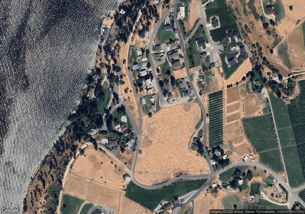
433 Pine Crest Place Manson, WA 98831
Estimated Value: $551,000 - $1,208,000
2
Beds
1
Bath
1,150
Sq Ft
$701/Sq Ft
Est. Value
About This Home
This home is located at 433 Pine Crest Place, Manson, WA 98831 and is currently estimated at $806,237, approximately $701 per square foot. 433 Pine Crest Place is a home located in Chelan County with nearby schools including Manson Elementary School and Manson High School.
Ownership History
Date
Name
Owned For
Owner Type
Purchase Details
Closed on
Feb 1, 2021
Sold by
Leanin Pine Llc
Bought by
Roth Douglas and Roth Ruth
Current Estimated Value
Purchase Details
Closed on
Aug 20, 2020
Sold by
Rice Gordon and Rice Cynthia
Bought by
Leanin Pine Llc
Home Financials for this Owner
Home Financials are based on the most recent Mortgage that was taken out on this home.
Original Mortgage
$750,000
Interest Rate
2.9%
Mortgage Type
Unknown
Purchase Details
Closed on
Jul 13, 2015
Sold by
Rodriguez Gregorio and Rodriguez Shirley A
Bought by
Rice Gordon and Rice Cynthia
Create a Home Valuation Report for This Property
The Home Valuation Report is an in-depth analysis detailing your home's value as well as a comparison with similar homes in the area
Home Values in the Area
Average Home Value in this Area
Purchase History
| Date | Buyer | Sale Price | Title Company |
|---|---|---|---|
| Roth Douglas | -- | None Available | |
| Leanin Pine Llc | $750,000 | North Meridian T&E Llc | |
| Rice Gordon | $387,500 | North Meridian Title & Escro |
Source: Public Records
Mortgage History
| Date | Status | Borrower | Loan Amount |
|---|---|---|---|
| Previous Owner | Leanin Pine Llc | $750,000 |
Source: Public Records
Tax History Compared to Growth
Tax History
| Year | Tax Paid | Tax Assessment Tax Assessment Total Assessment is a certain percentage of the fair market value that is determined by local assessors to be the total taxable value of land and additions on the property. | Land | Improvement |
|---|---|---|---|---|
| 2021 | $3,555 | $410,333 | $110,500 | $299,833 |
| 2020 | $2,962 | $302,464 | $88,988 | $213,476 |
| 2019 | $2,902 | $307,815 | $86,925 | $220,890 |
| 2018 | $3,021 | $298,707 | $74,100 | $224,607 |
| 2017 | $2,599 | $296,498 | $68,900 | $227,598 |
| 2016 | $2,094 | $276,325 | $78,975 | $197,350 |
| 2015 | $2,094 | $246,348 | $80,000 | $166,348 |
| 2013 | $2,094 | $227,221 | $75,000 | $152,221 |
Source: Public Records
Map
Nearby Homes
- 0 Loop Ave
- 555 Loop Ave
- 67 Apple Box Ln
- 75 Lewman Hubbard Ln Parcel A
- 75 Lewman Hubbard Ln Parcel B
- 1 ABC S Lakeshore Rd
- 1 C S Lakeshore Rd
- 1 B S Lakeshore Rd
- 1 A S Lakeshore Rd
- 0 Sapphire Ln Unit NWM2258629
- 0 Lower Joe Creek Rd Unit NWM2441658
- 157 Lainey Ln
- 142 Lainey Ln
- 0 Lainey Ln Unit NWM2355054
- 149 Lainey Ln
- 0 xxx Summit Blvd
- 116 Lainey Ln
- 115 Lainey Ln
- 1190 Summit Blvd
- 416 Mcclosky Dr
- 433 Pine Crest Place
- 130 Pine Crest Place
- 133 Pine Crest Place
- 427 Pine Crest Place
- 150 Pine Crest Place
- 0 xxx Kennedy Place
- 142 Sunset Place
- 123 Pine Crest Place
- 156 Pine Crest Place
- 0 NNA Kutil Place
- 134 Loop Ave
- 129 Kennedy Place
- 127 Kennedy Place
- 220 Pine Crest Place
- 175 Kennedy Place
- 213 Pine Crest Place
- 154 Loop Ave
- 215 Pine Crest Place
- 129 Loop Ave
