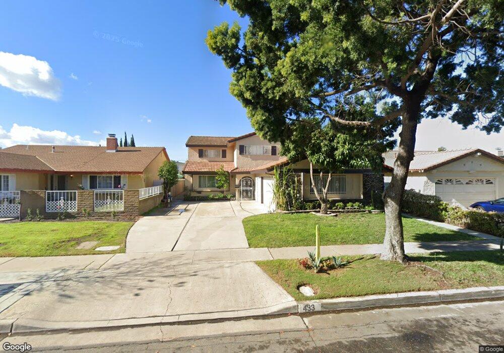
433 S Vicki Ln Anaheim, CA 92804
West Anaheim NeighborhoodEstimated Value: $1,081,000 - $1,207,000
5
Beds
3
Baths
2,930
Sq Ft
$390/Sq Ft
Est. Value
About This Home
This home is located at 433 S Vicki Ln, Anaheim, CA 92804 and is currently estimated at $1,141,950, approximately $389 per square foot. 433 S Vicki Ln is a home located in Orange County with nearby schools including Dr. Albert Schweitzer Elementary School, Dale Jr High School, and Magnolia High.
Ownership History
Date
Name
Owned For
Owner Type
Purchase Details
Closed on
Sep 23, 2021
Sold by
Ma Rita and Jung Bonnie L
Bought by
Pentecostes Iglesia Christiana Ebenezer
Current Estimated Value
Purchase Details
Closed on
Aug 15, 2021
Sold by
Wong Rosina and Wong Rosina Jean
Bought by
Wong Rosina Jean and The Kr Wong Survivor S Trust
Purchase Details
Closed on
Oct 1, 2009
Sold by
Jung Roger W and Jung Bonnie L
Bought by
Jung Roger W and Jung Bonnie L
Purchase Details
Closed on
Jun 6, 2005
Sold by
Jung Raymond Wayne
Bought by
Jung Raymond Wayne and Jung Joanne M
Purchase Details
Closed on
May 26, 2005
Sold by
Jung Raymond Wayne
Bought by
Jung Raymond Wayne and Jung Joanne M
Create a Home Valuation Report for This Property
The Home Valuation Report is an in-depth analysis detailing your home's value as well as a comparison with similar homes in the area
Home Values in the Area
Average Home Value in this Area
Purchase History
| Date | Buyer | Sale Price | Title Company |
|---|---|---|---|
| Pentecostes Iglesia Christiana Ebenezer | $800,000 | Lawyers Title Vn | |
| Wong Rosina Jean | -- | None Available | |
| Jung Roger W | -- | None Available | |
| Jung Raymond Wayne | -- | -- | |
| Jung Raymond Wayne | -- | -- | |
| Jung Raymond Wayne | -- | -- |
Source: Public Records
Tax History Compared to Growth
Tax History
| Year | Tax Paid | Tax Assessment Tax Assessment Total Assessment is a certain percentage of the fair market value that is determined by local assessors to be the total taxable value of land and additions on the property. | Land | Improvement |
|---|---|---|---|---|
| 2025 | $9,389 | $848,966 | $646,590 | $202,376 |
| 2024 | $9,389 | $832,320 | $633,912 | $198,408 |
| 2023 | $9,150 | $816,000 | $621,482 | $194,518 |
| 2022 | $9,068 | $800,000 | $609,296 | $190,704 |
| 2021 | $1,586 | $111,706 | $24,936 | $86,770 |
| 2020 | $1,576 | $110,561 | $24,680 | $85,881 |
| 2019 | $1,544 | $108,394 | $24,196 | $84,198 |
| 2018 | $1,525 | $106,269 | $23,721 | $82,548 |
| 2017 | $1,477 | $104,186 | $23,256 | $80,930 |
| 2016 | $1,468 | $102,144 | $22,800 | $79,344 |
| 2015 | $1,454 | $100,610 | $22,457 | $78,153 |
| 2014 | $1,389 | $98,640 | $22,017 | $76,623 |
Source: Public Records
Map
Nearby Homes
- 507 S Shields Dr
- 619 S Shields Dr
- 2770 W Lincoln Ave Unit 29A
- 2770 W Lincoln Ave Unit 40
- 2770 W Lincoln Ave Unit 58
- 2945 W Bridgeport Ave
- 2942 W Floyd Ave
- 2943 W Lincoln Ave
- 103 S Laxore St
- 106 S Laxore St Unit 407
- 107 S Laxore St
- Plan Two at Mason
- Plan Four at Mason
- Plan Three at Mason
- 2871 W Tyler Ave
- 109 S Laxore St
- 2550 W Rowland Ave
- 211 S Beach Blvd Unit 92
- 134 S Magnolia Ave Unit 4C
- 2955 W Lincoln Ave Unit 7
- 429 S Vicki Ln
- 437 S Vicki Ln
- 425 S Vicki Ln
- 441 S Vicki Ln
- 2781 W Bridgeport Ave
- 421 S Vicki Ln
- 503 S Vicki Ln
- 2780 W Rowland Cir
- 505 S Dale Ave
- 501 S Dale Ave
- 417 S Vicki Ln
- 2777 W Bridgeport Ave
- 507 S Vicki Ln
- 509 S Dale Ave
- 2776 W Rowland Cir
- 425 S Dale Ave
- 2780 W Bridgeport Ave
- 513 S Dale Ave
- 509 S Vicki Ln
- 413 S Vicki Ln