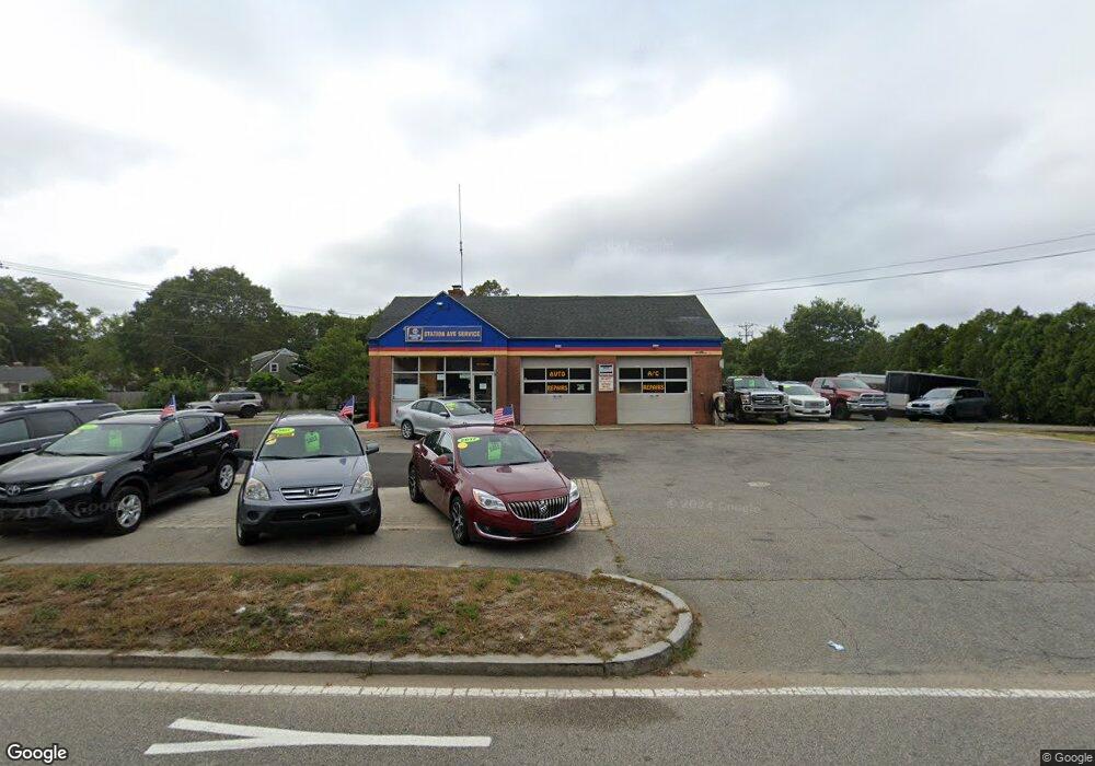
433 Station Ave South Yarmouth, MA 2664
--
Bed
--
Bath
1,646
Sq Ft
0.39
Acres
About This Home
This home is located at 433 Station Ave, South Yarmouth, MA 2664. 433 Station Ave is a home located in Barnstable County with nearby schools including Dennis-Yarmouth Regional High School and St. Pius X. School.
Ownership History
Date
Name
Owned For
Owner Type
Purchase Details
Closed on
Nov 14, 2024
Sold by
Petro Realty Corp
Bought by
Station Petro One Llc
Purchase Details
Closed on
Oct 14, 2010
Sold by
Energy Retailers Inc
Bought by
Petro Realty Corp
Home Financials for this Owner
Home Financials are based on the most recent Mortgage that was taken out on this home.
Original Mortgage
$1,865,000
Interest Rate
4.36%
Mortgage Type
Commercial
Purchase Details
Closed on
Nov 29, 1996
Sold by
Sun Co Inc
Bought by
Energy Retailers Inc
Create a Home Valuation Report for This Property
The Home Valuation Report is an in-depth analysis detailing your home's value as well as a comparison with similar homes in the area
Home Values in the Area
Average Home Value in this Area
Purchase History
| Date | Buyer | Sale Price | Title Company |
|---|---|---|---|
| Station Petro One Llc | -- | None Available | |
| Station Petro One Llc | -- | None Available | |
| Petro Realty Corp | $150,000 | -- | |
| Petro Realty Corp | $150,000 | -- | |
| Energy Retailers Inc | $250,000 | -- | |
| Energy Retailers Inc | $250,000 | -- |
Source: Public Records
Mortgage History
| Date | Status | Borrower | Loan Amount |
|---|---|---|---|
| Previous Owner | Petro Realty Corp | $1,865,000 | |
| Previous Owner | Energy Retailers Inc | $500,000 | |
| Previous Owner | Energy Retailers Inc | $2,350,000 |
Source: Public Records
Tax History Compared to Growth
Tax History
| Year | Tax Paid | Tax Assessment Tax Assessment Total Assessment is a certain percentage of the fair market value that is determined by local assessors to be the total taxable value of land and additions on the property. | Land | Improvement |
|---|---|---|---|---|
| 2025 | $3,311 | $467,600 | $317,700 | $149,900 |
| 2024 | $3,451 | $467,600 | $317,700 | $149,900 |
| 2023 | $3,165 | $390,300 | $257,100 | $133,200 |
| 2022 | $3,028 | $329,900 | $196,700 | $133,200 |
| 2021 | $3,154 | $329,900 | $196,700 | $133,200 |
| 2020 | $2,929 | $290,900 | $153,100 | $137,800 |
| 2019 | $2,938 | $290,900 | $153,100 | $137,800 |
| 2018 | $2,993 | $290,900 | $153,100 | $137,800 |
| 2017 | $2,915 | $290,900 | $153,100 | $137,800 |
| 2016 | $2,903 | $290,900 | $153,100 | $137,800 |
| 2015 | $3,071 | $305,900 | $156,400 | $149,500 |
Source: Public Records
Map
Nearby Homes
- 0 Forsyth Ave
- 33 Sparrow Way
- 30 Quartermaster Row
- 72 Quartermaster Row
- 76 Captain Chase Rd
- 97 Captain Bacon Rd
- 49 Captain Besse Rd
- 16 Warren Rd Unit 16
- 16 Warren Rd
- 176 Beacon St
- 35 Captain Percival Rd
- 147 Captain Bacon Rd
- 17 Trowbridge Path
- 105 Webbers Path
- 40 Deveau Ln
- 338 Forest Rd
- 32 Deveau Ln
- 140 Diane Ave
- 8 Rowley Ln
- 209 Union St
- 437-439 Station Ave
- 60 Sparrow Way
- 443 Station Ave
- 54 Sparrow Way
- 66 Sparrow Way
- 428 Station Ave
- 0 Forsythe Ave
- 70 Sparrow Way
- 447 Station Ave
- 417 Station Ave
- 52 Sparrow Way
- 41 Norma Ave
- 446 Station Ave
- 44 Bernard St
- 76 Sparrow Way
- 45 Bernard St
- 411 Station Ave
- 16 Forsyth Ave
- 46 Sparrow Way
- 410 Station Ave