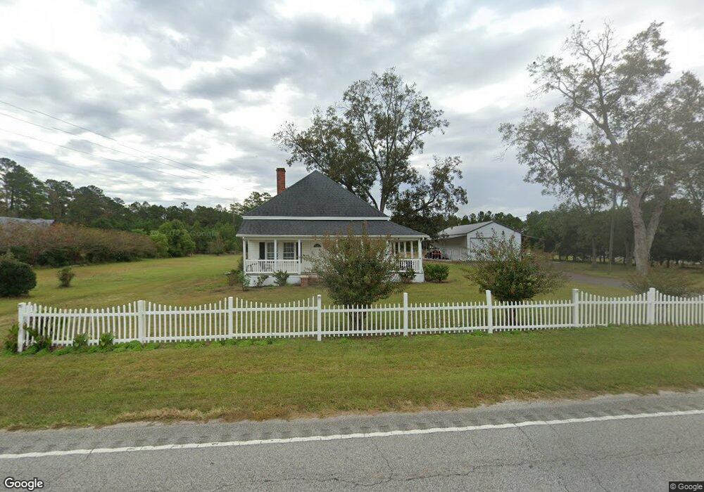
4330 Highway 65 Conway, SC 29526
Estimated Value: $303,000 - $322,715
3
Beds
1
Bath
1,672
Sq Ft
$188/Sq Ft
Est. Value
About This Home
This home is located at 4330 Highway 65, Conway, SC 29526 and is currently estimated at $314,929, approximately $188 per square foot. 4330 Highway 65 is a home located in Horry County with nearby schools including Homewood Elementary School, Whittemore Park Middle School, and Conway High School.
Ownership History
Date
Name
Owned For
Owner Type
Purchase Details
Closed on
Feb 18, 2025
Sold by
Ashford Properties Llc
Bought by
Richardson Christopher J
Current Estimated Value
Home Financials for this Owner
Home Financials are based on the most recent Mortgage that was taken out on this home.
Original Mortgage
$320,000
Outstanding Balance
$319,736
Interest Rate
6.96%
Mortgage Type
New Conventional
Estimated Equity
-$4,807
Purchase Details
Closed on
May 9, 2005
Sold by
Holloman Phyllis J
Bought by
Holloman Phyllis J and Holloman Jimmy
Create a Home Valuation Report for This Property
The Home Valuation Report is an in-depth analysis detailing your home's value as well as a comparison with similar homes in the area
Home Values in the Area
Average Home Value in this Area
Purchase History
| Date | Buyer | Sale Price | Title Company |
|---|---|---|---|
| Richardson Christopher J | $320,000 | -- | |
| Holloman Phyllis J | -- | -- |
Source: Public Records
Mortgage History
| Date | Status | Borrower | Loan Amount |
|---|---|---|---|
| Open | Richardson Christopher J | $320,000 | |
| Previous Owner | Holloman Phyllis J | $158,475 | |
| Previous Owner | Holloman Phyllis | $133,607 | |
| Previous Owner | Holloman Phyllis | $121,389 | |
| Previous Owner | Holloman Phyllis | $19,182 | |
| Previous Owner | Holloman Phyllis J | $85,500 | |
| Previous Owner | Holloman Phyllis J | $72,000 |
Source: Public Records
Tax History Compared to Growth
Tax History
| Year | Tax Paid | Tax Assessment Tax Assessment Total Assessment is a certain percentage of the fair market value that is determined by local assessors to be the total taxable value of land and additions on the property. | Land | Improvement |
|---|---|---|---|---|
| 2024 | $2,656 | $12,769 | $4,926 | $7,843 |
| 2023 | $2,656 | $2,777 | $1,513 | $1,264 |
| 2021 | $352 | $4,166 | $2,270 | $1,896 |
| 2020 | $112 | $4,166 | $2,270 | $1,896 |
| 2019 | $112 | $4,166 | $2,270 | $1,896 |
| 2018 | $0 | $3,907 | $1,543 | $2,364 |
| 2017 | $84 | $2,605 | $1,029 | $1,576 |
| 2016 | -- | $2,605 | $1,029 | $1,576 |
| 2015 | $84 | $2,605 | $1,029 | $1,576 |
| 2014 | $79 | $2,605 | $1,029 | $1,576 |
Source: Public Records
Map
Nearby Homes
- 4337 Highway 65
- 4289 Long Avenue Extension
- 221 Maple Oak Dr
- 253 Maple Oak Dr
- 153 Grier Crossing Dr
- 313 Basswood Ct
- 161 Grier Crossing Dr
- TBD Mill Berry Ln
- 4210 Bradford Dr
- 4174 Bradford Dr
- 523 Tillage Ct
- 3995 Highway 813 Unit LOT 3
- 3991 Highway 813 Unit LOT 2
- TBD Tillmond Dr
- 4084 Hagwood Cir
- 4107 Collins Farm Way Unit Lot 79 Wisteria II
- 4115 Collins Farm Way Unit Lot 81 Wisteria II
- 4119 Collins Farm Way Unit Lot 82 Courtland ll
- 4205 Collins Farm Way Unit Lot 85 Courtland ll
- 4209 Collins Farm Way Unit Lot 86 Wisteria II E
- 4328 Highway 65
- 4302 Highway 65
- 27.9 Acs Highway 65
- 4340 Highway 65
- 4301 Highway 65
- 4301 Highway 65
- 4346 Highway 65
- 4247 Long Avenue Extension
- TBB1 Long Avenue Extension
- TBB2 Long Avenue Extension
- 4277 Long Avenue Extension
- TBB Long Avenue Extension
- 4235 Highway 65
- 4267 Long Avenue Extension Unit Lot 5, Elm 4
- 4273 Long Avenue Extension Unit Lot 5A, Hemlock Alt
- 4451 Highway 65
- 4215 Long Avenue Extension
- 4281 Long Avenue Extension Unit Lot 6-A Crape Myrtle
- 4281 Long Avenue Extension
- 4285 Long Avenue Extension Unit Lot 6B, Elm