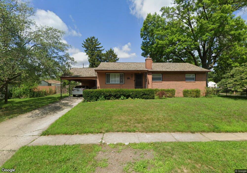
4331 Danforth Rd Columbus, OH 43224
Clinton Estates NeighborhoodEstimated Value: $211,561 - $256,000
3
Beds
1
Bath
1,092
Sq Ft
$220/Sq Ft
Est. Value
About This Home
This home is located at 4331 Danforth Rd, Columbus, OH 43224 and is currently estimated at $240,140, approximately $219 per square foot. 4331 Danforth Rd is a home located in Franklin County with nearby schools including Maize Road Elementary School, Medina Middle School, and Mifflin High School.
Ownership History
Date
Name
Owned For
Owner Type
Purchase Details
Closed on
Nov 12, 2009
Sold by
Hopper William B and Hopper Anna
Bought by
Rivera Edgardo J
Current Estimated Value
Home Financials for this Owner
Home Financials are based on the most recent Mortgage that was taken out on this home.
Original Mortgage
$106,043
Outstanding Balance
$67,933
Interest Rate
4.95%
Mortgage Type
FHA
Estimated Equity
$172,207
Create a Home Valuation Report for This Property
The Home Valuation Report is an in-depth analysis detailing your home's value as well as a comparison with similar homes in the area
Home Values in the Area
Average Home Value in this Area
Purchase History
| Date | Buyer | Sale Price | Title Company |
|---|---|---|---|
| Rivera Edgardo J | -- | Real Living |
Source: Public Records
Mortgage History
| Date | Status | Borrower | Loan Amount |
|---|---|---|---|
| Open | Rivera Edgardo J | $106,043 |
Source: Public Records
Tax History
| Year | Tax Paid | Tax Assessment Tax Assessment Total Assessment is a certain percentage of the fair market value that is determined by local assessors to be the total taxable value of land and additions on the property. | Land | Improvement |
|---|---|---|---|---|
| 2025 | $2,985 | $66,510 | $20,060 | $46,450 |
| 2024 | $2,985 | $66,510 | $20,060 | $46,450 |
| 2023 | $2,947 | $66,500 | $20,055 | $46,445 |
| 2022 | $2,161 | $41,660 | $9,210 | $32,450 |
| 2021 | $2,165 | $41,660 | $9,210 | $32,450 |
| 2020 | $2,167 | $41,660 | $9,210 | $32,450 |
| 2019 | $2,043 | $33,670 | $7,350 | $26,320 |
| 2018 | $2,049 | $33,670 | $7,350 | $26,320 |
| 2017 | $2,155 | $33,670 | $7,350 | $26,320 |
| 2016 | $2,268 | $34,240 | $7,180 | $27,060 |
| 2015 | $2,059 | $34,240 | $7,180 | $27,060 |
| 2014 | $2,064 | $34,240 | $7,180 | $27,060 |
| 2013 | $1,072 | $36,050 | $7,560 | $28,490 |
Source: Public Records
Map
Nearby Homes
- 4143 Karl Rd Unit 215
- 4143 Karl Rd Unit 314
- 4145 Karl Rd Unit 223
- 1130 Carbone Dr
- 3967 Karl Rd Unit 224
- 3941 Karl Rd Unit 133
- 1144 Reed Circle Dr
- 3939 Karl Rd Unit 311
- 4320 Sandy Lane Rd
- 4450 N 4th St
- 899 Meadowview Dr
- 4800 Bourke Rd
- 4795 Colonel Perry Dr
- 827 Inwood Place
- 1116 Tulsa Dr
- 1863 Ward Rd
- 4231 Glenmawr Ave Unit 233
- 4605 Glenmawr Ave
- 4615 Glenmawr Ave
- 991 Hidden Acres Ct Unit 991
- 1345 Matthias Dr
- 4315 Danforth Rd
- 4330 Danforth Rd
- 1337 Matthias Dr
- 1340 Evaline Dr
- 4314 Danforth Rd
- 1356 Matthias Dr
- 1332 Evaline Dr
- 1346 Matthias Dr
- 1329 Matthias Dr
- 1381 Matthias Dr
- 4354 Danforth Rd
- 1338 Matthias Dr
- 1374 Evaline Dr
- 1324 Evaline Dr
- 1321 Matthias Dr
- 1389 Matthias Dr
- 1382 Matthias Dr
- 1330 Matthias Dr
- 1382 Evaline Dr
Your Personal Tour Guide
Ask me questions while you tour the home.