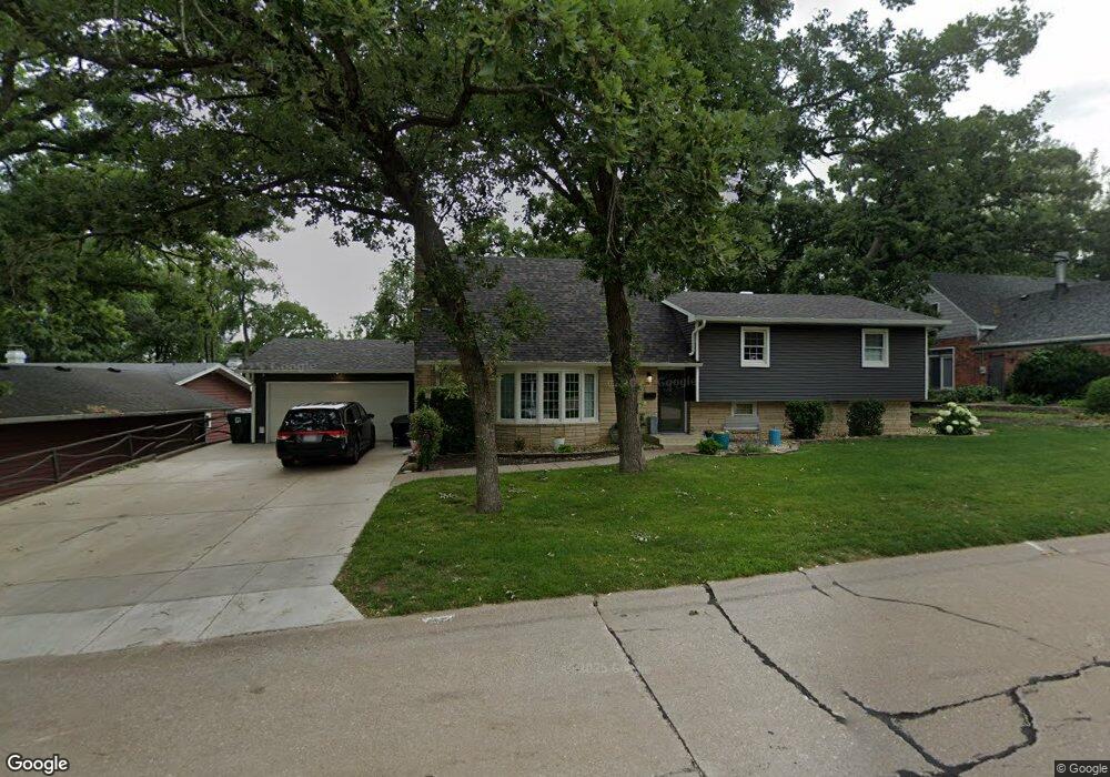
4332 Royal Oaks Dr Davenport, IA 52806
North Side NeighborhoodEstimated Value: $291,000 - $327,000
5
Beds
6
Baths
1,898
Sq Ft
$166/Sq Ft
Est. Value
About This Home
This home is located at 4332 Royal Oaks Dr, Davenport, IA 52806 and is currently estimated at $314,350, approximately $165 per square foot. 4332 Royal Oaks Dr is a home located in Scott County with nearby schools including Cumberland Hall School, Harrison Elementary School, and Academy Of Continuing Education.
Ownership History
Date
Name
Owned For
Owner Type
Purchase Details
Closed on
Apr 18, 2014
Sold by
Slyter Keith N and Slyter Mary L
Bought by
Hay Justin M and Hay Rachel K
Current Estimated Value
Home Financials for this Owner
Home Financials are based on the most recent Mortgage that was taken out on this home.
Original Mortgage
$213,750
Outstanding Balance
$162,917
Interest Rate
4.41%
Mortgage Type
New Conventional
Estimated Equity
$151,433
Create a Home Valuation Report for This Property
The Home Valuation Report is an in-depth analysis detailing your home's value as well as a comparison with similar homes in the area
Home Values in the Area
Average Home Value in this Area
Purchase History
| Date | Buyer | Sale Price | Title Company |
|---|---|---|---|
| Hay Justin M | $225,000 | None Available |
Source: Public Records
Mortgage History
| Date | Status | Borrower | Loan Amount |
|---|---|---|---|
| Open | Hay Justin M | $213,750 |
Source: Public Records
Tax History Compared to Growth
Tax History
| Year | Tax Paid | Tax Assessment Tax Assessment Total Assessment is a certain percentage of the fair market value that is determined by local assessors to be the total taxable value of land and additions on the property. | Land | Improvement |
|---|---|---|---|---|
| 2025 | $4,914 | $309,160 | $45,770 | $263,390 |
| 2024 | $4,792 | $285,210 | $45,770 | $239,440 |
| 2023 | $5,248 | $285,210 | $45,770 | $239,440 |
| 2022 | $5,270 | $254,540 | $33,290 | $221,250 |
| 2021 | $5,270 | $254,540 | $33,290 | $221,250 |
| 2020 | $4,742 | $227,050 | $33,290 | $193,760 |
| 2019 | $4,746 | $211,510 | $33,290 | $178,220 |
| 2018 | $4,646 | $211,510 | $33,290 | $178,220 |
| 2017 | $1,176 | $211,510 | $33,290 | $178,220 |
| 2016 | $4,438 | $202,600 | $0 | $0 |
| 2015 | $4,438 | $199,560 | $0 | $0 |
| 2014 | $4,432 | $199,560 | $0 | $0 |
| 2013 | $4,086 | $0 | $0 | $0 |
| 2012 | -- | $203,560 | $46,370 | $157,190 |
Source: Public Records
Map
Nearby Homes
- 4449 Royal Oaks Dr
- 4612 Warren St Unit 5
- 7 Vista Ct
- 4804 Northwest Blvd
- 4757 Willow Cir
- 4743 Willow Cir
- 4730 Willow Cir
- 4618 Fillmore Ln
- 1453 W 41st St
- 1336 W 38th Place
- 4705 N Sturdevant St
- 825 Northbrook Dr
- 405 Westerfield Rd
- 4942 Brown St
- 1517 W Kimberly Rd
- 710 Northbrook Dr
- 4610 N Ripley St
- 1344 W 37th St
- 611 Northbrook Dr
- 3831 N Sturdevant St
- 4320 Royal Oaks Dr
- 4342 Royal Oaks Dr
- 4439 Canterbury Ln
- 4431 Canterbury Ln
- 4310 Royal Oaks Dr
- 4335 Royal Oaks Dr
- 4445 Canterbury Ln
- 4343 Royal Oaks Dr
- 4327 Royal Oaks Dr
- 4404 Royal Oaks Dr
- 4302 Royal Oaks Dr
- 4319 Royal Oaks Dr
- 4425 Canterbury Ln
- 4455 Canterbury Ln
- 4311 Royal Oaks Dr
- 4414 Royal Oaks Dr
- 4316 Wittman Dr
- 4308 Wittmann Dr
- 1204 Royal Oaks Dr
- 4411 Royal Oaks Dr