Estimated Value: $157,000 - $181,000
2
Beds
2
Baths
1,052
Sq Ft
$164/Sq Ft
Est. Value
About This Home
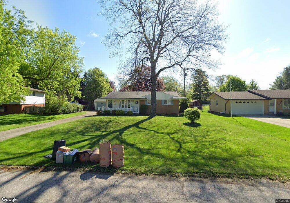
This home is located at 4333 Kentwood Ave, Flint, MI 48507 and is currently estimated at $172,762, approximately $164 per square foot. 4333 Kentwood Ave is a home located in Genesee County with nearby schools including Carman-Ainsworth High School and Madison Academy - Elementary School.
Ownership History
Date
Name
Owned For
Owner Type
Purchase Details
Closed on
Sep 25, 2023
Sold by
Peckham Laurie T
Bought by
Peckham Laurie T and Peckham Harry
Current Estimated Value
Home Financials for this Owner
Home Financials are based on the most recent Mortgage that was taken out on this home.
Original Mortgage
$90,000
Outstanding Balance
$88,015
Interest Rate
6.75%
Mortgage Type
New Conventional
Estimated Equity
$84,747
Purchase Details
Closed on
Sep 30, 2011
Sold by
Doris J Trober Revocable Trust
Bought by
Peckham Laurie T
Purchase Details
Closed on
Aug 31, 2005
Sold by
Trober Doris J and Trober Warren Oliver
Bought by
Trober Doris J and Doris J Trober Revocable Trust
Create a Home Valuation Report for This Property
The Home Valuation Report is an in-depth analysis detailing your home's value as well as a comparison with similar homes in the area
Home Values in the Area
Average Home Value in this Area
Purchase History
| Date | Buyer | Sale Price | Title Company |
|---|---|---|---|
| Peckham Laurie T | -- | Vanguard Title | |
| Peckham Laurie T | $42,000 | Greater Michigan Title Llc | |
| Trober Doris J | -- | None Available |
Source: Public Records
Mortgage History
| Date | Status | Borrower | Loan Amount |
|---|---|---|---|
| Open | Peckham Laurie T | $90,000 |
Source: Public Records
Tax History Compared to Growth
Tax History
| Year | Tax Paid | Tax Assessment Tax Assessment Total Assessment is a certain percentage of the fair market value that is determined by local assessors to be the total taxable value of land and additions on the property. | Land | Improvement |
|---|---|---|---|---|
| 2025 | $1,877 | $79,200 | $0 | $0 |
| 2024 | $959 | $78,500 | $0 | $0 |
| 2023 | $915 | $72,800 | $0 | $0 |
| 2022 | $822 | $63,200 | $0 | $0 |
| 2021 | $1,656 | $54,800 | $0 | $0 |
| 2020 | $822 | $49,600 | $0 | $0 |
| 2019 | $810 | $45,100 | $0 | $0 |
| 2018 | $1,548 | $42,000 | $0 | $0 |
| 2017 | $1,481 | $42,000 | $0 | $0 |
| 2016 | $1,539 | $38,600 | $0 | $0 |
| 2015 | $1,361 | $35,700 | $0 | $0 |
| 2014 | $807 | $34,100 | $0 | $0 |
| 2012 | -- | $34,500 | $34,500 | $0 |
Source: Public Records
Map
Nearby Homes
- 4505 Old Carriage Rd
- 1508 W Bristol Rd
- 4480 Cherrytree Ln
- 1203 Pickwick Place
- 1256 W Rowland St
- 1144 Pickwick Place
- 1108 Trotwood Ln
- 4460 Torrey Rd
- 1111 W Mclean Ave
- 4460 Saint Martins Dr
- 1136 W Rowland St
- 1097 W Buder Ave
- 1072 W Williamson Ave
- 1051 W Mclean Ave
- 1044 W Rowland St
- 1247 Catalina Dr
- 4493 Fenton Rd
- Lot 57 Walnut Creek Dr
- 1380 Sunset Blvd
- 5131 Gateway Centre Blvd
- 4341 Kentwood Ave
- 4327 Kentwood Ave
- 2023 Kingswood Dr
- 2017 Kingswood Dr
- 4349 Kentwood Ave
- 4321 Kentwood Ave
- 4334 Kentwood Ave
- 4344 Old Colony Dr
- 2035 Kingswood Dr
- 2087 Westminster Dr
- 2047 Kingswood Dr
- 4357 Kentwood Ave
- 2088 Westminster Dr
- 2064 Gerard St
- 2018 Kingswood Dr
- 4350 Old Colony Dr
- 2105 Westminster Dr
- 2094 Westminster Dr
- 2057 Kingswood Dr
- 2113 Westminster Dr