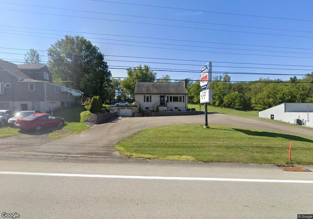
4333 State Route 30 Latrobe, PA 15650
Estimated Value: $80,850 - $319,000
--
Bed
--
Bath
--
Sq Ft
0.86
Acres
About This Home
This home is located at 4333 State Route 30, Latrobe, PA 15650 and is currently estimated at $227,963. 4333 State Route 30 is a home located in Westmoreland County with nearby schools including Greater Latrobe Junior High School, Greater Latrobe Senior High School, and High Acres School.
Ownership History
Date
Name
Owned For
Owner Type
Purchase Details
Closed on
Oct 26, 2006
Sold by
Kovach Richard A
Bought by
Kalp Daniel R and Kalp Lori L
Current Estimated Value
Home Financials for this Owner
Home Financials are based on the most recent Mortgage that was taken out on this home.
Original Mortgage
$52,434
Outstanding Balance
$31,484
Interest Rate
6.48%
Mortgage Type
Unknown
Estimated Equity
$196,479
Create a Home Valuation Report for This Property
The Home Valuation Report is an in-depth analysis detailing your home's value as well as a comparison with similar homes in the area
Home Values in the Area
Average Home Value in this Area
Purchase History
| Date | Buyer | Sale Price | Title Company |
|---|---|---|---|
| Kalp Daniel R | $80,000 | None Available |
Source: Public Records
Mortgage History
| Date | Status | Borrower | Loan Amount |
|---|---|---|---|
| Open | Kalp Daniel R | $52,434 |
Source: Public Records
Tax History Compared to Growth
Tax History
| Year | Tax Paid | Tax Assessment Tax Assessment Total Assessment is a certain percentage of the fair market value that is determined by local assessors to be the total taxable value of land and additions on the property. | Land | Improvement |
|---|---|---|---|---|
| 2025 | $2,073 | $17,180 | $2,880 | $14,300 |
| 2024 | $2,073 | $17,180 | $2,880 | $14,300 |
| 2023 | $1,902 | $17,180 | $2,880 | $14,300 |
| 2022 | $1,902 | $17,180 | $2,880 | $14,300 |
| 2021 | $1,884 | $17,180 | $2,880 | $14,300 |
| 2020 | $1,854 | $17,180 | $2,880 | $14,300 |
| 2019 | $1,829 | $17,180 | $2,880 | $14,300 |
| 2018 | $1,820 | $17,180 | $2,880 | $14,300 |
| 2017 | $1,773 | $17,180 | $2,880 | $14,300 |
| 2016 | $416 | $17,180 | $2,880 | $14,300 |
| 2015 | $416 | $17,180 | $2,880 | $14,300 |
| 2014 | -- | $17,180 | $2,880 | $14,300 |
Source: Public Records
Map
Nearby Homes
- 402 S Shenandoah Dr Unit 805A
- 214 Denali Dr Unit 856B
- 601 S Shenandoah Dr
- 113 Mount Ranier Dr
- 1580 Lois Ln Unit Lot 11 C
- 1582 Lois Ln Unit Lot 11 B
- 359 Meadow Spring Rd
- 1113 B St
- 1108 B St
- 710 Greyhound Ln
- 307 Persian Ln
- 5634 State Route 981
- 632 Charles Houck Rd
- 227 Meadow Spring Rd
- 1160 Murray Ave
- 1187 Lakeview Dr
- 1185 Murray Ave
- 400 Primrose Dr
- 5010 Linwood Ct
- 5009 Linwood Court (Lot #206)
- 4329 U S 30
- 4339 U S 30
- 4321 State Route 30
- 0 Route 30
- 4342 Us-30
- 4342 Latrobe St
- 174 Smiths Hill Rd
- 502 S Shenandoah Dr
- 500 S Shenandoah Dr
- 4385 State Route 30
- 504 S Shenandoah Dr
- 420 S Shenandoah Dr
- 104 Carlsbad Ct
- 418 S Shenandoah Dr
- 506 S Shenandoah Dr
- 416 S Shenandoah Dr
- 106 Carlsbad Ct
- 508 S Shenandoah Dr
- 108 Carlsbad Ct
- 110 Carlsbad Ct