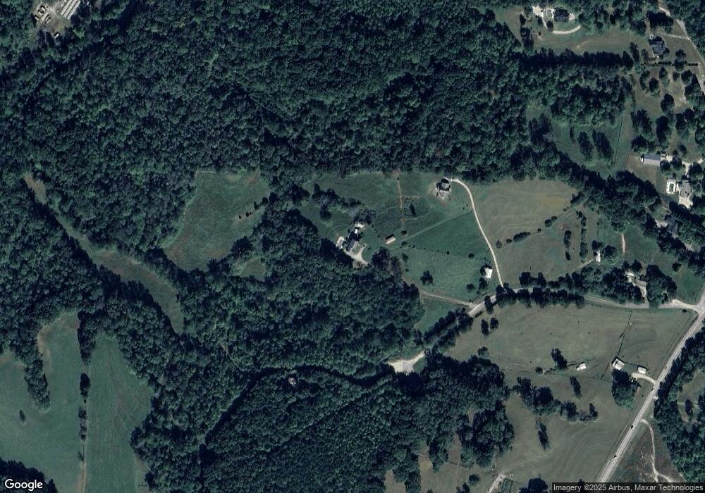
4334 Ed Henson Rd Gainesville, GA 30506
Estimated Value: $446,000 - $1,125,891
3
Beds
3
Baths
1,508
Sq Ft
$521/Sq Ft
Est. Value
About This Home
This home is located at 4334 Ed Henson Rd, Gainesville, GA 30506 and is currently estimated at $785,946, approximately $521 per square foot. 4334 Ed Henson Rd is a home with nearby schools including Wauka Mountain Elementary School, North Hall Middle School, and North Hall High School.
Ownership History
Date
Name
Owned For
Owner Type
Purchase Details
Closed on
Feb 20, 2015
Sold by
Edge Billy Lee
Bought by
Edge Shelia Ann and Edge Billy Lee
Current Estimated Value
Purchase Details
Closed on
Mar 14, 2014
Sold by
Edge Shelia Ann
Bought by
Edge Billy Lee
Purchase Details
Closed on
Mar 17, 1989
Sold by
Henson Howard Edward and Mary Emma
Bought by
Edge Shelia Ann
Purchase Details
Closed on
Sep 2, 1969
Sold by
Whelchel June C
Bought by
Henson Henson H and Henson Mary Emma B
Create a Home Valuation Report for This Property
The Home Valuation Report is an in-depth analysis detailing your home's value as well as a comparison with similar homes in the area
Home Values in the Area
Average Home Value in this Area
Purchase History
| Date | Buyer | Sale Price | Title Company |
|---|---|---|---|
| Edge Shelia Ann | -- | -- | |
| Edge Billy Lee | -- | -- | |
| Edge Shelia Ann | $40,800 | -- | |
| Henson Henson H | -- | -- |
Source: Public Records
Tax History Compared to Growth
Tax History
| Year | Tax Paid | Tax Assessment Tax Assessment Total Assessment is a certain percentage of the fair market value that is determined by local assessors to be the total taxable value of land and additions on the property. | Land | Improvement |
|---|---|---|---|---|
| 2024 | $2,812 | $458,720 | $210,720 | $248,000 |
| 2023 | $2,216 | $374,120 | $126,440 | $247,680 |
| 2022 | $1,931 | $264,760 | $77,000 | $187,760 |
| 2021 | $1,821 | $235,816 | $70,000 | $165,816 |
| 2020 | $2,046 | $262,496 | $77,760 | $184,736 |
| 2019 | $1,769 | $229,056 | $77,760 | $151,296 |
| 2018 | $1,726 | $220,536 | $77,760 | $142,776 |
| 2017 | $1,484 | $204,976 | $77,760 | $127,216 |
| 2016 | $4,021 | $137,936 | $10,720 | $127,216 |
| 2015 | $3,493 | $141,536 | $14,320 | $127,216 |
| 2014 | $3,493 | $115,996 | $0 | $115,996 |
Source: Public Records
Map
Nearby Homes
- 4368 Ed Henson Rd
- 4425 Clarks Bridge Rd
- 4542 Highland Gate Pkwy Unit 63
- 4542 Highland Gate Pkwy
- 5613 Bogus Rd
- 4449 Highland Gate Pkwy
- 4502 Highland Gate Pkwy Unit 73/74
- 4502 Highland Gate Pkwy
- 4603 Clarks Bridge Rd
- 4478 Highland Gate Pkwy Unit 78/79
- 4478 Highland Gate Pkwy
- 4160 Topsail Ridge
- 4022 Sutton Rd Unit 25
- 8320 Creekside Overlook
- 4193 Cleveland Hwy Unit 26
- 4246 Jim Hood Rd
- 3610 Creekstone Dr
- 3614 Creekstone Dr
- 3724 Clarks Bridge Rd
- 5163 Bogus Rd
- 4366 Ed Henson Rd
- 4324 Ed Henson Rd
- 4374 Ed Henson Rd
- 4367 O Smith Rd
- O O Smith Rd
- 4311 O Smith Rd
- 4227 Clarks Bridge Rd
- 4329 O Smith Rd
- 4229 Clarks Bridge Rd
- 4363 O Smith Rd
- 4230 Clarks Bridge Rd
- 4376 O Smith Rd
- 4262 Clarks Bridge Rd
- 4316 O Smith Rd
- 4191 Clarks Bridge Rd
- 4317 Clarks Bridge Rd
- 4370 O Smith Rd
- 4358 O Smith Rd
- 4321 Clarks Bridge Rd
- 4210 Clarks Bridge Rd
