Estimated Value: $409,027 - $430,000
4
Beds
3
Baths
2,498
Sq Ft
$167/Sq Ft
Est. Value
About This Home
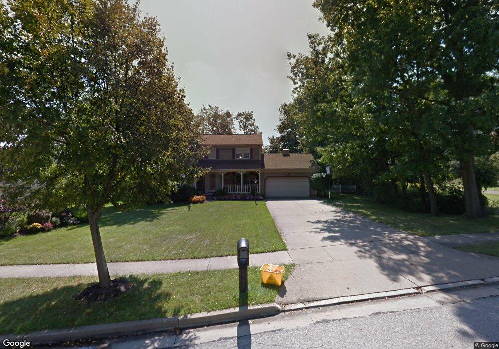
This home is located at 4337 Bunker Ln, Stow, OH 44224 and is currently estimated at $418,257, approximately $167 per square foot. 4337 Bunker Ln is a home located in Summit County with nearby schools including Stow-Munroe Falls High School, St Patrick Elementary School, and Walsh Jesuit High School.
Ownership History
Date
Name
Owned For
Owner Type
Purchase Details
Closed on
Jun 1, 2000
Sold by
Taylor Mark and Taylor Diane
Bought by
Noernberg Douglas C and Noernberg Jennifer T
Current Estimated Value
Home Financials for this Owner
Home Financials are based on the most recent Mortgage that was taken out on this home.
Original Mortgage
$172,800
Interest Rate
6.87%
Create a Home Valuation Report for This Property
The Home Valuation Report is an in-depth analysis detailing your home's value as well as a comparison with similar homes in the area
Home Values in the Area
Average Home Value in this Area
Purchase History
| Date | Buyer | Sale Price | Title Company |
|---|---|---|---|
| Noernberg Douglas C | $216,000 | Endress/Lawyers Title |
Source: Public Records
Mortgage History
| Date | Status | Borrower | Loan Amount |
|---|---|---|---|
| Closed | Noernberg Douglas C | $172,800 | |
| Closed | Noernberg Douglas C | $21,600 |
Source: Public Records
Tax History Compared to Growth
Tax History
| Year | Tax Paid | Tax Assessment Tax Assessment Total Assessment is a certain percentage of the fair market value that is determined by local assessors to be the total taxable value of land and additions on the property. | Land | Improvement |
|---|---|---|---|---|
| 2025 | $6,159 | $109,313 | $21,116 | $88,197 |
| 2024 | $6,159 | $109,313 | $21,116 | $88,197 |
| 2023 | $6,159 | $109,313 | $21,116 | $88,197 |
| 2022 | $5,731 | $89,797 | $17,308 | $72,489 |
| 2021 | $5,130 | $89,797 | $17,308 | $72,489 |
| 2020 | $5,042 | $89,800 | $17,310 | $72,490 |
| 2019 | $5,043 | $83,980 | $17,140 | $66,840 |
| 2018 | $4,961 | $83,980 | $17,140 | $66,840 |
| 2017 | $4,578 | $83,980 | $17,140 | $66,840 |
| 2016 | $4,712 | $75,240 | $17,140 | $58,100 |
| 2015 | $4,578 | $75,240 | $17,140 | $58,100 |
| 2014 | $4,582 | $75,240 | $17,140 | $58,100 |
| 2013 | $4,566 | $75,480 | $17,140 | $58,340 |
Source: Public Records
Map
Nearby Homes
- 2908 Wexford Blvd
- 2831 Saybrooke Blvd
- 2714 Wexford Blvd
- 4444 Hickory Trail
- 4445 Kenneth Trail
- 4556 Fishcreek Rd
- 3788 Woodbury Oval Unit 60
- 4638 Dresher Trail
- 3860 Lake Run Blvd
- 76 Wanda Ct
- 4910 Independence Cir Unit D
- 4078 Pardee Rd
- 4155 Burton Dr
- 4131 Burton Dr
- 4916 Friar Rd Unit B
- 0 Vira Rd
- 3801 Baird Rd
- 1302 Carol Dr
- 2410 Wrens Dr S
- 2260 E Gilwood Dr
- 4347 Bunker Ln
- 3001 Wexford Blvd
- 3009 Wexford Blvd
- 4325 Bunker Ln
- 4357 Bunker Ln
- 3017 Wexford Blvd
- 4348 Bunker Ln
- 4336 Bunker Ln
- 4324 Bunker Ln
- 3025 Wexford Blvd
- 4367 Bunker Ln
- 2951 Wexford Blvd
- 2835 Woodbridge Ln
- 4362 Bunker Ln
- 3033 Wexford Blvd
- 2968 Wexford Blvd
- 2986 Wexford Blvd
- 3000 Wexford Blvd
- 3008 Wexford Blvd
- 2978 Wexford Blvd