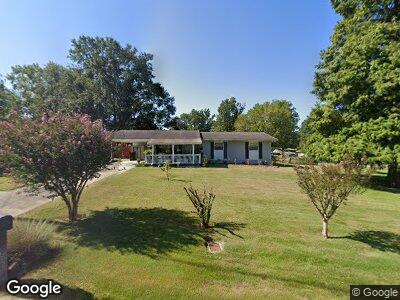
4337 Kenesaw Dr Columbus, GA 31907
Estimated Value: $137,000 - $159,811
3
Beds
3
Baths
1,649
Sq Ft
$92/Sq Ft
Est. Value
About This Home
This home is located at 4337 Kenesaw Dr, Columbus, GA 31907 and is currently estimated at $151,453, approximately $91 per square foot. 4337 Kenesaw Dr is a home located in Muscogee County with nearby schools including Lonnie Jackson Academy, Rothschild Leadership Academy, and Carver High School.
Ownership History
Date
Name
Owned For
Owner Type
Purchase Details
Closed on
Dec 27, 2016
Sold by
Graham David A
Bought by
Graham David A and Owens Gerry
Current Estimated Value
Home Financials for this Owner
Home Financials are based on the most recent Mortgage that was taken out on this home.
Original Mortgage
$77,900
Outstanding Balance
$65,888
Interest Rate
4.3%
Mortgage Type
New Conventional
Estimated Equity
$81,961
Create a Home Valuation Report for This Property
The Home Valuation Report is an in-depth analysis detailing your home's value as well as a comparison with similar homes in the area
Home Values in the Area
Average Home Value in this Area
Purchase History
| Date | Buyer | Sale Price | Title Company |
|---|---|---|---|
| Graham David A | -- | -- |
Source: Public Records
Mortgage History
| Date | Status | Borrower | Loan Amount |
|---|---|---|---|
| Open | Graham David A | $77,900 | |
| Previous Owner | Graham David A | $88,369 |
Source: Public Records
Tax History Compared to Growth
Tax History
| Year | Tax Paid | Tax Assessment Tax Assessment Total Assessment is a certain percentage of the fair market value that is determined by local assessors to be the total taxable value of land and additions on the property. | Land | Improvement |
|---|---|---|---|---|
| 2024 | -- | $52,556 | $7,692 | $44,864 |
| 2023 | $203 | $52,556 | $7,692 | $44,864 |
| 2022 | $930 | $45,324 | $7,692 | $37,632 |
| 2021 | $923 | $38,724 | $7,692 | $31,032 |
| 2020 | $924 | $38,724 | $7,692 | $31,032 |
| 2019 | $928 | $38,724 | $7,692 | $31,032 |
| 2018 | $928 | $38,724 | $7,692 | $31,032 |
| 2017 | $933 | $38,724 | $7,692 | $31,032 |
| 2016 | $938 | $40,412 | $6,970 | $33,442 |
| 2015 | $940 | $40,412 | $6,970 | $33,442 |
| 2014 | $941 | $40,412 | $6,970 | $33,442 |
| 2013 | -- | $40,412 | $6,970 | $33,442 |
Source: Public Records
Map
Nearby Homes
- 4327 Kenesaw Dr
- 4029 Kenesaw Ct
- 926 Rosewood Dr
- 1110 Woodburn Dr
- 1043 Quincy Dr
- 809 Dogwood Dr
- 4017 Merrywood Dr
- 914 Reynolds Rd
- 1361 Kevin Ct
- 636 Dogwood Dr
- 815 Englewood Dr
- 754 Wright Dr
- 4459 Bermuda St
- 937 Diggs Ave
- 1310 Woodgren Ct
- 1405 Hunt Ave
- 4483 Oriole St
- 3415 Terminal St
- 776 Terminal Ct
- 770 Terminal Ct
- 4337 Kenesaw Dr
- 4418 Royal Oak Ct
- 0 Royal Oak Ct Unit 8001945
- 0 Royal Oak Ct Unit 7603344
- 0 Royal Oak Ct
- 4340 Kenesaw Dr
- 4403 Kenesaw Dr
- 4424 Royal Oak Ct
- 4409 Royal Oak Ct
- 4330 Kenesaw Dr
- 4321 Kenesaw Dr
- 4415 Royal Oak Ct
- 4324 Kenesaw Dr
- 4406 Kenesaw Dr
- 4419 Royal Oak Ct
- 4432 Royal Oak Ct
- 4409 Kenesaw Dr
- 4425 Royal Oak Ct
- 4318 Kenesaw Dr
- 4313 Kenesaw Dr