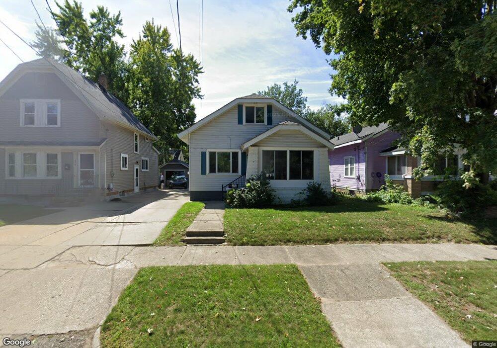
434 Knapp St NE Grand Rapids, MI 49505
Creston NeighborhoodEstimated Value: $248,000 - $310,000
2
Beds
1
Bath
1
Sq Ft
$278,950/Sq Ft
Est. Value
About This Home
This home is located at 434 Knapp St NE, Grand Rapids, MI 49505 and is currently estimated at $278,950, approximately $278,950 per square foot. 434 Knapp St NE is a home located in Kent County with nearby schools including Palmer School, Riverside Middle School, and Union High School.
Ownership History
Date
Name
Owned For
Owner Type
Purchase Details
Closed on
Oct 5, 2023
Sold by
Early Sandra L
Bought by
Early Sandra L
Current Estimated Value
Purchase Details
Closed on
Oct 30, 1995
Sold by
Smith Smith E E and Smith Early S
Bought by
Early Early S and Early Sandra
Purchase Details
Closed on
Jan 17, 1995
Sold by
Koster Tst and Koster Smith E
Bought by
Early Smith E and Early Sandra
Purchase Details
Closed on
Sep 4, 1992
Sold by
Koster Koster E E and Koster Tst
Bought by
Early Sandra
Create a Home Valuation Report for This Property
The Home Valuation Report is an in-depth analysis detailing your home's value as well as a comparison with similar homes in the area
Home Values in the Area
Average Home Value in this Area
Purchase History
| Date | Buyer | Sale Price | Title Company |
|---|---|---|---|
| Early Sandra L | -- | None Listed On Document | |
| Early Early S | $67,000 | -- | |
| Early Smith E | $57,000 | -- | |
| Early Sandra | -- | -- |
Source: Public Records
Tax History Compared to Growth
Tax History
| Year | Tax Paid | Tax Assessment Tax Assessment Total Assessment is a certain percentage of the fair market value that is determined by local assessors to be the total taxable value of land and additions on the property. | Land | Improvement |
|---|---|---|---|---|
| 2025 | $1,512 | $115,500 | $0 | $0 |
| 2024 | $1,512 | $103,000 | $0 | $0 |
| 2023 | $1,534 | $93,800 | $0 | $0 |
| 2022 | $1,456 | $83,900 | $0 | $0 |
| 2021 | $1,424 | $74,200 | $0 | $0 |
| 2020 | $1,361 | $65,800 | $0 | $0 |
| 2019 | $1,425 | $59,900 | $0 | $0 |
| 2018 | $1,377 | $51,600 | $0 | $0 |
| 2017 | $1,340 | $47,000 | $0 | $0 |
| 2016 | $1,356 | $42,900 | $0 | $0 |
| 2015 | $1,262 | $42,900 | $0 | $0 |
| 2013 | -- | $37,100 | $0 | $0 |
Source: Public Records
Map
Nearby Homes
- 2030 Sinclair Ave NE
- 2019 Plainfield Ave NE
- 321 Knapp St NE
- 612 Woodridge St NE
- 465 Kenwood St NE
- 1922 Coit Ave NE
- 240 Eleanor St NE
- 2038 Melita Ave NE
- 143 Dean St NE
- 132 Graceland St NE
- 114 Knapp St NE
- 155 Palmer St NE
- 120 Dean St NE
- 778 Eleanor St NE
- 22 Elmwood St NE
- 1825 Meadowfield Dr NE
- 1757 Westlane Dr NE
- 310 Sweet St NE
- 4 Elmwood St NW
- 1516 Cole Ave NE
- 438 Knapp St NE
- 430 Knapp St NE
- 440 Knapp St NE
- 426 Knapp St NE
- 446 Knapp St NE
- 420 Knapp St NE
- 435 Elmwood St NE
- 431 Elmwood St NE
- 441 Elmwood St NE
- 425 Elmwood St NE
- 418 Knapp St NE
- 450 Knapp St NE
- 423 Elmwood St NE
- 2001 Sinclair Ave NE
- 445 Elmwood St NE
- 445 Elmwood St NE Unit A
- 417 Elmwood St NE
- 454 Knapp St NE
- 2007 Sinclair Ave NE
- 445 Knapp St NE