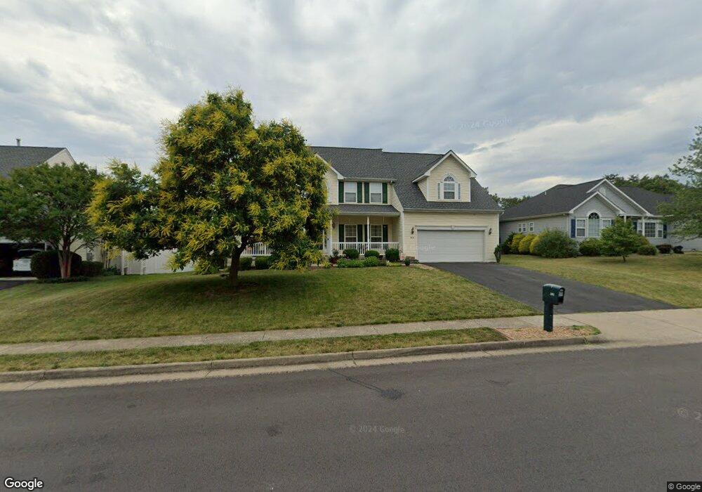
434 Lilys Way Winchester, VA 22602
Estimated Value: $592,000 - $683,000
5
Beds
4
Baths
3,350
Sq Ft
$188/Sq Ft
Est. Value
About This Home
This home is located at 434 Lilys Way, Winchester, VA 22602 and is currently estimated at $629,111, approximately $187 per square foot. 434 Lilys Way is a home located in Frederick County with nearby schools including James Wood Middle School, Millbrook High School, and Sharon's Centre.
Ownership History
Date
Name
Owned For
Owner Type
Purchase Details
Closed on
Apr 24, 2003
Sold by
Dan Ryan Builders Inc
Bought by
Ashbaugh Thomas J
Current Estimated Value
Home Financials for this Owner
Home Financials are based on the most recent Mortgage that was taken out on this home.
Original Mortgage
$249,400
Outstanding Balance
$106,275
Interest Rate
5.64%
Mortgage Type
New Conventional
Estimated Equity
$522,836
Create a Home Valuation Report for This Property
The Home Valuation Report is an in-depth analysis detailing your home's value as well as a comparison with similar homes in the area
Home Values in the Area
Average Home Value in this Area
Purchase History
| Date | Buyer | Sale Price | Title Company |
|---|---|---|---|
| Ashbaugh Thomas J | $311,799 | -- |
Source: Public Records
Mortgage History
| Date | Status | Borrower | Loan Amount |
|---|---|---|---|
| Open | Ashbaugh Thomas J | $249,400 |
Source: Public Records
Tax History Compared to Growth
Tax History
| Year | Tax Paid | Tax Assessment Tax Assessment Total Assessment is a certain percentage of the fair market value that is determined by local assessors to be the total taxable value of land and additions on the property. | Land | Improvement |
|---|---|---|---|---|
| 2025 | $2,771 | $577,300 | $93,000 | $484,300 |
| 2024 | $1,248 | $489,600 | $77,000 | $412,600 |
| 2023 | $2,497 | $489,600 | $77,000 | $412,600 |
| 2022 | $2,462 | $403,600 | $72,000 | $331,600 |
| 2021 | $2,462 | $403,600 | $72,000 | $331,600 |
| 2020 | $2,252 | $369,100 | $72,000 | $297,100 |
| 2019 | $2,252 | $369,100 | $72,000 | $297,100 |
| 2018 | $2,114 | $346,600 | $72,000 | $274,600 |
| 2017 | $2,080 | $346,600 | $72,000 | $274,600 |
| 2016 | $1,905 | $317,500 | $59,500 | $258,000 |
| 2015 | $1,778 | $317,500 | $59,500 | $258,000 |
| 2014 | $848 | $287,600 | $54,500 | $233,100 |
Source: Public Records
Map
Nearby Homes
- 128 Teaberry Dr
- 0 7 Building Lots In Shawneeland Unit VAFV2032844
- 203 Lynnehaven Dr
- 106 Foxglove Dr
- 140 Mccormick Cir Unit 403
- 151 Mccormick Cir Unit 203
- 151 Mccormick Cir Unit 201
- 100 Maury Way
- 619 Farmington Blvd
- 0 Grocery Ave Unit VAFV2015654
- 102 Brockham Ct
- 100 Brockham Ct
- 2003 Senseny Rd
- 114 Nassau Dr
- 253 Rossmann Blvd
- 251 Rossmann Blvd
- 114 Harold Ct
- 111 Pawn Ct
- Carlisle Plan at Abrams Pointe
- Somerset Plan at Abrams Pointe
- 436 Lilys Way
- 202 Ladyslipper Dr
- 105 Bluebell Ct
- 103 Bluebell Ct
- 121 Bluebell Ct
- 435 Lilys Way
- 430 Lilys Way
- 433 Lilys Way
- 204 Ladyslipper Dr
- 102 Ladyslipper Dr
- 431 Lilys Way
- 100 Yarrow Ct
- 107 Bluebell Ct
- 206 Ladyslipper Dr
- 103 Ladyslipper Dr
- 429 Lilys Way
- 108 Bluebell Ct
- 216 Woodrow Rd
- 102 Yarrow Ct
- 205 Ladyslipper Dr