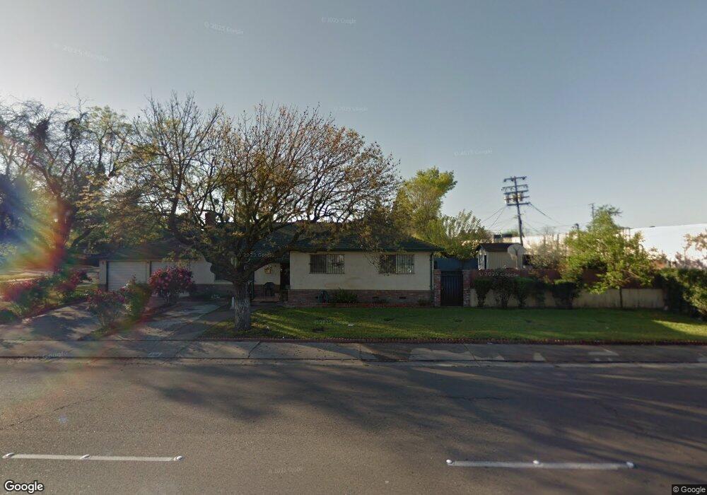
434 W Swain Rd Stockton, CA 95207
Lincoln Village NeighborhoodEstimated Value: $348,000 - $418,026
3
Beds
2
Baths
1,419
Sq Ft
$277/Sq Ft
Est. Value
About This Home
This home is located at 434 W Swain Rd, Stockton, CA 95207 and is currently estimated at $393,257, approximately $277 per square foot. 434 W Swain Rd is a home located in San Joaquin County with nearby schools including Adams Elementary School, Maxine Hong Kingston Elementary School, and Pulliam Elementary School.
Ownership History
Date
Name
Owned For
Owner Type
Purchase Details
Closed on
Mar 21, 2017
Sold by
Metzler Leroy and Ann M Hare Trust
Bought by
Lee Elbert
Current Estimated Value
Purchase Details
Closed on
Jul 10, 2012
Sold by
Metzler Leroy and Ann M Hare Trust
Bought by
Metzler Leroy
Purchase Details
Closed on
Aug 26, 2010
Sold by
Hare Ann M
Bought by
Metzler Leroy and Ann M Hare Trust
Create a Home Valuation Report for This Property
The Home Valuation Report is an in-depth analysis detailing your home's value as well as a comparison with similar homes in the area
Home Values in the Area
Average Home Value in this Area
Purchase History
| Date | Buyer | Sale Price | Title Company |
|---|---|---|---|
| Lee Elbert | $228,000 | First Ameri An Title Company | |
| Metzler Leroy | -- | First American Title Company | |
| Metzler Leroy | -- | First American Title Company | |
| Metzler Leroy | -- | None Available | |
| Metzler Leroy | -- | None Available |
Source: Public Records
Tax History Compared to Growth
Tax History
| Year | Tax Paid | Tax Assessment Tax Assessment Total Assessment is a certain percentage of the fair market value that is determined by local assessors to be the total taxable value of land and additions on the property. | Land | Improvement |
|---|---|---|---|---|
| 2025 | $3,209 | $264,374 | $92,263 | $172,111 |
| 2024 | $3,157 | $259,191 | $90,454 | $168,737 |
| 2023 | $3,084 | $254,110 | $88,681 | $165,429 |
| 2022 | $3,021 | $249,129 | $86,943 | $162,186 |
| 2021 | $2,986 | $244,245 | $85,239 | $159,006 |
| 2020 | $3,044 | $241,741 | $84,365 | $157,376 |
| 2019 | $3,032 | $237,002 | $82,711 | $154,291 |
| 2018 | $2,976 | $232,356 | $81,090 | $151,266 |
| 2017 | $1,506 | $120,510 | $38,257 | $82,253 |
| 2016 | $1,534 | $118,147 | $37,507 | $80,640 |
| 2014 | $1,460 | $114,093 | $36,220 | $77,873 |
Source: Public Records
Map
Nearby Homes
- 311 W Norwich Dr
- 210 W Pearl Ave
- 5614 Tamworth Way
- 6203 N Alturas Ave Unit 3
- 126 Nottingham Dr
- 20 W Norwich Dr
- 5806 N El Dorado St
- 1140 Douglas Rd Unit 3
- 518 W Lincoln Rd
- 6523 Vicksburg Place
- 332 Jean Ave
- 6510 N El Dorado St
- 36 Lynda Ave
- 6009 Glenbrook Ln
- 1489 W Swain Rd
- 7 W Loretta Ave
- 1583 W Swain Rd
- 1581 W Swain Rd
- 1443 San Rocco Cir
- 1545 Douglas Rd
- 434 Swain Court-A
- 438 W Swain Rd Unit 1
- 430 W Swain Rd Unit A
- 5928 Pacific Ave
- 422 W Swain Rd
- 422 W Swain Rd Unit A
- 5924 Pacific Ave
- 5924 Pacific Ave Unit 14062417
- 426 Swain Court-A
- 426 W Swain Rd
- 418 Swain Court-A
- 418 W Swain Rd Unit A
- 414 W Swain Rd Unit 1
- 419 W Longview Ave
- 415 W Longview Ave
- 503 W Longview Ave
- 411 W Longview Ave
- 507 W Longview Ave
- 437 W Swain Rd
- 447 W Swain Rd