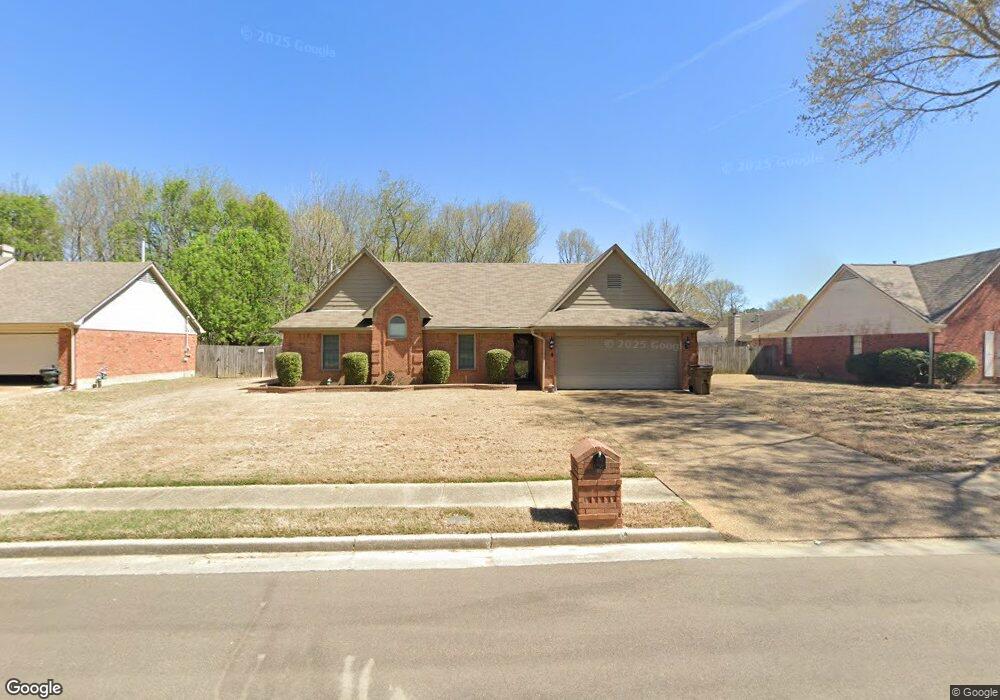
4344 Bunker Hill Dr Memphis, TN 38125
Southern Shelby County NeighborhoodEstimated Value: $210,000 - $240,000
3
Beds
2
Baths
1,355
Sq Ft
$166/Sq Ft
Est. Value
About This Home
This home is located at 4344 Bunker Hill Dr, Memphis, TN 38125 and is currently estimated at $225,191, approximately $166 per square foot. 4344 Bunker Hill Dr is a home located in Shelby County with nearby schools including Lowrance Elementary School, Southwind High School, and Power Center Academy - Southeast.
Ownership History
Date
Name
Owned For
Owner Type
Purchase Details
Closed on
Apr 29, 2020
Sold by
Wring David and Lookinghill Trust
Bought by
411 Investments Llc
Current Estimated Value
Purchase Details
Closed on
May 27, 2003
Sold by
Limbacher Lisa A and Prior Lisa A
Bought by
Hall Sophia
Home Financials for this Owner
Home Financials are based on the most recent Mortgage that was taken out on this home.
Original Mortgage
$114,098
Interest Rate
5.79%
Mortgage Type
FHA
Create a Home Valuation Report for This Property
The Home Valuation Report is an in-depth analysis detailing your home's value as well as a comparison with similar homes in the area
Home Values in the Area
Average Home Value in this Area
Purchase History
| Date | Buyer | Sale Price | Title Company |
|---|---|---|---|
| 411 Investments Llc | -- | Sure Title Co | |
| Hall Sophia | $115,000 | Realty Title & Escrow |
Source: Public Records
Mortgage History
| Date | Status | Borrower | Loan Amount |
|---|---|---|---|
| Previous Owner | Hall Sophia | $114,098 | |
| Closed | Hall Sophia | $4,563 |
Source: Public Records
Tax History Compared to Growth
Tax History
| Year | Tax Paid | Tax Assessment Tax Assessment Total Assessment is a certain percentage of the fair market value that is determined by local assessors to be the total taxable value of land and additions on the property. | Land | Improvement |
|---|---|---|---|---|
| 2025 | $1,306 | $52,075 | $14,125 | $37,950 |
| 2024 | $1,306 | $38,525 | $6,825 | $31,700 |
| 2023 | $1,306 | $38,525 | $6,825 | $31,700 |
| 2022 | $1,306 | $38,525 | $6,825 | $31,700 |
| 2021 | $1,329 | $38,525 | $6,825 | $31,700 |
| 2020 | $1,152 | $28,450 | $6,825 | $21,625 |
| 2019 | $1,152 | $28,450 | $6,825 | $21,625 |
| 2018 | $1,152 | $28,450 | $6,825 | $21,625 |
| 2017 | $1,169 | $28,450 | $6,825 | $21,625 |
| 2016 | $1,062 | $24,300 | $0 | $0 |
| 2014 | $1,062 | $24,300 | $0 | $0 |
Source: Public Records
Map
Nearby Homes
- 4310 Coral Creek Ln
- 7421 Richmond Rd
- 4386 S Germantown Rd
- 7527 Wilsford Cove
- 7286 New Britain Dr
- 4512 S Germantown Rd
- 4351 Spring Oak Cove
- 7321 Stonington Dr
- 7561 Shelby Cross Cir
- 4569 Cardiff Cove
- 4294 Thunderstone Cir W
- 7218 Barnstable Rd
- 4056 Clovis Cove
- 7124 Old Dr N
- 4331 Crimson Leaf Cove
- 4264 Timber Rise Rd
- 4735 Harvest Knoll Cove N
- 4162 Old Village Ln
- 7296 Germanshire Ln
- 7111 Peppermill Ln
- 4334 Bunker Hill Dr
- 4323 Bunker Hill Dr
- 7398 Concord View Dr
- 4339 Bunker Hill Dr
- 4349 Bunker Hill Dr
- 7406 Concord View Dr
- 4355 Bunker Hill Dr
- 4363 Bunker Hill Dr
- 4368 Bunker Hill Dr
- 7414 Concord View Dr
- 7399 Concord View Dr
- 7407 Concord View Dr
- 4371 Bunker Hill Dr
- 7422 Concord View Dr
- 4378 Bunker Hill Dr
- 7415 Concord View Dr
- 4379 Bunker Hill Dr
- 4385 Revere Cove
- 4345 Breeds Hill Dr
- 4337 Breeds Hill Dr