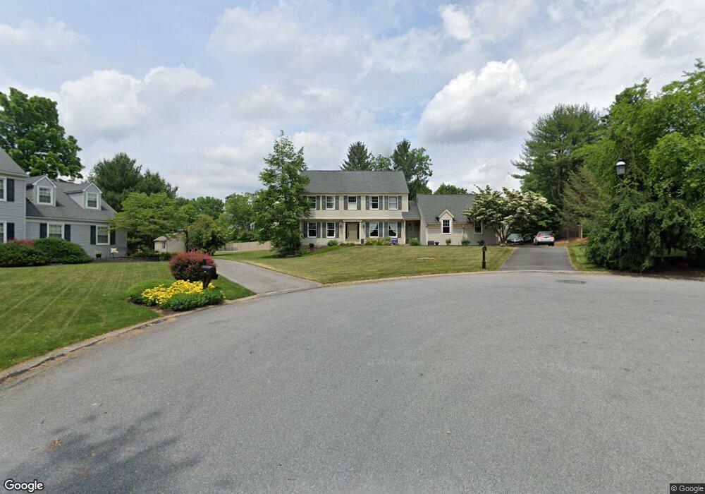
4345 Redwood Cir Allentown, PA 18103
Lower Macungie Township East NeighborhoodEstimated Value: $522,959 - $653,000
4
Beds
3
Baths
2,528
Sq Ft
$235/Sq Ft
Est. Value
About This Home
This home is located at 4345 Redwood Cir, Allentown, PA 18103 and is currently estimated at $594,240, approximately $235 per square foot. 4345 Redwood Cir is a home located in Lehigh County with nearby schools including Wescosville Elementary School, Lower Macungie Middle School, and Emmaus High School.
Ownership History
Date
Name
Owned For
Owner Type
Purchase Details
Closed on
Jun 24, 2011
Sold by
Bye Roger J
Bought by
Chase Edward J
Current Estimated Value
Home Financials for this Owner
Home Financials are based on the most recent Mortgage that was taken out on this home.
Original Mortgage
$227,425
Outstanding Balance
$156,708
Interest Rate
4.62%
Mortgage Type
New Conventional
Estimated Equity
$437,532
Purchase Details
Closed on
Mar 30, 2004
Sold by
Meyer Janice Pietsch
Bought by
Bye Roger J and Bye Francisca
Purchase Details
Closed on
Jan 25, 1994
Sold by
Rienzo Janice
Bought by
Meyer Janice Pietsch
Purchase Details
Closed on
Feb 21, 1992
Sold by
Rienzo Robert J and Rienzo Janice
Bought by
Rienzo Janice
Purchase Details
Closed on
Apr 30, 1984
Bought by
Rienzo Robert J and Rienzo Janice
Create a Home Valuation Report for This Property
The Home Valuation Report is an in-depth analysis detailing your home's value as well as a comparison with similar homes in the area
Home Values in the Area
Average Home Value in this Area
Purchase History
| Date | Buyer | Sale Price | Title Company |
|---|---|---|---|
| Chase Edward J | $329,900 | -- | |
| Bye Roger J | $295,000 | -- | |
| Meyer Janice Pietsch | -- | -- | |
| Rienzo Janice | -- | -- | |
| Rienzo Robert J | $143,700 | -- |
Source: Public Records
Mortgage History
| Date | Status | Borrower | Loan Amount |
|---|---|---|---|
| Open | Chase Edward J | $227,425 |
Source: Public Records
Tax History Compared to Growth
Tax History
| Year | Tax Paid | Tax Assessment Tax Assessment Total Assessment is a certain percentage of the fair market value that is determined by local assessors to be the total taxable value of land and additions on the property. | Land | Improvement |
|---|---|---|---|---|
| 2025 | $6,929 | $271,400 | $46,700 | $224,700 |
| 2024 | $6,704 | $271,400 | $46,700 | $224,700 |
| 2023 | $6,570 | $271,400 | $46,700 | $224,700 |
| 2022 | $6,414 | $271,400 | $224,700 | $46,700 |
| 2021 | $6,278 | $271,400 | $46,700 | $224,700 |
| 2020 | $6,218 | $271,400 | $46,700 | $224,700 |
| 2019 | $6,112 | $271,400 | $46,700 | $224,700 |
| 2018 | $6,032 | $271,400 | $46,700 | $224,700 |
| 2017 | $5,927 | $271,400 | $46,700 | $224,700 |
| 2016 | -- | $271,400 | $46,700 | $224,700 |
| 2015 | -- | $271,400 | $46,700 | $224,700 |
| 2014 | -- | $271,400 | $46,700 | $224,700 |
Source: Public Records
Map
Nearby Homes
- 2117 Isabel Ln
- 2153 Isabel Ln
- 2096 Gregory Dr
- Henley Plan at Mountainview Estates
- Penny Plan at Mountainview Estates
- 2041 Gregory Dr
- 4762 Steeplechase Dr Unit 13C
- 2518 Stanford Cir
- 1270 Minesite Rd
- 2300 S Cedar Crest Blvd
- 2570 Millbrook Dr
- 2560 Gracie Lone
- 5133 Meadow Ln
- 5175 Meadowview Dr
- 4881 Spruce Rd
- 1675 Hamlet Dr
- 1385 Brookside Rd
- 1045 Barnside Rd
- 4626 N Hedgerow Dr
- 2834 Sheffield Dr
- 4349 Redwood Cir
- 1890 Maplewood Ln
- 1875 Maplewood Ln
- 1860 Maplewood Ln
- 1883 Maplewood Ln
- 4340 Redwood Cir
- 4370 Driftwood Ln
- 4367 Redwood Ln
- 1855 Maplewood Ln
- 1943 Forest Ln
- 1901 Maplewood Ln
- 1910 Maplewood Ln
- 4400 Driftwood Ln
- 1940 Maplewood Cir
- 1836 Maplewood Ln
- 1932 Maplewood Cir
- 1971 Forest Ln
- 1915 Maplewood Ln
- 4385 Driftwood Ln
- 4383 Redwood Ln