Estimated Value: $675,358 - $725,000
3
Beds
3
Baths
2,444
Sq Ft
$285/Sq Ft
Est. Value
About This Home
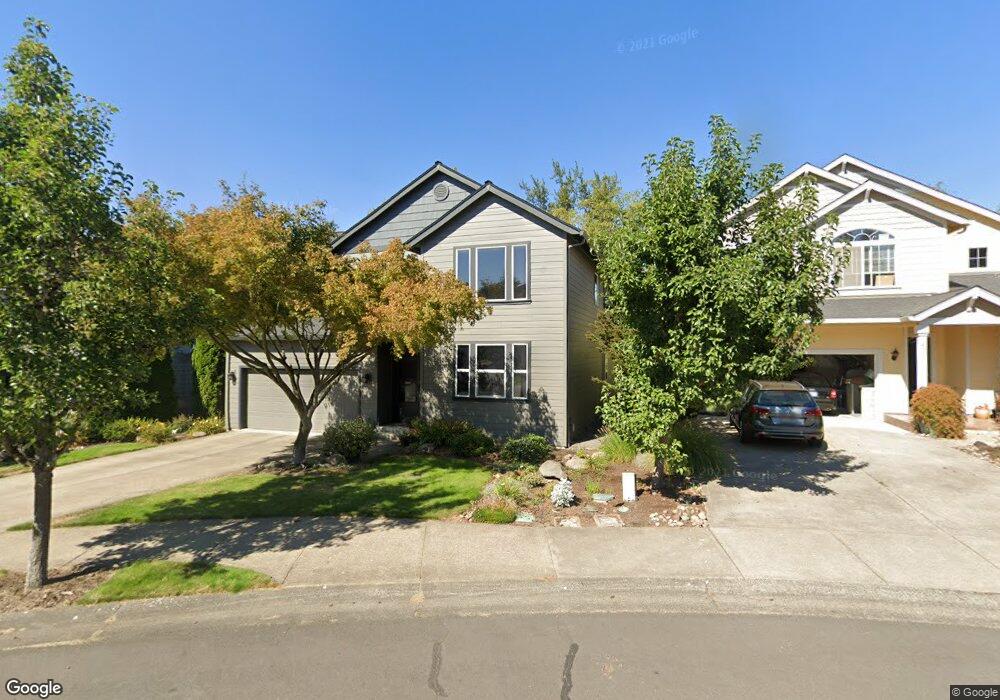
This home is located at 4347 NW 12th Loop, Camas, WA 98607 and is currently estimated at $697,590, approximately $285 per square foot. 4347 NW 12th Loop is a home located in Clark County with nearby schools including Prune Hill Elementary School, Skyridge Middle School, and Camas High School.
Ownership History
Date
Name
Owned For
Owner Type
Purchase Details
Closed on
Jul 12, 2014
Sold by
Munroe Shari L
Bought by
Bunnell Shari L and Bunnell Michael D
Current Estimated Value
Purchase Details
Closed on
Aug 27, 2009
Sold by
Herb William D and Herb Bonnie J
Bought by
Munroe Shari L
Home Financials for this Owner
Home Financials are based on the most recent Mortgage that was taken out on this home.
Original Mortgage
$140,000
Interest Rate
5.09%
Mortgage Type
Purchase Money Mortgage
Purchase Details
Closed on
Feb 20, 2007
Sold by
Herb William D and Herb Bonnie J
Bought by
Herb William D and Herb Bonnie J
Purchase Details
Closed on
Mar 8, 2006
Sold by
Gabriel Kristin N and Gabriel Jean Phillippe
Bought by
Herb William D and Herb Bonnie Jean
Home Financials for this Owner
Home Financials are based on the most recent Mortgage that was taken out on this home.
Original Mortgage
$298,500
Interest Rate
6.25%
Mortgage Type
Fannie Mae Freddie Mac
Purchase Details
Closed on
Apr 28, 2005
Sold by
Swann Cynthia A and Swann Laurence B
Bought by
Gabriel Jean Phillippe and Gabriel Kristin N
Home Financials for this Owner
Home Financials are based on the most recent Mortgage that was taken out on this home.
Original Mortgage
$252,000
Interest Rate
5.92%
Mortgage Type
Fannie Mae Freddie Mac
Purchase Details
Closed on
Jul 17, 2003
Sold by
Swann June A
Bought by
Swann Cynthia A and Swann Laurence B
Home Financials for this Owner
Home Financials are based on the most recent Mortgage that was taken out on this home.
Original Mortgage
$140,000
Interest Rate
5.15%
Mortgage Type
Purchase Money Mortgage
Purchase Details
Closed on
Jan 22, 2001
Sold by
Apc The Greens Llc
Bought by
Swann Cynthia A and Swann Laurence B
Home Financials for this Owner
Home Financials are based on the most recent Mortgage that was taken out on this home.
Original Mortgage
$171,450
Interest Rate
7.54%
Create a Home Valuation Report for This Property
The Home Valuation Report is an in-depth analysis detailing your home's value as well as a comparison with similar homes in the area
Purchase History
| Date | Buyer | Sale Price | Title Company |
|---|---|---|---|
| Bunnell Shari L | -- | None Available | |
| Munroe Shari L | $290,000 | Columbia Title | |
| Herb William D | -- | None Available | |
| Herb William D | $373,500 | First American Title | |
| Gabriel Jean Phillippe | $315,000 | First American Title | |
| Swann Cynthia A | -- | Fidelity National Title | |
| Swann Cynthia A | $221,455 | Fidelity National Title Co |
Source: Public Records
Mortgage History
| Date | Status | Borrower | Loan Amount |
|---|---|---|---|
| Previous Owner | Munroe Shari L | $140,000 | |
| Previous Owner | Herb William D | $298,500 | |
| Previous Owner | Gabriel Jean Phillippe | $252,000 | |
| Previous Owner | Swann Cynthia A | $140,000 | |
| Previous Owner | Swann Cynthia A | $171,450 | |
| Closed | Gabriel Jean Phillippe | $47,250 |
Source: Public Records
Tax History
| Year | Tax Paid | Tax Assessment Tax Assessment Total Assessment is a certain percentage of the fair market value that is determined by local assessors to be the total taxable value of land and additions on the property. | Land | Improvement |
|---|---|---|---|---|
| 2025 | $5,572 | $540,496 | $165,000 | $375,496 |
| 2024 | $5,224 | $584,467 | $221,000 | $363,467 |
| 2023 | $5,837 | $589,075 | $213,800 | $375,275 |
| 2022 | $5,449 | $626,054 | $234,632 | $391,422 |
| 2021 | $5,251 | $488,535 | $183,992 | $304,543 |
| 2020 | $5,470 | $436,332 | $165,000 | $271,332 |
| 2019 | $5,146 | $421,513 | $165,000 | $256,513 |
| 2018 | $5,455 | $422,381 | $0 | $0 |
| 2017 | $4,507 | $376,338 | $0 | $0 |
| 2016 | $4,272 | $338,632 | $0 | $0 |
Source: Public Records
Map
Nearby Homes
- 845 NW Sacajawea St
- 4030 NW Quinault St
- 560 NW Brady Rd
- 580 NW Brady Rd
- 0 NW Brady Rd
- 3983 NW 64th Ave Unit 22
- 3983 NW 64th Ave
- 4907 NW Highpoint Dr
- 810 NW Brady Rd
- 1727 NW Ogden St
- 3538 NW 17th Ave
- 3270 NW 17th Ave
- 3308 NW 17th Ave
- 1730 NW Klickitat St
- 3345 NW 14th Ave
- 3321 NW 17th Ave
- 3003 NW 13th Cir
- 3011 NW 13th Cir
- 0 NW Goodwin St
- 1012 NW Goodwin St
- 4363 NW 12th Loop
- 4339 NW 12th Loop
- 4375 NW 12th Loop
- 4323 NW 12th Loop
- 4311 NW 12th Loop
- 4354 NW 12th Loop
- 4342 NW 12th Loop
- 4326 NW 12th Loop
- 4378 NW 12th Loop
- 4259 NW 12th Loop
- 4314 NW 12th Loop
- 4262 NW 12th Loop
- 4402 NW 12th Loop
- 4247 NW 12th Loop
- 4236 NW 12th Loop
- 4408 NW 12th Loop
- 4345 NW 12th Ave
- 4357 NW 12th Ave
- 4335 NW 12th Ave
- 4235 NW 12th Loop
Your Personal Tour Guide
Ask me questions while you tour the home.