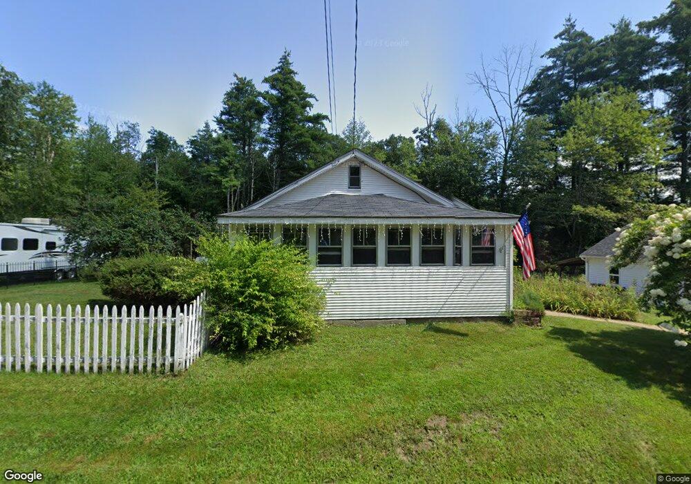
435 4th Range Rd Pembroke, NH 03275
Estimated Value: $400,334 - $451,000
2
Beds
1
Bath
1,200
Sq Ft
$359/Sq Ft
Est. Value
About This Home
This home is located at 435 4th Range Rd, Pembroke, NH 03275 and is currently estimated at $430,584, approximately $358 per square foot. 435 4th Range Rd is a home located in Merrimack County with nearby schools including Pembroke Hill School, Pembroke Village School, and Three Rivers School.
Ownership History
Date
Name
Owned For
Owner Type
Purchase Details
Closed on
Jul 21, 2021
Sold by
Brown Katherine A and Paulsen Erik S
Bought by
Paulsen Ft
Current Estimated Value
Purchase Details
Closed on
Mar 24, 2000
Sold by
Severance Margaret
Bought by
Braun Katherine A
Home Financials for this Owner
Home Financials are based on the most recent Mortgage that was taken out on this home.
Original Mortgage
$52,350
Interest Rate
8.31%
Create a Home Valuation Report for This Property
The Home Valuation Report is an in-depth analysis detailing your home's value as well as a comparison with similar homes in the area
Home Values in the Area
Average Home Value in this Area
Purchase History
| Date | Buyer | Sale Price | Title Company |
|---|---|---|---|
| Paulsen Ft | -- | None Available | |
| Braun Katherine A | $84,900 | -- |
Source: Public Records
Mortgage History
| Date | Status | Borrower | Loan Amount |
|---|---|---|---|
| Previous Owner | Braun Katherine A | $77,207 | |
| Previous Owner | Braun Katherine A | $52,350 |
Source: Public Records
Tax History
| Year | Tax Paid | Tax Assessment Tax Assessment Total Assessment is a certain percentage of the fair market value that is determined by local assessors to be the total taxable value of land and additions on the property. | Land | Improvement |
|---|---|---|---|---|
| 2024 | $6,870 | $349,800 | $139,100 | $210,700 |
| 2023 | $6,290 | $225,600 | $91,500 | $134,100 |
| 2022 | $5,500 | $220,900 | $91,500 | $129,400 |
| 2021 | $5,302 | $220,900 | $91,500 | $129,400 |
| 2020 | $5,319 | $220,900 | $91,500 | $129,400 |
| 2019 | $5,209 | $220,900 | $91,500 | $129,400 |
| 2018 | $6,106 | $190,100 | $83,500 | $106,600 |
| 2017 | $5,681 | $190,900 | $83,500 | $107,400 |
| 2015 | $4,570 | $157,900 | $74,700 | $83,200 |
| 2014 | $4,690 | $157,900 | $74,700 | $83,200 |
| 2011 | $4,680 | $177,000 | $82,600 | $94,400 |
Source: Public Records
Map
Nearby Homes
- 474 Blane Cir Unit 40
- 427 Grady Ln Unit 29
- 441 Blane Cir Unit 12
- 325 Pembroke Hill Rd
- 426 Dawn Ct Unit 22
- 431 Dawn Ct Unit 17
- 506 4th Range Rd Unit 4
- 348 Brickett Hill Rd Unit 3
- 344 Brickett Hill Rd Unit 2
- 340 Brickett Hill Rd
- 514 4th Range Rd Unit 6
- 101-1 Brickett Hill Rd
- 101-2 Brickett Hill Rd
- 214 Pembroke St
- 214 Pembroke St Unit A
- 365 Pembroke St
- 260 Church Rd
- 357 Pembroke St
- 481 Woodlawn Ridge Rd
- 91 Whittemore Rd
- 439 4th Range Rd
- 429 4th Range Rd
- 442 4th Range Rd
- 442 4th Range Rd
- 446 4th Range Rd
- 425 4th Range Rd
- 447 4th Range Rd
- 419 4th Range Rd
- 454 4th Range Rd
- 420 4th Range Rd
- 454B 4th Range Rd
- 415 4th Range Rd
- 416 4th Range Rd
- 457 4th Range Rd
- 458 4th Range Rd
- 410 4th Range Rd
- 462 4th Range Rd
- 652-658 4th Range Rd Unit Lot 2
- 477 4th Range Rd
- 489-491 4th Range Rd
Your Personal Tour Guide
Ask me questions while you tour the home.