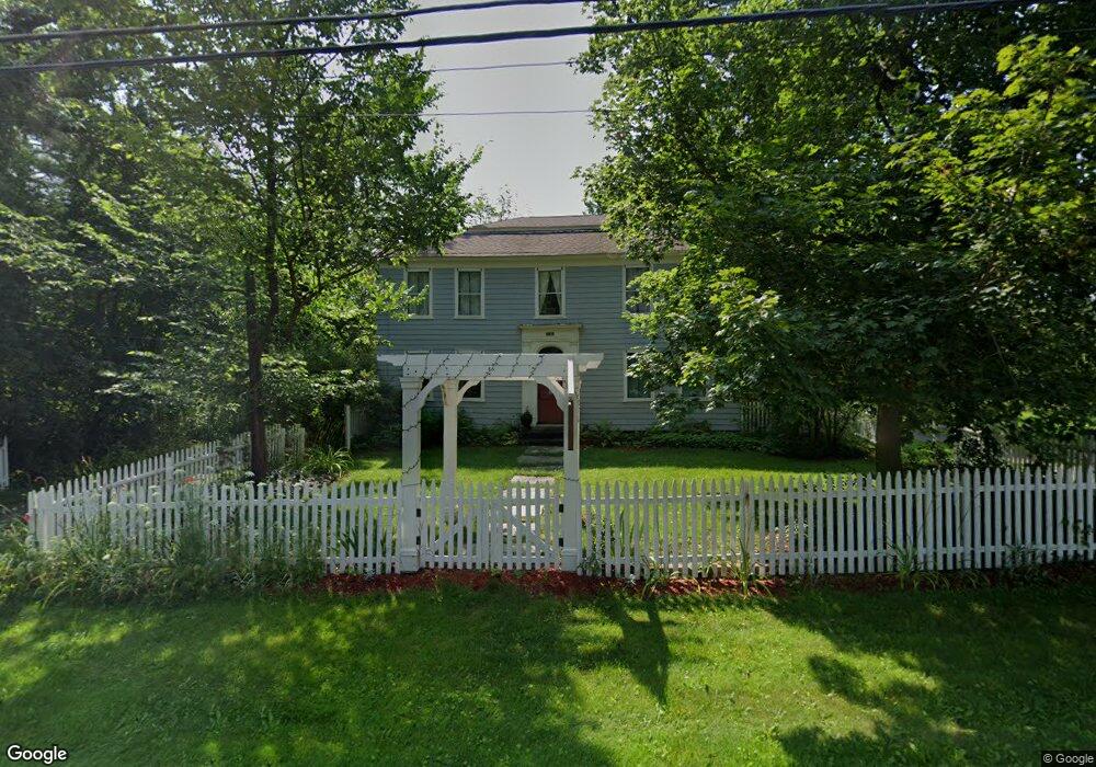
435 Boston Rd Sutton, MA 01590
Estimated Value: $746,882 - $916,000
4
Beds
2
Baths
2,844
Sq Ft
$291/Sq Ft
Est. Value
About This Home
This home is located at 435 Boston Rd, Sutton, MA 01590 and is currently estimated at $828,721, approximately $291 per square foot. 435 Boston Rd is a home located in Worcester County with nearby schools including Sutton Elementary School, Sutton Middle School, and Sutton High School.
Create a Home Valuation Report for This Property
The Home Valuation Report is an in-depth analysis detailing your home's value as well as a comparison with similar homes in the area
Home Values in the Area
Average Home Value in this Area
Tax History
| Year | Tax Paid | Tax Assessment Tax Assessment Total Assessment is a certain percentage of the fair market value that is determined by local assessors to be the total taxable value of land and additions on the property. | Land | Improvement |
|---|---|---|---|---|
| 2025 | $7,164 | $596,000 | $280,200 | $315,800 |
| 2024 | $6,822 | $538,000 | $256,800 | $281,200 |
| 2023 | $7,354 | $531,000 | $269,700 | $261,300 |
| 2022 | $7,907 | $520,900 | $230,700 | $290,200 |
| 2021 | $7,317 | $457,300 | $230,700 | $226,600 |
| 2020 | $7,253 | $457,300 | $230,700 | $226,600 |
| 2019 | $7,799 | $472,100 | $271,800 | $200,300 |
| 2018 | $7,813 | $472,100 | $271,800 | $200,300 |
| 2017 | $7,603 | $460,800 | $256,600 | $204,200 |
| 2016 | $7,686 | $460,800 | $256,600 | $204,200 |
| 2015 | $7,524 | $451,100 | $256,600 | $194,500 |
| 2014 | $7,772 | $460,400 | $270,500 | $189,900 |
Source: Public Records
Map
Nearby Homes
- 5 Putnam Hill Rd
- 354 W Sutton Rd
- 109 Mendon Rd
- 5 Hamlets Way
- 31 Central Turnpike
- 51 Central Turnpike
- 186 8 Lots Rd
- 1 Burbank Rd
- 24 Manchaug Rd
- 198 Uxbridge Rd
- 266 Putnam Hill Rd
- 99 Burbank Rd
- 99 Burbank Road Lot 182
- 37 Sutton Rd
- 11 Laurel Dr
- 168 Burbank Rd
- 0 W Main St
- 303 W Main St
- 196 Horne Way Unit 196
- 100 Horne Way
Your Personal Tour Guide
Ask me questions while you tour the home.