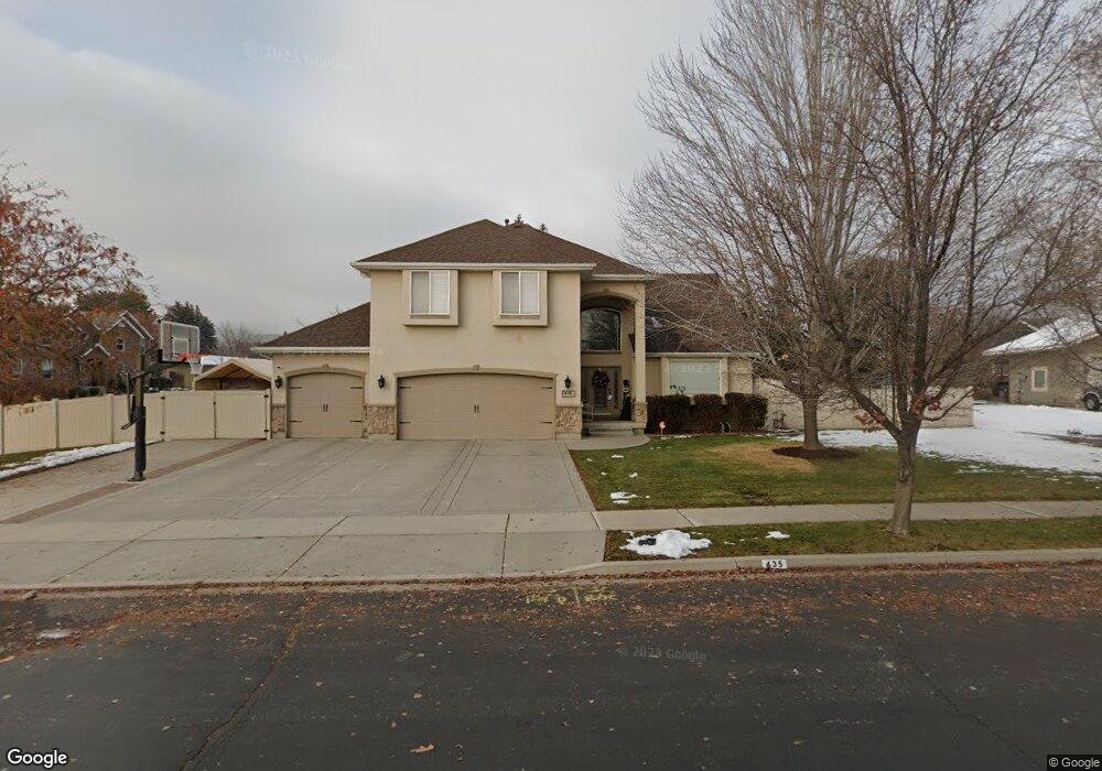
435 E 426 N Alpine, UT 84004
Estimated Value: $820,000 - $1,053,000
4
Beds
3
Baths
3,552
Sq Ft
$263/Sq Ft
Est. Value
About This Home
This home is located at 435 E 426 N, Alpine, UT 84004 and is currently estimated at $935,552, approximately $263 per square foot. 435 E 426 N is a home located in Utah County with nearby schools including Alpine School, Timberline Middle School, and Lone Peak High School.
Ownership History
Date
Name
Owned For
Owner Type
Purchase Details
Closed on
May 30, 2024
Sold by
Funk Randall B and Funk Markae P
Bought by
Funk
Current Estimated Value
Purchase Details
Closed on
Aug 16, 2002
Sold by
Wade Alan Fred and Wade Karen Lucille
Bought by
Funk Randall B and Funk Markae P
Home Financials for this Owner
Home Financials are based on the most recent Mortgage that was taken out on this home.
Original Mortgage
$282,000
Interest Rate
6.51%
Purchase Details
Closed on
Jun 5, 2002
Sold by
Eaton Virginia G
Bought by
Wade Alan
Purchase Details
Closed on
Sep 27, 2000
Sold by
Hunziker Kurt
Bought by
Eaton Virginia G
Home Financials for this Owner
Home Financials are based on the most recent Mortgage that was taken out on this home.
Original Mortgage
$350,000
Interest Rate
9.99%
Create a Home Valuation Report for This Property
The Home Valuation Report is an in-depth analysis detailing your home's value as well as a comparison with similar homes in the area
Home Values in the Area
Average Home Value in this Area
Purchase History
| Date | Buyer | Sale Price | Title Company |
|---|---|---|---|
| Funk | -- | None Listed On Document | |
| Funk Randall B | -- | Title West Title Co | |
| Wade Alan | $262,695 | Title West Title Co | |
| Eaton Virginia G | -- | Equity Title Agency Inc |
Source: Public Records
Mortgage History
| Date | Status | Borrower | Loan Amount |
|---|---|---|---|
| Previous Owner | Funk Randall B | $282,000 | |
| Previous Owner | Eaton Virginia G | $350,000 | |
| Closed | Eaton Virginia G | $130,008 |
Source: Public Records
Tax History
| Year | Tax Paid | Tax Assessment Tax Assessment Total Assessment is a certain percentage of the fair market value that is determined by local assessors to be the total taxable value of land and additions on the property. | Land | Improvement |
|---|---|---|---|---|
| 2025 | $3,567 | $427,460 | -- | -- |
| 2024 | $3,567 | $415,745 | $0 | $0 |
| 2023 | $3,355 | $419,815 | $0 | $0 |
| 2022 | $3,266 | $396,935 | $0 | $0 |
| 2021 | $2,914 | $550,000 | $269,300 | $280,700 |
| 2020 | $2,757 | $509,400 | $234,200 | $275,200 |
| 2019 | $2,455 | $473,500 | $234,200 | $239,300 |
| 2018 | $2,321 | $442,300 | $234,200 | $208,100 |
| 2017 | $2,314 | $234,685 | $0 | $0 |
| 2016 | $2,331 | $220,385 | $0 | $0 |
| 2015 | $2,287 | $204,490 | $0 | $0 |
| 2014 | $2,287 | $202,345 | $0 | $0 |
Source: Public Records
Map
Nearby Homes
- 499 E 300 N
- 475 Grove Dr
- 512 Eastridge Cir
- 48 N 100 E
- 151 Glacier Lily Dr
- 887 E Village Way
- 30 S Main St
- 381 E Watkins Cir Unit 28
- 202 E Alpine Dr
- 1103 E Lone Peak Dr
- 382 E Heritage Hills Dr
- 463 Heritage Hills Dr
- 248 Deerfield Dr
- 287 Heritage Hills Dr
- 19 E Elk Ct
- 781 N Country Manor Ln
- 986 N Sunbrook Cir
- 1063 E Alpine Dr
- 128 E Deer Crest Ln Unit 304
- 250 S Main St Unit 25
- 435 E 426 N Unit 1
- 474 Wilderness Dr
- 455 E 426 N
- 455 E 426 N Unit 2
- 459 N 425 E
- 459 Wilderness Dr
- 403 E 426 N
- 438 E 426 N
- 438 E 426 N Unit 5
- 489 Wilderness Dr
- 496 Wilderness Dr
- 458 E 426 N
- 458 E 426 N Unit 4
- 406 E 426 N
- 373 E 426 N
- 373 E 426 N
- 518 Wilderness Dr
- 496 Mountainville Cir
- 374 N 425 E
- 420 N 425 E
Your Personal Tour Guide
Ask me questions while you tour the home.