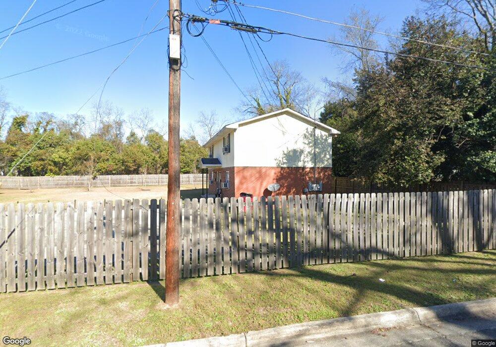
435 Moseley St Unit A Macon, GA 31204
Estimated Value: $130,000 - $296,880
2
Beds
1
Bath
1,968
Sq Ft
$124/Sq Ft
Est. Value
About This Home
This home is located at 435 Moseley St Unit A, Macon, GA 31204 and is currently estimated at $243,470, approximately $123 per square foot. 435 Moseley St Unit A is a home located in Bibb County with nearby schools including Hartley Elementary School, Southwest High School, and Cirrus Charter Academy.
Ownership History
Date
Name
Owned For
Owner Type
Purchase Details
Closed on
Dec 20, 2022
Sold by
Mbc Media Group Llc
Bought by
Smith Michael D
Current Estimated Value
Purchase Details
Closed on
Jun 28, 2018
Sold by
Hillman Izell
Bought by
Mbc Media Group Llc
Home Financials for this Owner
Home Financials are based on the most recent Mortgage that was taken out on this home.
Original Mortgage
$118,000
Interest Rate
7%
Mortgage Type
Adjustable Rate Mortgage/ARM
Purchase Details
Closed on
Sep 11, 2014
Sold by
Barnes William T
Bought by
Hillman Izell
Purchase Details
Closed on
Dec 28, 1984
Sold by
Woodson Frances D
Bought by
Barnes William T
Create a Home Valuation Report for This Property
The Home Valuation Report is an in-depth analysis detailing your home's value as well as a comparison with similar homes in the area
Home Values in the Area
Average Home Value in this Area
Purchase History
| Date | Buyer | Sale Price | Title Company |
|---|---|---|---|
| Smith Michael D | $249,000 | -- | |
| Mbc Media Group Llc | $155,000 | None Available | |
| Hillman Izell | -- | -- | |
| Barnes William T | $6,000 | -- |
Source: Public Records
Mortgage History
| Date | Status | Borrower | Loan Amount |
|---|---|---|---|
| Previous Owner | Mbc Media Group Llc | $118,000 |
Source: Public Records
Tax History Compared to Growth
Tax History
| Year | Tax Paid | Tax Assessment Tax Assessment Total Assessment is a certain percentage of the fair market value that is determined by local assessors to be the total taxable value of land and additions on the property. | Land | Improvement |
|---|---|---|---|---|
| 2025 | $2,705 | $110,064 | $4,032 | $106,032 |
| 2024 | $2,292 | $90,249 | $2,800 | $87,449 |
| 2023 | $2,476 | $83,595 | $2,800 | $80,795 |
| 2022 | $1,957 | $56,528 | $4,800 | $51,728 |
| 2021 | $2,034 | $53,538 | $4,800 | $48,738 |
| 2020 | $2,079 | $53,538 | $4,800 | $48,738 |
| 2019 | $2,010 | $51,355 | $4,800 | $46,555 |
| 2018 | $2,898 | $36,333 | $3,120 | $33,213 |
| 2017 | $1,361 | $36,333 | $3,120 | $33,213 |
| 2016 | $1,260 | $36,405 | $3,456 | $32,949 |
| 2015 | $1,749 | $35,716 | $3,456 | $32,260 |
| 2014 | $299 | $5,311 | $3,456 | $1,855 |
Source: Public Records
Map
Nearby Homes
- 297 Pansy Ave
- 254 Lilly Ave
- 1485 Brentwood Ave
- 430 Daffodil St
- 348 Hortman Ave
- 310 Edwards Ave
- 1470 Bankston Ave
- 576 Pansy Ave
- 466 Petunia Ave
- 1580 Marigold Ave
- 1568 Marigold Ave
- 1518 Marigold Ave
- 284 Grosso Ave
- 2960 Churchill St
- 1422 Helon St
- 1458 Bailey Ave
- 1340 Courtland Ave
- 210 Moseley Ave
- 1198 Brentwood Ave
- 710 Poppy Ave
- 435 Moseley St Unit D
- 435 Moseley St Unit 4
- 435 Moseley St
- 435 Moseley St
- 285 Pansy Ave
- 290 Lilly Ave
- 311 Pansy Ave
- 2838 Elpis St
- 436 Moseley Ave
- 288 Lilly Ave
- 436 Moseley St Unit &438
- 2822 Elpis St
- 2830 Elpis St
- 286 Lilly Ave
- 273 Pansy Ave
- 345 Pansy Ave
- 2844 Elpis St
- 251 Pansy Ave
- 314 Pansy Ave
- 353 Pansy Ave