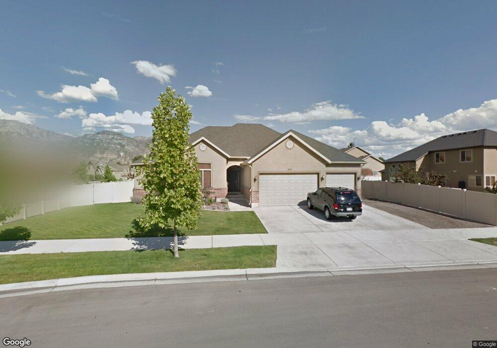
435 S 2210 W Unit Lot 12 Provo, UT 84601
Franklin NeighborhoodEstimated Value: $534,000 - $561,000
3
Beds
2
Baths
1,950
Sq Ft
$281/Sq Ft
Est. Value
About This Home
This home is located at 435 S 2210 W Unit Lot 12, Provo, UT 84601 and is currently estimated at $548,875, approximately $281 per square foot. 435 S 2210 W Unit Lot 12 is a home located in Utah County with nearby schools including Dixon Middle School, Provo High School, and Freedom Preparatory Academy.
Ownership History
Date
Name
Owned For
Owner Type
Purchase Details
Closed on
Aug 30, 2007
Sold by
Atwood Erika and Atwood Scott
Bought by
Valgardson Craig W and Valgardson Kyrie O
Current Estimated Value
Home Financials for this Owner
Home Financials are based on the most recent Mortgage that was taken out on this home.
Original Mortgage
$297,350
Outstanding Balance
$189,224
Interest Rate
6.67%
Mortgage Type
Purchase Money Mortgage
Estimated Equity
$359,651
Purchase Details
Closed on
Dec 22, 2006
Sold by
Atwood Erika and Atwood Scott
Bought by
Atwood Scott and Atwood Erika
Home Financials for this Owner
Home Financials are based on the most recent Mortgage that was taken out on this home.
Original Mortgage
$38,400
Interest Rate
6.12%
Mortgage Type
Stand Alone Second
Purchase Details
Closed on
Jul 20, 2005
Sold by
Sandalwood Llc
Bought by
Atwood Scott and Atwood Erika
Home Financials for this Owner
Home Financials are based on the most recent Mortgage that was taken out on this home.
Original Mortgage
$234,400
Interest Rate
5.56%
Mortgage Type
Construction
Create a Home Valuation Report for This Property
The Home Valuation Report is an in-depth analysis detailing your home's value as well as a comparison with similar homes in the area
Home Values in the Area
Average Home Value in this Area
Purchase History
| Date | Buyer | Sale Price | Title Company |
|---|---|---|---|
| Valgardson Craig W | -- | First American American F | |
| Atwood Scott | -- | First American Title Agency | |
| Atwood Scott | -- | Cottonwood Title Insurance |
Source: Public Records
Mortgage History
| Date | Status | Borrower | Loan Amount |
|---|---|---|---|
| Open | Valgardson Craig W | $297,350 | |
| Previous Owner | Atwood Scott | $38,400 | |
| Previous Owner | Atwood Scott | $255,000 | |
| Previous Owner | Atwood Scott | $234,400 |
Source: Public Records
Tax History Compared to Growth
Tax History
| Year | Tax Paid | Tax Assessment Tax Assessment Total Assessment is a certain percentage of the fair market value that is determined by local assessors to be the total taxable value of land and additions on the property. | Land | Improvement |
|---|---|---|---|---|
| 2025 | $2,671 | $282,040 | $233,600 | $279,200 |
| 2024 | $2,671 | $262,955 | $0 | $0 |
| 2023 | $2,601 | $252,395 | $0 | $0 |
| 2022 | $2,532 | $247,720 | $0 | $0 |
| 2021 | $1,929 | $329,200 | $131,800 | $197,400 |
| 2020 | $1,848 | $295,700 | $114,600 | $181,100 |
| 2019 | $1,775 | $295,400 | $114,600 | $180,800 |
| 2018 | $1,671 | $281,900 | $103,500 | $178,400 |
| 2017 | $1,549 | $143,660 | $0 | $0 |
| 2016 | $1,568 | $135,520 | $0 | $0 |
| 2015 | $1,388 | $121,275 | $0 | $0 |
| 2014 | $1,285 | $116,985 | $0 | $0 |
Source: Public Records
Map
Nearby Homes
- 386 S 2390 W
- 312 S 1920 W
- 273 S 1860 W
- 1828 W 170 S
- 147 S 1680 W
- 201 N Geneva Rd Unit 3
- 227 West Ln
- 249 West Ln Unit 10
- 154 N 2560 W
- 1744 W 150 N
- 2744 W 50 N
- 255 N 1600 W Unit 148
- 255 N 1600 W Unit 52
- 255 N 1600 W Unit 84
- 255 N 1600 W Unit 108
- 392 N 2150 W
- 478 S 1330 W
- 1075 Lakeview Pkwy
- 1125 Lakeview Pkwy
- 2727 W 220 N
- 435 S 2210 W
- 2188 S 470
- 2188 W 470 S
- 2188 W 470 S Unit 11
- 2137 W 410 S
- 2167 W 410 S
- 2166 W 470 S
- 2166 W 470 S Unit 10
- 2186 W 410 S
- 2186 W 410 S Unit 21
- 438 S 2210 W
- 2164 W 410 S
- 406 S 2210 W
- 406 S 2210 W Unit 35
- 452 S 2210 W
- 452 S 2210 W Unit 37
- 2145 W 410 S
- 2148 W 470 S
- 2148 W 470 S Unit 9
- 441 S 2280 W