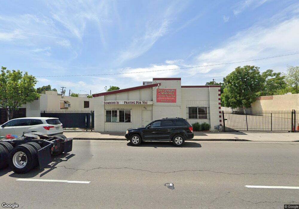
435 S Wilson Way Stockton, CA 95205
East Stockton NeighborhoodEstimated Value: $257,821
--
Bed
--
Bath
--
Sq Ft
5,009
Sq Ft Lot
About This Home
This home is located at 435 S Wilson Way, Stockton, CA 95205 and is currently estimated at $257,821. 435 S Wilson Way is a home located in San Joaquin County with nearby schools including John C. Fremont Elementary School, King Elementary School, and Roosevelt Elementary School.
Ownership History
Date
Name
Owned For
Owner Type
Purchase Details
Closed on
Jul 15, 2010
Sold by
Ilyas Mohammad and Ilyas Shazia
Bought by
Ahmed Parvez and Ahmed Fatima B
Current Estimated Value
Purchase Details
Closed on
Oct 5, 1999
Sold by
Giovannoni Adolph L & E Tr and Adolph Leonard
Bought by
Ahmed Parvez and Ahmed Fatima B
Purchase Details
Closed on
Feb 18, 1998
Sold by
A & J Construction Co
Bought by
Giovannoni Adolph Leonard and Williams Jerry
Create a Home Valuation Report for This Property
The Home Valuation Report is an in-depth analysis detailing your home's value as well as a comparison with similar homes in the area
Home Values in the Area
Average Home Value in this Area
Purchase History
| Date | Buyer | Sale Price | Title Company |
|---|---|---|---|
| Ahmed Parvez | $41,000 | None Available | |
| Ahmed Parvez | $41,000 | None Available | |
| Ahmed Parvez | $70,000 | Chicago Title Co | |
| Giovannoni Adolph Leonard | -- | -- |
Source: Public Records
Tax History Compared to Growth
Tax History
| Year | Tax Paid | Tax Assessment Tax Assessment Total Assessment is a certain percentage of the fair market value that is determined by local assessors to be the total taxable value of land and additions on the property. | Land | Improvement |
|---|---|---|---|---|
| 2025 | $1,338 | $106,311 | $39,064 | $67,247 |
| 2024 | $1,317 | $104,228 | $38,299 | $65,929 |
| 2023 | $1,287 | $102,186 | $37,549 | $64,637 |
| 2022 | $1,263 | $100,183 | $36,813 | $63,370 |
| 2021 | $1,214 | $98,220 | $36,092 | $62,128 |
| 2020 | $1,237 | $97,213 | $35,722 | $61,491 |
| 2019 | $1,232 | $95,308 | $35,022 | $60,286 |
| 2018 | $1,209 | $93,440 | $34,336 | $59,104 |
| 2017 | $1,145 | $91,609 | $33,663 | $57,946 |
| 2016 | $1,166 | $89,813 | $33,003 | $56,810 |
| 2014 | $1,111 | $86,731 | $31,870 | $54,861 |
Source: Public Records
Map
Nearby Homes
- 336 S Airport Way
- 1224 E Lafayette St
- 835 S Airport Way
- 832 S Pilgrim St
- 1816 E Sonora St
- 1211 E Main St
- 1636 E Anderson St
- 709 E Sonora St
- 921 S Aurora St
- 1200 E Miner Ave
- 144 N Grant St
- 312 Florence St
- 28 S American St
- 328 Florence St
- 1145 S Grant St
- 525 S California St
- 2191 E Scotts Ave
- 2229 Alma St
- 609 E Jefferson St
- 2125 E Myrtle St
- 443 S Wilson Way
- 1431 E Church St
- 1427 E Church St
- 505 S Wilson Way
- 1432 E Sonora St
- 428 S Sierra Nevada St
- 1422 E Sonora St
- 442 S Sierra Nevada St
- 446 S Sierra Nevada St
- 420 S Sierra Nevada St
- 1422 E Church St
- 504 S Sierra Nevada St
- 404 S Sierra Nevada St
- 512 S Sierra Nevada St
- 518 S Sierra Nevada St
- 1421 E Sonora St
- 527 S Wilson Way
- 435 S Sierra Nevada St
- 526 S Sierra Nevada St
- 439 S Sierra Nevada St Unit 2