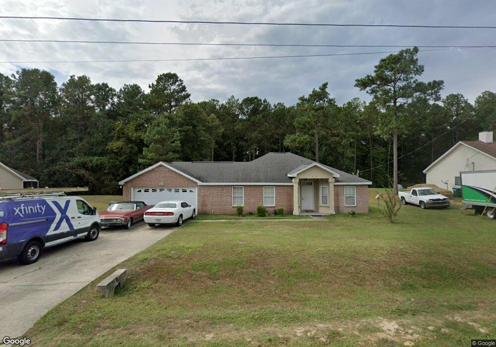
435 Slash Cir Unit 1 Midway, FL 32343
Estimated Value: $235,000 - $260,000
3
Beds
2
Baths
1,470
Sq Ft
$171/Sq Ft
Est. Value
About This Home
This home is located at 435 Slash Cir Unit 1, Midway, FL 32343 and is currently estimated at $251,947, approximately $171 per square foot. 435 Slash Cir Unit 1 is a home located in Gadsden County.
Ownership History
Date
Name
Owned For
Owner Type
Purchase Details
Closed on
Jun 18, 2010
Sold by
Us Bank National Association
Bought by
Dixon Crystal N
Current Estimated Value
Home Financials for this Owner
Home Financials are based on the most recent Mortgage that was taken out on this home.
Original Mortgage
$114,570
Interest Rate
5.25%
Mortgage Type
FHA
Purchase Details
Closed on
Jul 16, 2009
Sold by
Shepherd Darryl E
Bought by
Us Bank National Association
Purchase Details
Closed on
Jun 16, 2006
Sold by
Han Yichun
Bought by
Shepherd Darryl E
Home Financials for this Owner
Home Financials are based on the most recent Mortgage that was taken out on this home.
Original Mortgage
$167,640
Interest Rate
8.2%
Mortgage Type
Purchase Money Mortgage
Create a Home Valuation Report for This Property
The Home Valuation Report is an in-depth analysis detailing your home's value as well as a comparison with similar homes in the area
Home Values in the Area
Average Home Value in this Area
Purchase History
| Date | Buyer | Sale Price | Title Company |
|---|---|---|---|
| Dixon Crystal N | $120,000 | American Guardian Title Inc | |
| Us Bank National Association | -- | None Available | |
| Shepherd Darryl E | $167,700 | North State Title Svcs Inc |
Source: Public Records
Mortgage History
| Date | Status | Borrower | Loan Amount |
|---|---|---|---|
| Previous Owner | Dixon Crystal N | $114,570 | |
| Previous Owner | Shepherd Darryl E | $167,640 |
Source: Public Records
Tax History Compared to Growth
Tax History
| Year | Tax Paid | Tax Assessment Tax Assessment Total Assessment is a certain percentage of the fair market value that is determined by local assessors to be the total taxable value of land and additions on the property. | Land | Improvement |
|---|---|---|---|---|
| 2025 | $1,560 | $125,914 | -- | -- |
| 2024 | $1,503 | $122,366 | -- | -- |
| 2023 | $1,456 | $118,802 | $0 | $0 |
| 2022 | $1,394 | $115,342 | $0 | $0 |
| 2021 | $1,361 | $111,983 | $0 | $0 |
| 2020 | $1,329 | $110,437 | $0 | $0 |
| 2019 | $1,307 | $107,954 | $0 | $0 |
| 2018 | $1,304 | $105,941 | $0 | $0 |
| 2017 | $1,264 | $103,762 | $0 | $0 |
| 2016 | $1,239 | $101,628 | $0 | $0 |
| 2015 | $1,227 | $100,922 | $0 | $0 |
| 2014 | $1,193 | $100,121 | $0 | $0 |
Source: Public Records
Map
Nearby Homes
- 65 Deloris Madison Dr
- 420 N Charles Willis Dr
- 6 Slash Ln
- 62 Frank Run
- 50 Frank Run
- 49 Francis Harrell Way
- 7 Mae Cato Dr
- 17 Pine Bark Ln
- 315 Mae Cato Dr
- 25 Pine Bark Ln
- 407 Mae Cato Dr
- 137 Monroe Creek Dr
- 668 M l King Blvd
- 8873 High Bridge Rd
- 8877 High Bridge Rd
- 81 Knight Rd
- 0 Central Rd Unit 381525
- 274 Forest Cir S
- 69 Buckskin Cir
- XX S Lanier Rd
- 435 Slash Cir
- 425 Slash Cir
- 455 Slash Cir
- 440 Slash Cir
- 415 Slash Cir
- 475 Slash Cir Unit 1
- 475 Slash Cir
- 420 Slash Cir
- 420 Slash Pine Cir
- 460 Slash Cir
- 400 Slash Cir
- 0 Slash Pine Unit 20 225447
- 490 Slash Cir Unit 20
- 490 Slash Cir
- 515 Slash Cir Unit LT
- 515 Slash Cir
- 295 Slash Ln
- 277 Slash Ln
- 115 Ponderosa Cir
- 313 Slash Ln