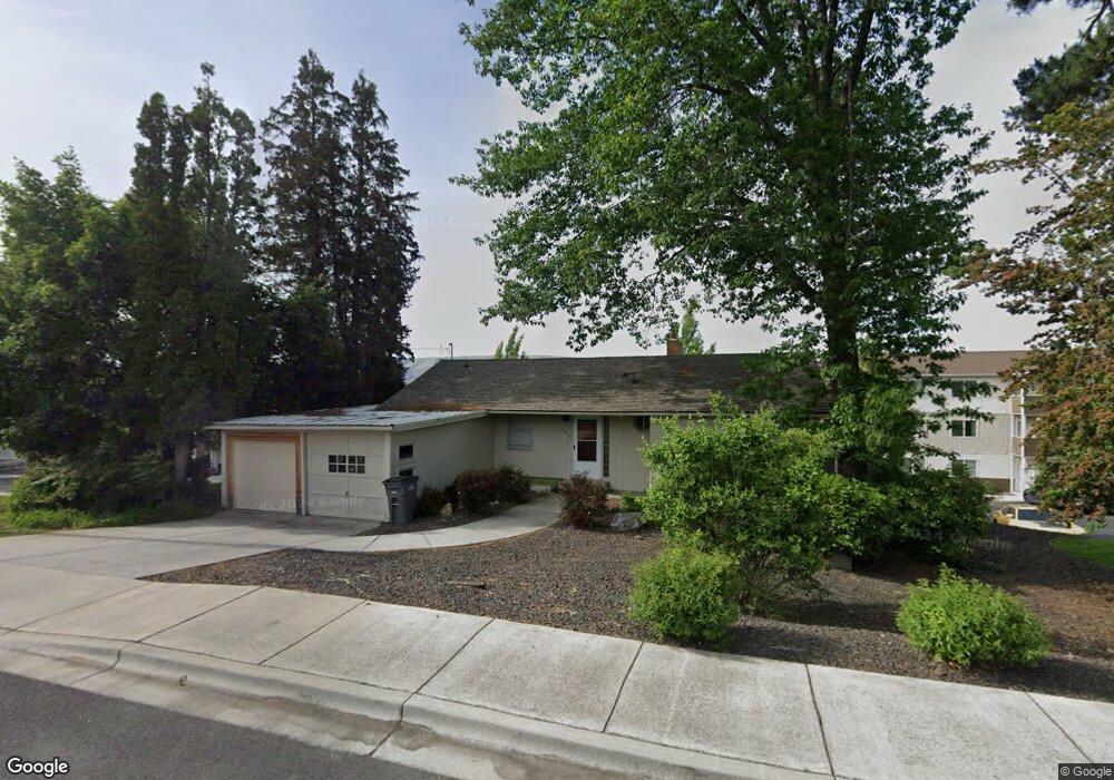
435 Stewart Ave Lewiston, ID 83501
Estimated Value: $347,000 - $472,000
2
Beds
2
Baths
2,025
Sq Ft
$194/Sq Ft
Est. Value
About This Home
This home is located at 435 Stewart Ave, Lewiston, ID 83501 and is currently estimated at $393,460, approximately $194 per square foot. 435 Stewart Ave is a home located in Nez Perce County with nearby schools including McSorley Elementary School, Lewiston High School, and Beacon Christian School.
Ownership History
Date
Name
Owned For
Owner Type
Purchase Details
Closed on
Dec 28, 2021
Sold by
Cs Blum Properties-4 Llc
Bought by
Canyon View Lewiston 120 Llc
Current Estimated Value
Home Financials for this Owner
Home Financials are based on the most recent Mortgage that was taken out on this home.
Original Mortgage
$13,431,745
Outstanding Balance
$12,369,276
Interest Rate
3.05%
Mortgage Type
New Conventional
Estimated Equity
-$11,975,816
Purchase Details
Closed on
Feb 14, 2014
Sold by
Lindsay Bernette Jan Forsman and Forsman David Smith
Bought by
Blum J Curtis and Blum Stacy A
Create a Home Valuation Report for This Property
The Home Valuation Report is an in-depth analysis detailing your home's value as well as a comparison with similar homes in the area
Home Values in the Area
Average Home Value in this Area
Purchase History
| Date | Buyer | Sale Price | Title Company |
|---|---|---|---|
| Canyon View Lewiston 120 Llc | -- | First American Title | |
| Blum J Curtis | -- | Land Title |
Source: Public Records
Mortgage History
| Date | Status | Borrower | Loan Amount |
|---|---|---|---|
| Open | Canyon View Lewiston 120 Llc | $13,431,745 |
Source: Public Records
Tax History Compared to Growth
Tax History
| Year | Tax Paid | Tax Assessment Tax Assessment Total Assessment is a certain percentage of the fair market value that is determined by local assessors to be the total taxable value of land and additions on the property. | Land | Improvement |
|---|---|---|---|---|
| 2025 | $4,600 | $327,561 | $140,606 | $186,955 |
| 2024 | $46 | $307,193 | $130,240 | $176,953 |
| 2023 | $4,680 | $304,930 | $127,240 | $177,690 |
| 2022 | $4,643 | $276,076 | $107,955 | $168,121 |
| 2021 | $4,336 | $220,144 | $87,062 | $133,082 |
| 2020 | $3,775 | $191,041 | $81,512 | $109,529 |
| 2019 | $3,821 | $176,320 | $81,512 | $94,808 |
| 2018 | $3,532 | $161,613 | $74,146 | $87,467 |
| 2017 | $2,968 | $0 | $0 | $0 |
| 2016 | $2,968 | $0 | $0 | $0 |
| 2015 | $2,915 | $0 | $0 | $0 |
| 2014 | $2,645 | $133,743 | $48,500 | $85,243 |
Source: Public Records
Map
Nearby Homes