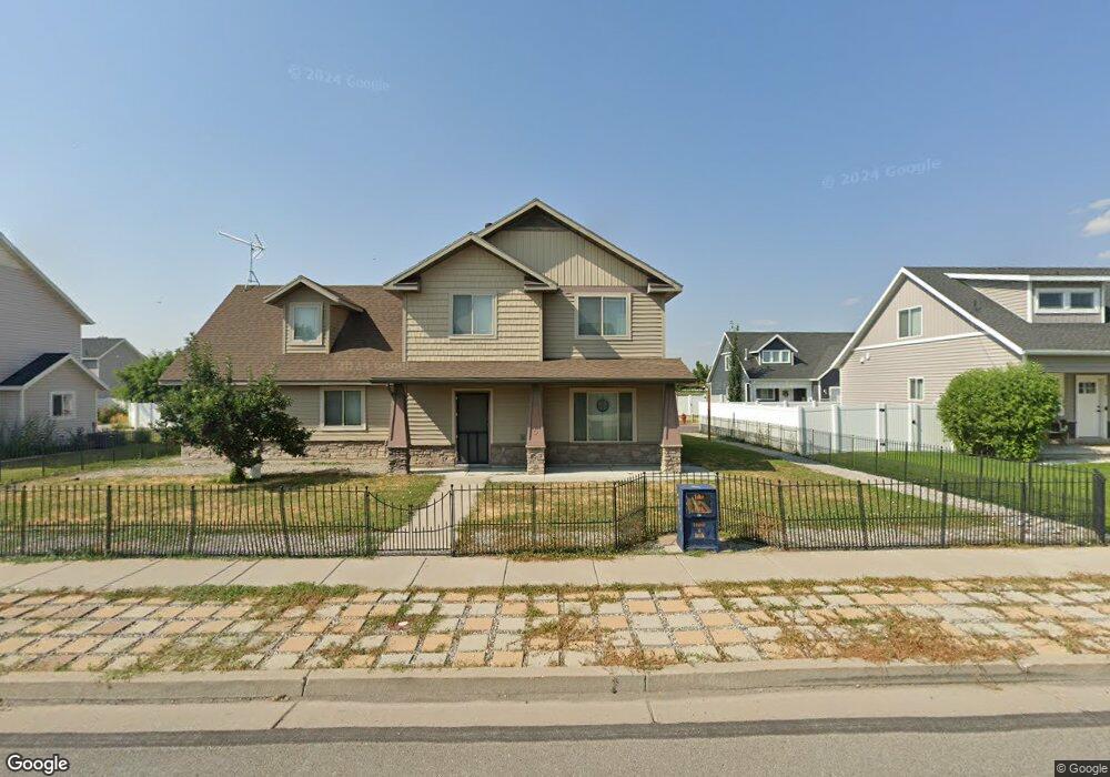
435 W 1140 N Logan, UT 84341
Bridger NeighborhoodEstimated Value: $393,000 - $452,000
3
Beds
3
Baths
2,020
Sq Ft
$211/Sq Ft
Est. Value
About This Home
This home is located at 435 W 1140 N, Logan, UT 84341 and is currently estimated at $426,167, approximately $210 per square foot. 435 W 1140 N is a home located in Cache County with nearby schools including Bridger School, Mount Logan Middle School, and Logan High School.
Ownership History
Date
Name
Owned For
Owner Type
Purchase Details
Closed on
Nov 23, 2009
Sold by
Johnson Ready Mix Concrete Company
Bought by
Gibson Gustaf I and Gibson Tawnya I
Current Estimated Value
Home Financials for this Owner
Home Financials are based on the most recent Mortgage that was taken out on this home.
Original Mortgage
$164,255
Outstanding Balance
$106,762
Interest Rate
4.99%
Mortgage Type
New Conventional
Estimated Equity
$319,405
Create a Home Valuation Report for This Property
The Home Valuation Report is an in-depth analysis detailing your home's value as well as a comparison with similar homes in the area
Home Values in the Area
Average Home Value in this Area
Purchase History
| Date | Buyer | Sale Price | Title Company |
|---|---|---|---|
| Gibson Gustaf I | -- | Hickman Land Title Company | |
| Gibson Gustaf I | -- | Hickman Land Title Company | |
| Gibson Gustaf I | -- | Hickman Land Title Company |
Source: Public Records
Mortgage History
| Date | Status | Borrower | Loan Amount |
|---|---|---|---|
| Open | Gibson Gustaf I | $164,255 | |
| Closed | Gibson Gustaf I | $164,255 |
Source: Public Records
Tax History
| Year | Tax Paid | Tax Assessment Tax Assessment Total Assessment is a certain percentage of the fair market value that is determined by local assessors to be the total taxable value of land and additions on the property. | Land | Improvement |
|---|---|---|---|---|
| 2025 | $1,845 | $238,590 | $0 | $0 |
| 2024 | $1,905 | $238,590 | $0 | $0 |
| 2023 | $1,991 | $237,710 | $0 | $0 |
| 2022 | $2,132 | $237,710 | $0 | $0 |
| 2021 | $1,517 | $261,359 | $42,000 | $219,359 |
| 2020 | $1,501 | $232,747 | $42,000 | $190,747 |
| 2019 | $1,569 | $232,747 | $42,000 | $190,747 |
| 2018 | $1,568 | $212,310 | $42,000 | $170,310 |
| 2017 | $1,569 | $112,310 | $0 | $0 |
| 2016 | $1,626 | $91,900 | $0 | $0 |
| 2015 | $1,332 | $91,900 | $0 | $0 |
| 2014 | $1,204 | $91,900 | $0 | $0 |
| 2013 | -- | $91,900 | $0 | $0 |
Source: Public Records
Map
Nearby Homes
- 465 W 1140 N
- 948 N 480 W
- 1030 N 250 W
- 2200 N 220 W
- 905 N 540 W
- 1368 N 590 W
- 897 N 250 W
- 723 W 1400 N Unit 3
- 430 W 810 N
- 111 Kings Ct
- 420 W 750 N
- 1515 N 450 W Unit 103
- 1492 N 565 W Unit 103
- 1521 N 420 W Unit 104
- 20 Kings Ct
- 476 W 725 N
- 306 W 725 N
- 1555 N 280 W Unit 102
- 519 W 1570 N Unit 103
- 365 W 690 N
Your Personal Tour Guide
Ask me questions while you tour the home.