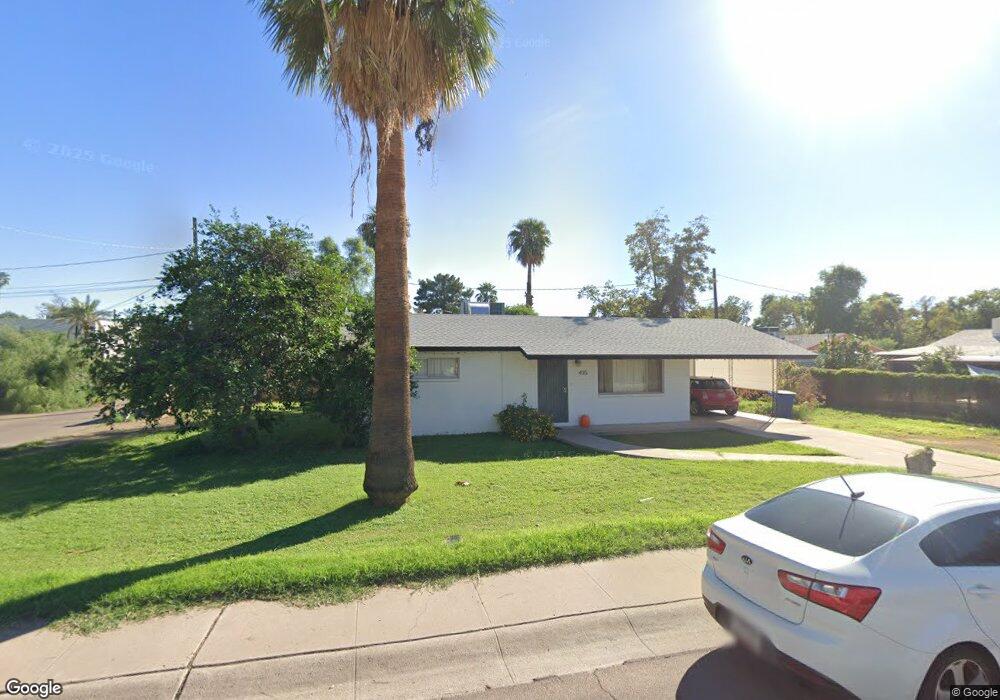
435 W 12th St Tempe, AZ 85281
Mitchell Park East NeighborhoodEstimated Value: $339,000 - $474,000
--
Bed
1
Bath
864
Sq Ft
$440/Sq Ft
Est. Value
About This Home
This home is located at 435 W 12th St, Tempe, AZ 85281 and is currently estimated at $380,302, approximately $440 per square foot. 435 W 12th St is a home located in Maricopa County with nearby schools including Geneva Epps Mosley Middle School, Tempe High School, and New School for the Arts & Academics.
Ownership History
Date
Name
Owned For
Owner Type
Purchase Details
Closed on
Dec 4, 2013
Sold by
Knight Terry and Knight Anne S
Bought by
Knights University Rentals Llco
Current Estimated Value
Purchase Details
Closed on
Feb 23, 1999
Sold by
Reynolds James H
Bought by
Knight Terry and Anne Knight S
Purchase Details
Closed on
Jul 17, 1998
Sold by
Reynolds James Harry
Bought by
Knight Sara Anne Reynolds
Create a Home Valuation Report for This Property
The Home Valuation Report is an in-depth analysis detailing your home's value as well as a comparison with similar homes in the area
Home Values in the Area
Average Home Value in this Area
Purchase History
| Date | Buyer | Sale Price | Title Company |
|---|---|---|---|
| Knights University Rentals Llco | -- | None Available | |
| Knight Terry | $37,500 | First American Title | |
| Knight Sara Anne Reynolds | -- | -- |
Source: Public Records
Tax History Compared to Growth
Tax History
| Year | Tax Paid | Tax Assessment Tax Assessment Total Assessment is a certain percentage of the fair market value that is determined by local assessors to be the total taxable value of land and additions on the property. | Land | Improvement |
|---|---|---|---|---|
| 2025 | $2,116 | $17,651 | -- | -- |
| 2024 | $1,953 | $16,810 | -- | -- |
| 2023 | $1,953 | $33,130 | $6,620 | $26,510 |
| 2022 | $1,874 | $27,500 | $5,500 | $22,000 |
| 2021 | $1,887 | $25,120 | $5,020 | $20,100 |
| 2020 | $1,829 | $21,850 | $4,370 | $17,480 |
| 2019 | $1,795 | $17,650 | $3,530 | $14,120 |
| 2018 | $1,750 | $16,370 | $3,270 | $13,100 |
| 2017 | $1,698 | $13,750 | $2,750 | $11,000 |
| 2016 | $1,686 | $13,450 | $2,690 | $10,760 |
| 2015 | $1,619 | $12,850 | $2,570 | $10,280 |
Source: Public Records
Map
Nearby Homes
- 1218 S Farmer Ave
- 1234 S Farmer Ave
- 1101 S Farmer Ave
- 522 W Howe St
- 63 W 13th St Unit 63 & 69
- 1224 S Maple Ave
- 1190 S Maple Ave Unit 1
- 538 W 13th St
- 538 W 13th St Unit A
- 620 W Howe St
- 531 W 14th St
- 117 W 10th St
- 942 S Ash Ave Unit 103
- 542 W 15th St
- 535 W 15th St
- 601 W 15th St
- 14 E 14th St
- 22 E 15th St
- 700 W University Dr Unit 122
- 700 W University Dr Unit 253
- 1205 S Wilson St
- 1201 S Wilson St
- 431 W 12th St
- 1209 S Wilson St
- 420 W 12th St
- 424 W 12th St
- 414 W 12th St
- 1213 S Wilson St
- 428 W 12th St
- 1208 S Farmer Ave
- 1214 S Farmer Ave
- 1214 S Farmer Ave Unit 101.2A
- 1200 S Farmer Ave
- 1217 S Wilson St
- 1140 S Farmer Ave
- 515 W 12th St
- 505 W 12th St
- 419 W Howe St
- 415 W Howe St
- 1221 S Wilson St