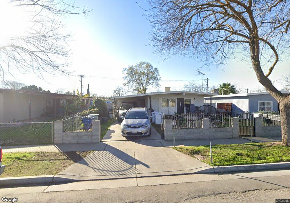
435 W Hawes Ave Fresno, CA 93706
Edison NeighborhoodEstimated Value: $214,000 - $274,000
3
Beds
1
Bath
816
Sq Ft
$301/Sq Ft
Est. Value
About This Home
This home is located at 435 W Hawes Ave, Fresno, CA 93706 and is currently estimated at $245,595, approximately $300 per square foot. 435 W Hawes Ave is a home located in Fresno County with nearby schools including King Elementary School, Rutherford B. Gaston Sr. Middle, and Edison High School.
Ownership History
Date
Name
Owned For
Owner Type
Purchase Details
Closed on
Sep 7, 2005
Sold by
Raub Brent A and Raub Karen E
Bought by
Cook Freddie and Cook Mattie
Current Estimated Value
Home Financials for this Owner
Home Financials are based on the most recent Mortgage that was taken out on this home.
Original Mortgage
$111,200
Interest Rate
7.87%
Mortgage Type
Stand Alone First
Purchase Details
Closed on
Nov 10, 1998
Sold by
Black Nancy Lee and Sutton Rozalind
Bought by
Raub Brent A and Raub Karen E
Home Financials for this Owner
Home Financials are based on the most recent Mortgage that was taken out on this home.
Original Mortgage
$20,000
Interest Rate
6.69%
Mortgage Type
Seller Take Back
Purchase Details
Closed on
Apr 21, 1994
Sold by
Davis Clarence
Bought by
Black Nancy L
Create a Home Valuation Report for This Property
The Home Valuation Report is an in-depth analysis detailing your home's value as well as a comparison with similar homes in the area
Home Values in the Area
Average Home Value in this Area
Purchase History
| Date | Buyer | Sale Price | Title Company |
|---|---|---|---|
| Cook Freddie | $139,000 | North American Title Co Inc | |
| Raub Brent A | $21,000 | First American Title Co | |
| Black Nancy L | -- | Fidelity National Title Ins |
Source: Public Records
Mortgage History
| Date | Status | Borrower | Loan Amount |
|---|---|---|---|
| Previous Owner | Cook Freddie | $111,200 | |
| Previous Owner | Raub Brent A | $20,000 |
Source: Public Records
Tax History Compared to Growth
Tax History
| Year | Tax Paid | Tax Assessment Tax Assessment Total Assessment is a certain percentage of the fair market value that is determined by local assessors to be the total taxable value of land and additions on the property. | Land | Improvement |
|---|---|---|---|---|
| 2025 | $1,800 | $152,300 | $37,600 | $114,700 |
| 2023 | $1,770 | $137,600 | $34,000 | $103,600 |
| 2022 | $1,714 | $132,400 | $32,700 | $99,700 |
| 2021 | $1,422 | $110,400 | $27,300 | $83,100 |
| 2020 | $1,280 | $98,600 | $24,400 | $74,200 |
| 2019 | $1,193 | $93,600 | $23,200 | $70,400 |
| 2018 | $1,169 | $91,900 | $22,800 | $69,100 |
| 2017 | $1,098 | $86,000 | $21,400 | $64,600 |
| 2016 | $1,034 | $82,000 | $20,400 | $61,600 |
| 2015 | $934 | $73,900 | $18,400 | $55,500 |
| 2014 | $875 | $69,300 | $17,300 | $52,000 |
Source: Public Records
Map
Nearby Homes
- 356 W Strother Ave
- 255 W Hawes Ave
- 209 W Eden Ave
- 119 W Eden Ave
- 23 E Strother Ave
- 54 E Kearney Blvd
- 1667 S Plumas St
- 5 E Oleander Ave
- 511 S Teilman Ave
- 924 W Myers Ave
- 0 Fresno St
- 939 S Arthur Ave
- 1015 Jones Ave
- 90 E Geary St
- 78 E Geary St
- 448 E Tuolumne St
- 75 E Florence Ave
- 66 E Geary St
- 84 E Geary St
- 87 E Florence Ave
- 425 W Hawes Ave
- 441 W Hawes Ave
- 415 W Hawes Ave
- 445 W Hawes Ave
- 405 W Hawes Ave
- 436 W Strother Ave
- 426 W Strother Ave
- 446 W Strother Ave
- 416 W Strother Ave
- 355 W Hawes Ave
- 456 W Strother Ave
- 430 W Hawes Ave
- 420 W Hawes Ave
- 406 W Strother Ave
- 1455 S Fruit Ave
- 404 W Hawes Ave
- 345 W Hawes Ave
- 360 W Hawes Ave
- 346 W Strother Ave
- 335 W Hawes Ave