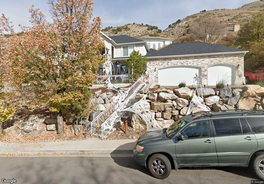
4352 Imperial Way Provo, UT 84604
Rock Canyon NeighborhoodEstimated Value: $886,000 - $1,234,000
7
Beds
4
Baths
4,685
Sq Ft
$225/Sq Ft
Est. Value
About This Home
This home is located at 4352 Imperial Way, Provo, UT 84604 and is currently estimated at $1,052,443, approximately $224 per square foot. 4352 Imperial Way is a home located in Utah County with nearby schools including Canyon Crest Elementary School, Centennial Middle School, and Timpview High School.
Ownership History
Date
Name
Owned For
Owner Type
Purchase Details
Closed on
Oct 29, 2024
Sold by
Hecs Properties Llc
Bought by
Keystone Surveys Inc
Current Estimated Value
Purchase Details
Closed on
Dec 2, 2019
Sold by
Hemsley Aaron A and Hemsley Karen M
Bought by
Branson Jason Edward and Branson Brittany Lynn
Home Financials for this Owner
Home Financials are based on the most recent Mortgage that was taken out on this home.
Original Mortgage
$395,000
Interest Rate
3.6%
Mortgage Type
New Conventional
Purchase Details
Closed on
Oct 2, 2008
Sold by
Magnusson Sharon and Hemsley Aaron
Bought by
Hemsley Aaron A and Hemsley Karen M
Purchase Details
Closed on
Jul 24, 2008
Sold by
Exon Wesley and Mortgage Electronic Registrati
Bought by
Magnusson Sharon and Hensley Aaron
Purchase Details
Closed on
Dec 28, 2006
Sold by
Hullinger Lola Alice
Bought by
Exon Wesley
Home Financials for this Owner
Home Financials are based on the most recent Mortgage that was taken out on this home.
Original Mortgage
$520,000
Interest Rate
8%
Mortgage Type
Purchase Money Mortgage
Purchase Details
Closed on
Dec 9, 2004
Sold by
Brost Glen D
Bought by
Hullinger Lola Alice
Home Financials for this Owner
Home Financials are based on the most recent Mortgage that was taken out on this home.
Original Mortgage
$324,000
Interest Rate
6.62%
Mortgage Type
New Conventional
Purchase Details
Closed on
Aug 26, 2004
Sold by
Washington Mutual Bank Fa
Bought by
Borst Glen D
Home Financials for this Owner
Home Financials are based on the most recent Mortgage that was taken out on this home.
Original Mortgage
$355,950
Interest Rate
9.35%
Mortgage Type
Purchase Money Mortgage
Purchase Details
Closed on
May 18, 2004
Sold by
Hansen Theodore L and Hansen Kara R
Bought by
Washington Mutual Bank Fa
Purchase Details
Closed on
Feb 25, 1998
Sold by
Riverside Llc
Bought by
Pleasant River Llc
Purchase Details
Closed on
Feb 11, 1998
Sold by
Brandow Retta Marie
Bought by
Riverside Llc
Purchase Details
Closed on
Nov 10, 1997
Sold by
Paez Jose R and Paez Alexis N
Bought by
Hansen Theodore L and Hansen Kara R
Home Financials for this Owner
Home Financials are based on the most recent Mortgage that was taken out on this home.
Original Mortgage
$420,000
Interest Rate
7.3%
Purchase Details
Closed on
Apr 16, 1996
Sold by
Hansen Theodore L and Hansen Kara R
Bought by
Hansen Theodore L and Hansen Kara R
Create a Home Valuation Report for This Property
The Home Valuation Report is an in-depth analysis detailing your home's value as well as a comparison with similar homes in the area
Home Values in the Area
Average Home Value in this Area
Purchase History
| Date | Buyer | Sale Price | Title Company |
|---|---|---|---|
| Keystone Surveys Inc | -- | None Listed On Document | |
| Branson Jason Edward | -- | Northern Title Company | |
| Hemsley Aaron A | -- | None Available | |
| Magnusson Sharon | $413,242 | None Available | |
| Exon Wesley | -- | Independence Title | |
| Hullinger Lola Alice | -- | 1St National Title Insuranc | |
| Borst Glen D | -- | First Southwestern Title Ag | |
| Washington Mutual Bank Fa | $345,000 | First Southwestern Title Ag | |
| Pleasant River Llc | -- | -- | |
| Riverside Llc | -- | First American Title | |
| Hansen Theodore L | -- | -- | |
| Hansen Theodore L | -- | Empire Land Title Inc |
Source: Public Records
Mortgage History
| Date | Status | Borrower | Loan Amount |
|---|---|---|---|
| Previous Owner | Branson Jason Edward | $395,000 | |
| Previous Owner | Exon Wesley | $520,000 | |
| Previous Owner | Hullinger Lola Alice | $324,000 | |
| Previous Owner | Borst Glen D | $355,950 | |
| Previous Owner | Hansen Theodore L | $420,000 | |
| Closed | Hullinger Lola Alice | $81,000 |
Source: Public Records
Tax History
| Year | Tax Paid | Tax Assessment Tax Assessment Total Assessment is a certain percentage of the fair market value that is determined by local assessors to be the total taxable value of land and additions on the property. | Land | Improvement |
|---|---|---|---|---|
| 2025 | $4,419 | $451,165 | -- | -- |
| 2024 | $4,419 | $434,995 | $0 | $0 |
| 2023 | $4,454 | $432,245 | $0 | $0 |
| 2022 | $5,056 | $494,670 | $0 | $0 |
| 2021 | $4,081 | $696,400 | $177,800 | $518,600 |
| 2020 | $4,104 | $656,600 | $148,200 | $508,400 |
| 2019 | $3,461 | $575,900 | $148,200 | $427,700 |
| 2018 | $242 | $563,000 | $148,200 | $414,800 |
| 2017 | $3,094 | $286,880 | $0 | $0 |
| 2016 | $3,319 | $286,880 | $0 | $0 |
| 2015 | $3,263 | $285,010 | $0 | $0 |
| 2014 | $2,866 | $260,975 | $0 | $0 |
Source: Public Records
Map
Nearby Homes
- 4277 N Imperial Way Unit 347
- 4529 Windsor Dr
- 4299 Ivy Ln
- 981 Waterford Dr Unit 5&6
- 4612 N Bristol Cir
- 1085 Windsor Dr
- 4006 Sherwood Dr
- 4606 Brookshire Cir
- 4640 Brookshire Cir
- 4601 Foothill Dr
- 3702 N 920 E
- 645 Foothill Dr
- 285 Three Fountains Dr
- 299 E 4000 N
- 3250 Mohawk Ln
- 3711 N Canyon Rd
- 221 E 4735 N
- 3129 Cherokee Ln
- 5600 N Canyon Rd
- 3043 Bannock Dr
- 4353 Mile High Dr
- 4374 Imperial Way
- 4334 Imperial Way
- 4374 N Imperial Way
- 4335 Mile High Dr
- 4355 Imperial Way
- 4379 Mile High Dr
- 4335 Imperial Way
- 4375 Imperial Way
- 4392 N Imperial Way Unit 361
- 4322 Imperial Way
- 4323 Mile High Dr
- 4323 Imperial Way
- 4395 N Imperial Way Unit 354
- 4395 N Imperial Way
- 4384 Mile High Dr
- 4395 Imperial Way
- 4304 Imperial Way
- 4328 Mile High Dr
- 4358 Churchill Dr
Your Personal Tour Guide
Ask me questions while you tour the home.