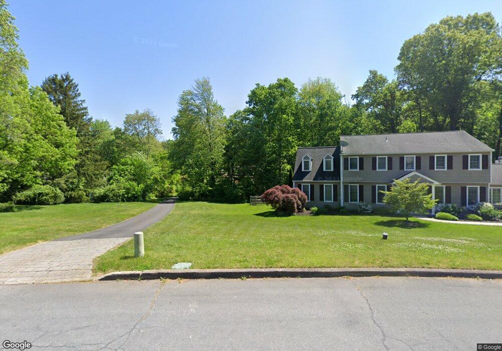
4359 Angus Cir Doylestown, PA 18902
Estimated Value: $699,000 - $920,000
4
Beds
3
Baths
3,045
Sq Ft
$267/Sq Ft
Est. Value
About This Home
This home is located at 4359 Angus Cir, Doylestown, PA 18902 and is currently estimated at $814,241, approximately $267 per square foot. 4359 Angus Cir is a home located in Bucks County with nearby schools including Buckingham Elementary School, Holicong Middle School, and Central Bucks High School - East.
Ownership History
Date
Name
Owned For
Owner Type
Purchase Details
Closed on
Dec 23, 1999
Sold by
Phinney Gary and Phinney Diana
Bought by
Kells David E and Kells Deirdre A
Current Estimated Value
Home Financials for this Owner
Home Financials are based on the most recent Mortgage that was taken out on this home.
Original Mortgage
$154,400
Outstanding Balance
$47,022
Interest Rate
7.5%
Estimated Equity
$767,219
Purchase Details
Closed on
Nov 8, 1999
Sold by
Farrington Carl C and Farrington Joan M
Bought by
Phinney Gary and Phinney Diana
Home Financials for this Owner
Home Financials are based on the most recent Mortgage that was taken out on this home.
Original Mortgage
$154,400
Outstanding Balance
$47,022
Interest Rate
7.5%
Estimated Equity
$767,219
Create a Home Valuation Report for This Property
The Home Valuation Report is an in-depth analysis detailing your home's value as well as a comparison with similar homes in the area
Home Values in the Area
Average Home Value in this Area
Purchase History
| Date | Buyer | Sale Price | Title Company |
|---|---|---|---|
| Kells David E | $193,000 | -- | |
| Phinney Gary | $170,000 | -- |
Source: Public Records
Mortgage History
| Date | Status | Borrower | Loan Amount |
|---|---|---|---|
| Open | Kells David E | $154,400 |
Source: Public Records
Tax History Compared to Growth
Tax History
| Year | Tax Paid | Tax Assessment Tax Assessment Total Assessment is a certain percentage of the fair market value that is determined by local assessors to be the total taxable value of land and additions on the property. | Land | Improvement |
|---|---|---|---|---|
| 2025 | $9,542 | $58,610 | $10,450 | $48,160 |
| 2024 | $9,542 | $58,610 | $10,450 | $48,160 |
| 2023 | $9,219 | $58,610 | $10,450 | $48,160 |
| 2022 | $9,109 | $58,610 | $10,450 | $48,160 |
| 2021 | $9,000 | $58,610 | $10,450 | $48,160 |
| 2020 | $9,000 | $58,610 | $10,450 | $48,160 |
| 2019 | $8,941 | $58,610 | $10,450 | $48,160 |
| 2018 | $8,941 | $58,610 | $10,450 | $48,160 |
| 2017 | $8,868 | $58,610 | $10,450 | $48,160 |
| 2016 | $8,956 | $58,610 | $10,450 | $48,160 |
| 2015 | -- | $58,610 | $10,450 | $48,160 |
| 2014 | -- | $58,610 | $10,450 | $48,160 |
Source: Public Records
Map
Nearby Homes
- 2728 Red Gate Dr
- 2799 Manion Way
- 4604 Sands Way
- 2880 Snake Hill Rd
- 2565 Bogarts Tavern Rd
- 2479 Wheatfield Ln
- 4350 Church Rd
- 3889 Robin Rd
- lot #3 next to 3739 York Rd
- 3146 Mill Rd
- 3111 Burnt House Hill Rd
- 3772 Powder Horn Dr
- 3196 Mill Rd
- 4245 Mechanicsville Rd
- 5025 Anderson Rd
- 3657 Powder Horn Dr
- 1908 Durham Rd
- 3015 Yorkshire Rd
- 3775 Buckingham Dr
- 4871 E Blossom Dr
- 4340 Sunnyside Dr
- 4365 Angus Cir
- 4355 Angus Cir
- 4356 Sunnyside Dr
- 4362 York Rd
- 4326 Sunnyside Dr
- 4352 Old York Rd
- 4336 Old York Rd
- 4371 Angus Cir
- 4370 Sunnyside Dr
- 4362 Old York Rd
- 4343 Angus Cir
- 4314 Sunnyside Dr
- 4356 Angus Cir
- 4376 Old York Rd
- 4382 Sunnyside Dr
- 4389 Angus Cir
- 2538 Red Gate Dr
- 4308 Sunnyside Dr
- 4327 Angus Cir