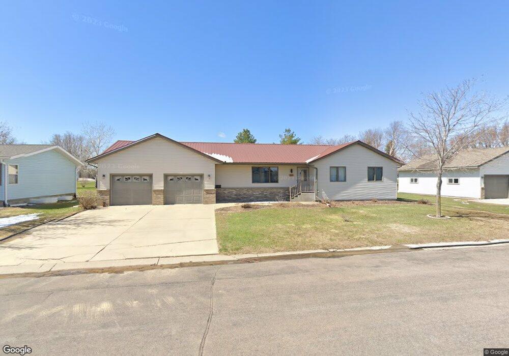
436 7thh Ave S Brownton, MN 55312
Estimated Value: $256,000 - $279,535
3
Beds
3
Baths
3,124
Sq Ft
$85/Sq Ft
Est. Value
About This Home
This home is located at 436 7thh Ave S, Brownton, MN 55312 and is currently estimated at $266,634, approximately $85 per square foot. 436 7thh Ave S is a home located in McLeod County with nearby schools including Lincoln Elementary School, Lakeside Elementary School, and Glencoe-Silver Lake Jr. High School.
Ownership History
Date
Name
Owned For
Owner Type
Purchase Details
Closed on
May 31, 2019
Sold by
Schuette Audrey D
Bought by
Borchardt Camille M and Sanchez Joshua
Current Estimated Value
Home Financials for this Owner
Home Financials are based on the most recent Mortgage that was taken out on this home.
Original Mortgage
$154,755
Outstanding Balance
$136,341
Interest Rate
4.2%
Mortgage Type
New Conventional
Estimated Equity
$130,293
Create a Home Valuation Report for This Property
The Home Valuation Report is an in-depth analysis detailing your home's value as well as a comparison with similar homes in the area
Home Values in the Area
Average Home Value in this Area
Purchase History
| Date | Buyer | Sale Price | Title Company |
|---|---|---|---|
| Borchardt Camille M | $162,900 | Mcleod County Abstract & Tit |
Source: Public Records
Mortgage History
| Date | Status | Borrower | Loan Amount |
|---|---|---|---|
| Open | Borchardt Camille M | $154,755 |
Source: Public Records
Tax History Compared to Growth
Tax History
| Year | Tax Paid | Tax Assessment Tax Assessment Total Assessment is a certain percentage of the fair market value that is determined by local assessors to be the total taxable value of land and additions on the property. | Land | Improvement |
|---|---|---|---|---|
| 2024 | $4,416 | $238,500 | $34,500 | $204,000 |
| 2023 | $4,092 | $238,500 | $34,500 | $204,000 |
| 2022 | $3,544 | $201,200 | $30,000 | $171,200 |
| 2021 | $3,610 | $172,300 | $26,100 | $146,200 |
| 2020 | $3,636 | $172,300 | $26,100 | $146,200 |
| 2019 | $3,010 | $156,200 | $23,700 | $132,500 |
| 2018 | $3,382 | $0 | $0 | $0 |
| 2017 | $2,846 | $0 | $0 | $0 |
| 2016 | $2,672 | $0 | $0 | $0 |
| 2015 | $2,436 | $0 | $0 | $0 |
| 2014 | -- | $0 | $0 | $0 |
Source: Public Records
Map
Nearby Homes
- 356 6th Ave S
- Lot 2 U S Highway 212
- 531 2nd St N
- 123 2nd Ave S
- 122 2nd Ave S
- xxx Lot 3 Division St W
- 304 1st Ave N
- 237 5th St N
- XXX Us Hwy 212
- 10877 Highway 15
- 19282 108th St
- 11655 Sunset Cir
- 11742 Sunset Cir
- 7900 Lace Ave N
- 7900 Lace Ave
- Lot 2 Tagus Ave
- 631 Mowbray St
- 1199 E 2nd St
- 15092 Highway 15 S
- 22447 150th St