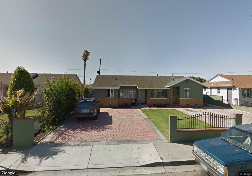
436 E Guava St Oxnard, CA 93033
Cal-Gisler NeighborhoodEstimated Value: $664,898 - $858,000
Studio
--
Bath
1,528
Sq Ft
$499/Sq Ft
Est. Value
About This Home
This home is located at 436 E Guava St, Oxnard, CA 93033 and is currently estimated at $763,225, approximately $499 per square foot. 436 E Guava St is a home located in Ventura County with nearby schools including Harrington Elementary School, R.J. Frank Academy of Marine Science & Engineering, and Santa Clara High School.
Ownership History
Date
Name
Owned For
Owner Type
Purchase Details
Closed on
Feb 6, 2003
Sold by
Rodriguez Jose A and Rodriguez Gloria
Bought by
Rodriguez Jose G and Rodriguez Virginia M
Current Estimated Value
Home Financials for this Owner
Home Financials are based on the most recent Mortgage that was taken out on this home.
Original Mortgage
$151,000
Interest Rate
5.76%
Create a Home Valuation Report for This Property
The Home Valuation Report is an in-depth analysis detailing your home's value as well as a comparison with similar homes in the area
Home Values in the Area
Average Home Value in this Area
Purchase History
| Date | Buyer | Sale Price | Title Company |
|---|---|---|---|
| Rodriguez Jose G | $75,500 | Stewart Title Company |
Source: Public Records
Mortgage History
| Date | Status | Borrower | Loan Amount |
|---|---|---|---|
| Closed | Rodriguez Jose G | $151,000 |
Source: Public Records
Tax History
| Year | Tax Paid | Tax Assessment Tax Assessment Total Assessment is a certain percentage of the fair market value that is determined by local assessors to be the total taxable value of land and additions on the property. | Land | Improvement |
|---|---|---|---|---|
| 2025 | $2,303 | $186,407 | $82,842 | $103,565 |
| 2024 | $2,303 | $182,752 | $81,217 | $101,535 |
| 2023 | $2,220 | $179,169 | $79,624 | $99,545 |
| 2022 | $2,154 | $175,656 | $78,062 | $97,594 |
| 2021 | $2,137 | $172,212 | $76,531 | $95,681 |
| 2020 | $2,176 | $170,448 | $75,748 | $94,700 |
| 2019 | $2,116 | $167,107 | $74,263 | $92,844 |
| 2018 | $2,087 | $163,831 | $72,807 | $91,024 |
| 2017 | $1,982 | $160,620 | $71,380 | $89,240 |
| 2016 | $1,914 | $157,472 | $69,981 | $87,491 |
| 2015 | $1,934 | $155,109 | $68,931 | $86,178 |
| 2014 | $1,914 | $152,073 | $67,582 | $84,491 |
Source: Public Records
Map
Nearby Homes
- 225 W Iris St
- 3130 Paula St
- 3151 Fournier St
- 1239 S C St
- 2024 S J St
- 1127 S C St
- 2151 E Wooley Rd
- 865 S B St Unit Q1
- 819 S B St Unit 34
- 3631 La Costa Place
- 1928 San Benito St
- 633 Meta St
- 860 Morro Way
- 3638 S B St
- 360 Ibsen Place Unit 129
- 1030 Ilena St
- 140 Gaviota Place Unit 157
- 4160 Petit Dr Unit 39
- 1140 Teakwood St
- 1431 Casa San Carlos Ln Unit B
- 426 E Guava St
- 450 E Guava St
- 1941 Gisler Ave
- 416 E Guava St
- 414 E Guava St Unit 2
- 414 E Guava St
- 425 E Hemlock St
- 435 E Guava St
- 433 E Guava St
- 445 E Guava St
- 513 E Hemlock St
- 425 E Guava St
- 415 E Hemlock St
- 453 E Guava St
- 404 E Guava St
- 415 E Guava St
- 525 E Hemlock St
- 1904 Gisler Ave
- 463 E Guava St
- 405 E Hemlock St
Your Personal Tour Guide
Ask me questions while you tour the home.