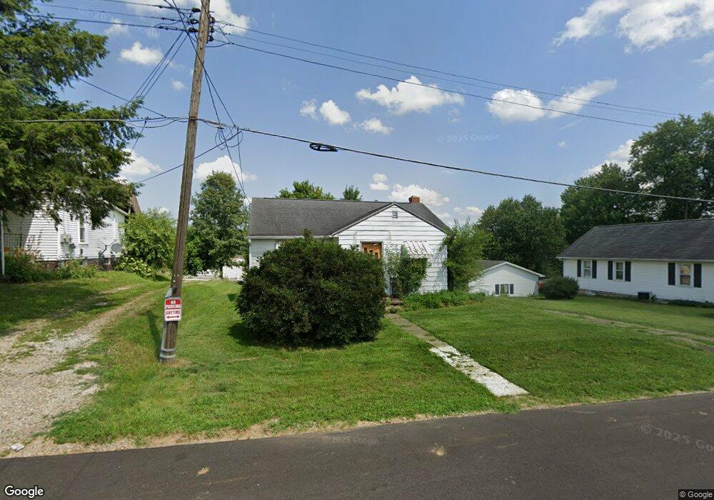
436 N Adams St Loudonville, OH 44842
Estimated Value: $126,000 - $163,000
2
Beds
1
Bath
912
Sq Ft
$150/Sq Ft
Est. Value
About This Home
This home is located at 436 N Adams St, Loudonville, OH 44842 and is currently estimated at $137,053, approximately $150 per square foot. 436 N Adams St is a home located in Ashland County with nearby schools including McMullen Elementary School, Budd Elementary School, and Loudonville High School.
Ownership History
Date
Name
Owned For
Owner Type
Purchase Details
Closed on
Sep 2, 2011
Sold by
Switzer Donivan K Living Trust
Bought by
Sprang Randy L and Sprang Shannon L
Current Estimated Value
Home Financials for this Owner
Home Financials are based on the most recent Mortgage that was taken out on this home.
Original Mortgage
$26,000
Outstanding Balance
$10,409
Interest Rate
4.58%
Mortgage Type
New Conventional
Estimated Equity
$126,644
Purchase Details
Closed on
Feb 7, 1996
Sold by
Speaks William S
Bought by
Switzer Ii Donivan K
Purchase Details
Closed on
Jul 25, 1988
Bought by
Speaks William S
Create a Home Valuation Report for This Property
The Home Valuation Report is an in-depth analysis detailing your home's value as well as a comparison with similar homes in the area
Home Values in the Area
Average Home Value in this Area
Purchase History
| Date | Buyer | Sale Price | Title Company |
|---|---|---|---|
| Sprang Randy L | $32,500 | -- | |
| Switzer Ii Donivan K | $46,600 | -- | |
| Speaks William S | $39,500 | -- |
Source: Public Records
Mortgage History
| Date | Status | Borrower | Loan Amount |
|---|---|---|---|
| Open | Sprang Randy L | $26,000 |
Source: Public Records
Tax History Compared to Growth
Tax History
| Year | Tax Paid | Tax Assessment Tax Assessment Total Assessment is a certain percentage of the fair market value that is determined by local assessors to be the total taxable value of land and additions on the property. | Land | Improvement |
|---|---|---|---|---|
| 2024 | $1,104 | $27,670 | $7,290 | $20,380 |
| 2023 | $1,104 | $27,670 | $7,290 | $20,380 |
| 2022 | $870 | $19,090 | $5,030 | $14,060 |
| 2021 | $882 | $19,090 | $5,030 | $14,060 |
| 2020 | $833 | $19,090 | $5,030 | $14,060 |
| 2019 | $795 | $17,850 | $5,140 | $12,710 |
| 2018 | $800 | $17,850 | $5,140 | $12,710 |
| 2017 | $703 | $17,850 | $5,140 | $12,710 |
| 2016 | $703 | $15,800 | $4,550 | $11,250 |
| 2015 | $699 | $15,800 | $4,550 | $11,250 |
| 2013 | $781 | $17,620 | $4,630 | $12,990 |
Source: Public Records
Map
Nearby Homes
- 333 E Campbell St
- 316 E Campbell St
- 526 E Campbell St
- 524 N Union St
- 518 Snyder Dr
- 500 Stone Meadow Cir
- 723 Pearl Dr
- 2818 Township Road 2812
- 1406 Pearl Dr
- 6620 Township Road 451
- 6913 County Road 22
- 0 County Road 917
- 14602 Township Road 469
- 3317 Township Road 539
- 136 Bridge St
- 14355 Township Road 467
- 609 Ohio 95
- 7129 Township Road 466
- 560 Township Road 2402
- 440 N Adams St
- 434 N Adams St
- 442 N Adams St
- 416 N Adams St
- 425 N Adams St
- 423 N Adams St
- 433 N Adams St
- 334 E Campbell St
- 404 N Adams St
- 417 N Jefferson St
- 415 N Adams St
- 339 E Campbell St
- 415 E Campbell St
- 323 Highland Ct
- 421 E Haskell St
- 409 N Adams St
- 326 E Campbell St
- 403 N Adams St
- 429 E Campbell St
- 329 E Campbell St