Estimated Value: $227,090 - $271,000
4
Beds
2
Baths
1,998
Sq Ft
$123/Sq Ft
Est. Value
About This Home
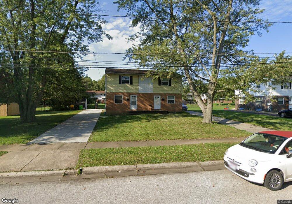
This home is located at 4362 Elmhurst Dr Unit 4366, Stow, OH 44224 and is currently estimated at $244,773, approximately $122 per square foot. 4362 Elmhurst Dr Unit 4366 is a home located in Summit County with nearby schools including Stow-Munroe Falls High School, Holy Family Elementary School, and Walsh Jesuit High School.
Ownership History
Date
Name
Owned For
Owner Type
Purchase Details
Closed on
Jul 14, 2012
Sold by
Casto James L
Bought by
4371-4375 Elmhurst Ltd
Current Estimated Value
Home Financials for this Owner
Home Financials are based on the most recent Mortgage that was taken out on this home.
Original Mortgage
$60,213
Outstanding Balance
$41,760
Interest Rate
3.77%
Mortgage Type
New Conventional
Estimated Equity
$203,013
Purchase Details
Closed on
Sep 1, 2009
Sold by
Casto James L
Bought by
4371-4375 Elmhurst Ltd
Purchase Details
Closed on
Mar 31, 1998
Sold by
Joan Swierenger Trst
Bought by
Casto James L
Create a Home Valuation Report for This Property
The Home Valuation Report is an in-depth analysis detailing your home's value as well as a comparison with similar homes in the area
Home Values in the Area
Average Home Value in this Area
Purchase History
| Date | Buyer | Sale Price | Title Company |
|---|---|---|---|
| 4371-4375 Elmhurst Ltd | -- | None Available | |
| Casto James L | -- | None Available | |
| 4371-4375 Elmhurst Ltd | -- | Attorney | |
| Casto James L | $98,500 | -- |
Source: Public Records
Mortgage History
| Date | Status | Borrower | Loan Amount |
|---|---|---|---|
| Open | Casto James L | $60,213 |
Source: Public Records
Tax History Compared to Growth
Tax History
| Year | Tax Paid | Tax Assessment Tax Assessment Total Assessment is a certain percentage of the fair market value that is determined by local assessors to be the total taxable value of land and additions on the property. | Land | Improvement |
|---|---|---|---|---|
| 2025 | $3,465 | $55,889 | $14,165 | $41,724 |
| 2024 | $3,465 | $55,889 | $14,165 | $41,724 |
| 2023 | $3,465 | $55,889 | $14,165 | $41,724 |
| 2022 | $2,798 | $42,022 | $10,651 | $31,371 |
| 2021 | $2,517 | $42,022 | $10,651 | $31,371 |
| 2020 | $2,476 | $42,020 | $10,650 | $31,370 |
| 2019 | $2,640 | $42,000 | $10,650 | $31,350 |
| 2018 | $2,599 | $42,000 | $10,650 | $31,350 |
| 2017 | $2,608 | $42,000 | $10,650 | $31,350 |
| 2016 | $2,538 | $39,100 | $10,650 | $28,450 |
| 2015 | $2,608 | $39,100 | $10,650 | $28,450 |
| 2014 | $2,496 | $39,100 | $10,650 | $28,450 |
| 2013 | $2,849 | $44,630 | $10,650 | $33,980 |
Source: Public Records
Map
Nearby Homes
- 4556 Fishcreek Rd
- 4155 Burton Dr
- 4131 Burton Dr
- 4444 Hickory Trail
- 4445 Kenneth Trail
- 2260 E Gilwood Dr
- 2714 Wexford Blvd
- 4322 Lorwood Dr
- 4078 Pardee Rd
- 4638 Dresher Trail
- 2410 Wrens Dr S
- 4916 Friar Rd Unit B
- 4910 Independence Cir Unit D
- 0 Vira Rd
- 3961 Klein Ave
- 2831 Saybrooke Blvd
- 0 Stow Rd Unit 5102979
- 2908 Wexford Blvd
- 2055-2059 Bryn Mawr Dr
- 2140 Uniondale Dr
- 4372 Elmhurst Dr Unit 4376
- 4354 Elmhurst Dr Unit 4358
- 4354 4358 Elmhurst Dr
- 4358 Elmhurst Dr
- 4376 Elmhurst Dr
- 4381 N Norman Dr Unit 4385
- 4373 N Norman Dr Unit 4377
- 4381 4385 N Norman Dr
- 4385 N Norman Dr
- 4389 N Norman Dr Unit 4393
- 4380 Elmhurst Dr Unit 4384
- 4344 Elmhurst Dr
- 4389 N Norman Dr
- 4363 Elmhurst Dr Unit 4367
- 4365 N Norman Dr Unit 4369
- 4393 N Norman Dr
- 4355 Elmhurst Dr Unit 4359
- 4371 Elmhurst Dr Unit 4375
- 4397 N Norman Dr Unit 4401
- 4338 Elmhurst Dr