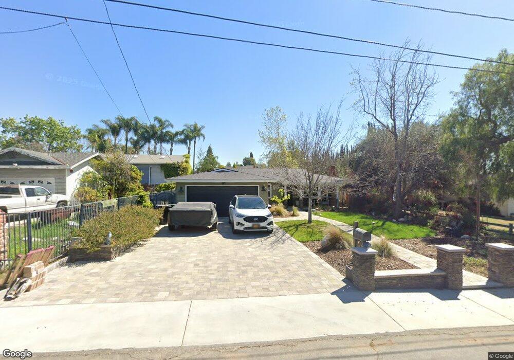
4362 Osmond St Yorba Linda, CA 92886
Estimated Value: $951,927 - $1,115,000
3
Beds
2
Baths
1,354
Sq Ft
$771/Sq Ft
Est. Value
About This Home
This home is located at 4362 Osmond St, Yorba Linda, CA 92886 and is currently estimated at $1,043,482, approximately $770 per square foot. 4362 Osmond St is a home located in Orange County with nearby schools including Rose Drive Elementary, Yorba Linda Middle School, and El Dorado High School.
Ownership History
Date
Name
Owned For
Owner Type
Purchase Details
Closed on
Aug 6, 1997
Sold by
Miller Robert E and Pearl Lenore Pearl
Bought by
Pokorny Michael E and Pokorny Mary K
Current Estimated Value
Home Financials for this Owner
Home Financials are based on the most recent Mortgage that was taken out on this home.
Original Mortgage
$191,250
Interest Rate
7.3%
Mortgage Type
VA
Create a Home Valuation Report for This Property
The Home Valuation Report is an in-depth analysis detailing your home's value as well as a comparison with similar homes in the area
Home Values in the Area
Average Home Value in this Area
Purchase History
| Date | Buyer | Sale Price | Title Company |
|---|---|---|---|
| Pokorny Michael E | $187,500 | First American Title Ins Co |
Source: Public Records
Mortgage History
| Date | Status | Borrower | Loan Amount |
|---|---|---|---|
| Previous Owner | Pokorny Michael E | $191,250 |
Source: Public Records
Tax History Compared to Growth
Tax History
| Year | Tax Paid | Tax Assessment Tax Assessment Total Assessment is a certain percentage of the fair market value that is determined by local assessors to be the total taxable value of land and additions on the property. | Land | Improvement |
|---|---|---|---|---|
| 2025 | $3,724 | $299,381 | $159,678 | $139,703 |
| 2024 | $3,724 | $293,511 | $156,547 | $136,964 |
| 2023 | $3,648 | $287,756 | $153,477 | $134,279 |
| 2022 | $3,602 | $282,114 | $150,467 | $131,647 |
| 2021 | $3,533 | $276,583 | $147,517 | $129,066 |
| 2020 | $3,426 | $273,747 | $146,004 | $127,743 |
| 2019 | $3,312 | $268,380 | $143,141 | $125,239 |
| 2018 | $3,271 | $263,118 | $140,334 | $122,784 |
| 2017 | $3,219 | $257,959 | $137,582 | $120,377 |
| 2016 | $3,156 | $252,901 | $134,884 | $118,017 |
| 2015 | $3,117 | $249,103 | $132,858 | $116,245 |
| 2014 | $3,027 | $244,224 | $130,256 | $113,968 |
Source: Public Records
Map
Nearby Homes
- 4215 Sand Rock Cir
- 11715 Rose Dr
- 4781 Kona Kove Way
- 4802 Brookway Ave
- 16942 Lake Park Way
- 16950 Lake Park Way Unit 7
- 16692 Meadowview Dr
- 3744 Lake Grove Dr Unit 21
- 16742 Lake Park Way
- 16959 Lake Knoll Ln Unit 109
- 3738 Lakeside Dr Unit 75
- 1429 Prospect Ave Unit B
- 3708 Lake Crest Dr
- 3699 Lake Grove Dr Unit 46
- 943 Berkenstock Ln
- 3731 Lake Side Dr
- 3761 Lake Glen Dr Unit 146
- 3678 Lake Crest Dr Unit 41
- 16735 Lake Knoll Ln Unit 195
- 16742 Lake Ridge Way Unit 154
- 4372 Osmond St
- 4342 Osmond St
- 4382 Osmond St
- 4251 Citrus Cir
- 4392 Osmond St
- 4257 Citrus Cir
- 4400 Osmond St
- 4459 La Serena Dr
- 4292 Osmond St
- 4235 Citrus Cir
- 4260 Citrus Cir
- 4461 La Serena Dr
- 4412 La Paz Cir
- 4421 La Paz Cir
- 4391 Casa Oro Dr
- 4250 Citrus Cir
- 4240 Citrus Cir
- 4282 Osmond St
- 4225 Citrus Cir
- 4441 La Paz Cir