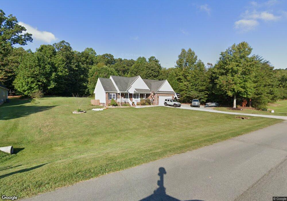
4363 Dusty Ridge Ct Denver, NC 28037
Estimated Value: $406,058 - $432,000
3
Beds
2
Baths
1,588
Sq Ft
$265/Sq Ft
Est. Value
About This Home
This home is located at 4363 Dusty Ridge Ct, Denver, NC 28037 and is currently estimated at $420,765, approximately $264 per square foot. 4363 Dusty Ridge Ct is a home located in Lincoln County with nearby schools including Rock Springs Elementary School, North Lincoln Middle School, and North Lincoln High School.
Ownership History
Date
Name
Owned For
Owner Type
Purchase Details
Closed on
Nov 19, 2015
Sold by
Cobb Eric L and Cobb Jennifer
Bought by
Parrish Sharyn Ann and Parrish Christopher Glenn
Current Estimated Value
Home Financials for this Owner
Home Financials are based on the most recent Mortgage that was taken out on this home.
Original Mortgage
$202,350
Outstanding Balance
$159,104
Interest Rate
3.78%
Mortgage Type
New Conventional
Estimated Equity
$261,661
Purchase Details
Closed on
May 24, 2007
Sold by
Pope Construnction Inc
Bought by
Cobb Eric L and Cobb Jennifer
Home Financials for this Owner
Home Financials are based on the most recent Mortgage that was taken out on this home.
Original Mortgage
$190,000
Interest Rate
6.1%
Mortgage Type
New Conventional
Purchase Details
Closed on
Dec 4, 2006
Sold by
Primestar Properties Inc
Bought by
Pope Construction Inc
Create a Home Valuation Report for This Property
The Home Valuation Report is an in-depth analysis detailing your home's value as well as a comparison with similar homes in the area
Home Values in the Area
Average Home Value in this Area
Purchase History
| Date | Buyer | Sale Price | Title Company |
|---|---|---|---|
| Parrish Sharyn Ann | $213,000 | None Available | |
| Cobb Eric L | $200,000 | None Available | |
| Pope Construction Inc | $28,000 | None Available |
Source: Public Records
Mortgage History
| Date | Status | Borrower | Loan Amount |
|---|---|---|---|
| Open | Parrish Sharyn Ann | $202,350 | |
| Previous Owner | Cobb Eric L | $190,000 |
Source: Public Records
Tax History Compared to Growth
Tax History
| Year | Tax Paid | Tax Assessment Tax Assessment Total Assessment is a certain percentage of the fair market value that is determined by local assessors to be the total taxable value of land and additions on the property. | Land | Improvement |
|---|---|---|---|---|
| 2025 | $2,313 | $359,154 | $50,000 | $309,154 |
| 2024 | $2,286 | $359,154 | $50,000 | $309,154 |
| 2023 | $2,281 | $359,154 | $50,000 | $309,154 |
| 2022 | $1,657 | $208,091 | $28,000 | $180,091 |
| 2021 | $1,642 | $208,091 | $28,000 | $180,091 |
| 2020 | $1,486 | $208,091 | $28,000 | $180,091 |
| 2019 | $1,486 | $208,091 | $28,000 | $180,091 |
| 2018 | $1,388 | $177,212 | $26,000 | $151,212 |
| 2017 | $1,287 | $177,212 | $26,000 | $151,212 |
| 2016 | $1,282 | $177,212 | $26,000 | $151,212 |
| 2015 | $1,342 | $177,212 | $26,000 | $151,212 |
| 2014 | $1,326 | $175,651 | $32,000 | $143,651 |
Source: Public Records
Map
Nearby Homes
- 4351 Dusty Ridge Ct
- 5333 Pembrey Dr
- 6264 Burnhurst Ln
- 5351 Pembrey Dr
- Charleston Plan at Rock Creek
- 5916 Burnhurst Ln
- 4237 Island Fox Ln
- 5129 Devonshire Rd
- 4243 Island Fox Ln
- 5169 Devonshire Rd
- 4612 Buoy Ln
- Bridgeport Plan at Cobblestone
- Townsend Plan at Cobblestone
- 6782 Kingfisher Ct
- 6997 Cobblefield Ln
- 7142 Forest Hills Dr
- 4315 Palm Dr
- 5019 Mundy Ln
- 3227 Cape Fox Ct
- 19.9 +/- Acres Nc Hwy 16 Business Hwy
- 4375 Dusty Ridge Ct
- LOT 14 Dusty Ridge Ct Unit 14
- LOT36 Fly A Way Dr Unit LOT36
- LT2728 Fly A Way Dr
- L27-28 Fly A Way Dr
- 4395 Dusty Ridge Ct
- 4319 Dusty Ridge Ct
- LOT37 Fly A Way Dr Unit LOT37
- Lot19 Fly A Way Dr Unit LOT19
- LOT 37 Fly A Way Dr Unit LOT 37
- 4309 Dusty Ridge Ct
- 6488 Fly A Way Dr
- 4290 Catawba Burris Rd
- 6463 Ameba Ln
- 6451 Ameba Ln
- 6451 Ameba Ln Unit 8
- 6479 Ameba Ln
- LOT 36 Fly A Way Dr Unit LOT 36
- LOT 7 Ameba Ln
- LOT 19 Fly A Way Dr Unit LOT 19