Estimated Value: $196,000 - $230,053
3
Beds
2
Baths
1,144
Sq Ft
$190/Sq Ft
Est. Value
About This Home
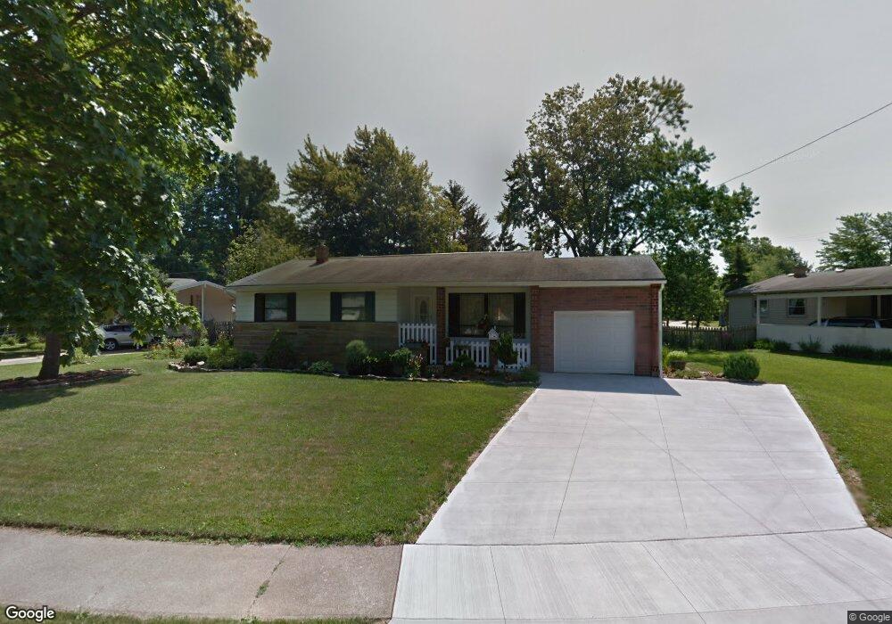
This home is located at 4363 Maplepark Rd, Stow, OH 44224 and is currently estimated at $217,013, approximately $189 per square foot. 4363 Maplepark Rd is a home located in Summit County with nearby schools including Stow-Munroe Falls High School, Holy Family Elementary School, and Walsh Jesuit High School.
Ownership History
Date
Name
Owned For
Owner Type
Purchase Details
Closed on
Jun 23, 2005
Sold by
Kibler Louise C
Bought by
Kupusovic Relja and Kupusovic Biljana
Current Estimated Value
Home Financials for this Owner
Home Financials are based on the most recent Mortgage that was taken out on this home.
Original Mortgage
$118,146
Interest Rate
5.87%
Mortgage Type
FHA
Create a Home Valuation Report for This Property
The Home Valuation Report is an in-depth analysis detailing your home's value as well as a comparison with similar homes in the area
Home Values in the Area
Average Home Value in this Area
Purchase History
| Date | Buyer | Sale Price | Title Company |
|---|---|---|---|
| Kupusovic Relja | $120,000 | Progressive Land Title |
Source: Public Records
Mortgage History
| Date | Status | Borrower | Loan Amount |
|---|---|---|---|
| Closed | Kupusovic Relja | $118,146 |
Source: Public Records
Tax History
| Year | Tax Paid | Tax Assessment Tax Assessment Total Assessment is a certain percentage of the fair market value that is determined by local assessors to be the total taxable value of land and additions on the property. | Land | Improvement |
|---|---|---|---|---|
| 2024 | $3,605 | $62,752 | $12,649 | $50,103 |
| 2023 | $3,605 | $62,752 | $12,649 | $50,103 |
| 2022 | $3,084 | $47,184 | $9,513 | $37,671 |
| 2021 | $2,769 | $47,184 | $9,513 | $37,671 |
| 2020 | $2,722 | $47,180 | $9,510 | $37,670 |
| 2019 | $2,469 | $39,830 | $9,110 | $30,720 |
| 2018 | $2,430 | $39,830 | $9,110 | $30,720 |
| 2017 | $2,325 | $39,830 | $9,110 | $30,720 |
| 2016 | $2,361 | $36,980 | $9,110 | $27,870 |
| 2015 | $2,325 | $36,980 | $9,110 | $27,870 |
| 2014 | $2,328 | $36,980 | $9,110 | $27,870 |
| 2013 | $2,455 | $39,360 | $9,110 | $30,250 |
Source: Public Records
Map
Nearby Homes
- 4399-4403 Cherryhurst Dr
- 2365 Norman Dr
- 4556 Fishcreek Rd
- 4155 Burton Dr
- 2260 E Gilwood Dr
- 4138 Genevieve Blvd
- 4909 Fishcreek Rd
- 4638 Dresher Trail
- 4040 Burton Dr
- 4078 Pardee Rd
- 4916 Friar Rd Unit B
- 2066 King Dr
- 2072 White Oak Dr Unit 2076
- 2054 Maplewood Rd
- 4424 Timberdale Dr Unit 4428
- 2055-2059 Bryn Mawr Dr
- 3961 Klein Ave
- 4932 Friar Rd Unit A
- 0 Vira Rd
- 3861 Klein Ave
- 4377 Maplepark Rd
- 4443 N Norman Dr
- 4433 N Norman Dr
- 4429 N Norman Dr Unit 4433
- 4385 Maplepark Rd
- 4356 Maplepark Rd
- 4362 Maplepark Rd
- 4368 Maplepark Rd
- 4350 Maplepark Rd
- 4391 Maplepark Rd
- 2473 Maplehurst Dr Unit 2477
- 4440 N Norman Dr
- 4337 Maplepark Rd
- 4342 Maplepark Rd
- 4426 N Norman Dr Unit 4430
- 2483 Maplehurst Dr Unit 2487
- 4399 Maplepark Rd
- 4386 Maplepark Rd
- 4426 4430 N Norman Dr
- 4336 Maplepark Rd
Your Personal Tour Guide
Ask me questions while you tour the home.