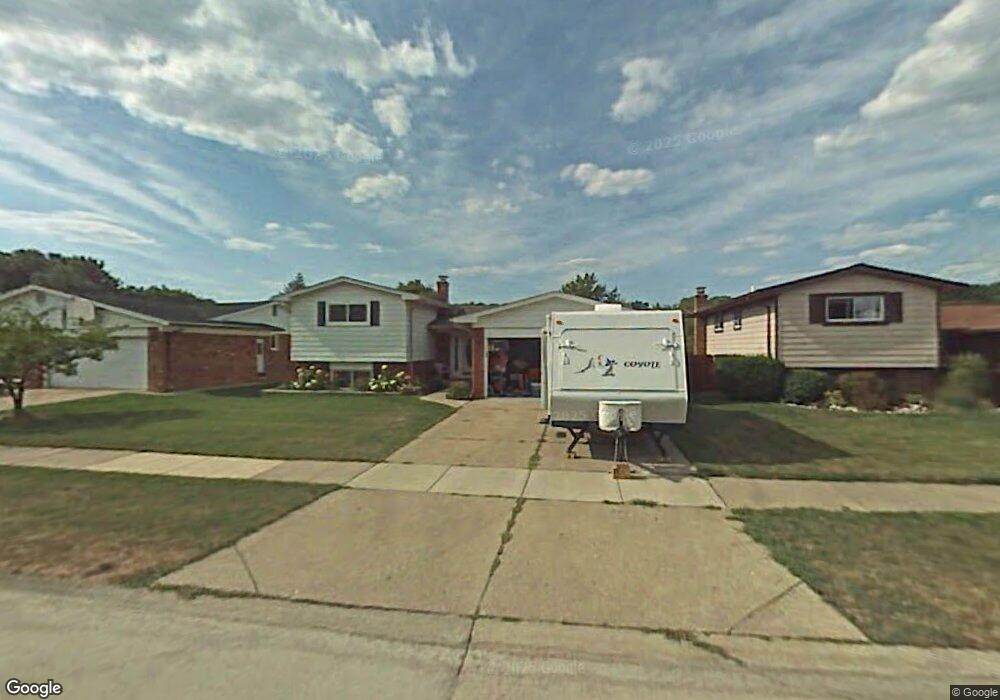
43634 Lombardy Dr Canton, MI 48187
Estimated Value: $378,628 - $440,000
4
Beds
2
Baths
1,826
Sq Ft
$222/Sq Ft
Est. Value
About This Home
This home is located at 43634 Lombardy Dr, Canton, MI 48187 and is currently estimated at $405,157, approximately $221 per square foot. 43634 Lombardy Dr is a home located in Wayne County with nearby schools including Canton High School, East Middle School, and Salem High School.
Ownership History
Date
Name
Owned For
Owner Type
Purchase Details
Closed on
Apr 14, 2009
Sold by
Wells Fargo Bank Na
Bought by
Federal National Mortgage Association
Current Estimated Value
Purchase Details
Closed on
Apr 8, 2009
Sold by
Baker Geoffrey Scott and Baker Susan Marie
Bought by
Wells Fargo Bank Na
Purchase Details
Closed on
Oct 10, 2001
Sold by
Roan John H
Bought by
Baker Geoffrey S
Create a Home Valuation Report for This Property
The Home Valuation Report is an in-depth analysis detailing your home's value as well as a comparison with similar homes in the area
Home Values in the Area
Average Home Value in this Area
Purchase History
| Date | Buyer | Sale Price | Title Company |
|---|---|---|---|
| Federal National Mortgage Association | -- | None Available | |
| Wells Fargo Bank Na | $188,557 | None Available | |
| Baker Geoffrey S | $202,000 | -- |
Source: Public Records
Tax History
| Year | Tax Paid | Tax Assessment Tax Assessment Total Assessment is a certain percentage of the fair market value that is determined by local assessors to be the total taxable value of land and additions on the property. | Land | Improvement |
|---|---|---|---|---|
| 2025 | $1,929 | $173,800 | $0 | $0 |
| 2024 | $1,874 | $161,200 | $0 | $0 |
| 2023 | $1,787 | $146,300 | $0 | $0 |
| 2022 | $4,017 | $133,900 | $0 | $0 |
| 2021 | $3,893 | $130,000 | $0 | $0 |
| 2020 | $3,836 | $129,600 | $0 | $0 |
| 2019 | $3,767 | $118,920 | $0 | $0 |
| 2018 | $1,519 | $116,950 | $0 | $0 |
| 2017 | $3,970 | $114,100 | $0 | $0 |
| 2016 | $3,456 | $111,600 | $0 | $0 |
| 2015 | $8,344 | $102,440 | $0 | $0 |
| 2013 | $8,083 | $84,350 | $0 | $0 |
| 2010 | -- | $83,210 | $35,596 | $47,614 |
Source: Public Records
Map
Nearby Homes
- 43086 Versailles Rd
- 43529 Oakbrook Rd
- 44432 Newburyport Dr
- 44570 Tillotson Dr
- 8830 Northern Ave
- 42542 Saratoga Rd Unit 26
- 8815 Marlowe Ave
- 6852 New Providence Way Unit 104
- 41950 Coventry Way Unit 135
- 8887 Morrison Ave
- 42090 Saratoga Cir Unit 53
- 0 Joy Rd Unit Parcel 3
- 0 Joy Rd Unit Parcel 2
- 0 Joy Rd Unit Parcel B
- 0 Joy Rd Unit Parcel A
- 9011 Elmhurst Ave
- 835 Coldrose Way
- 44805 Joy Rd
- 9048 Brookline Ave
- 9021 Elmhurst Ave
- 43646 Lombardy Dr
- 43622 Lombardy Dr
- 43658 Lombardy Dr
- 43608 Lombardy Dr
- 43629 Lancaster Ct
- 43619 Lancaster Ct
- 43641 Lancaster Ct
- 43670 Lombardy Dr
- 43651 Lancaster Ct
- 43607 Lancaster Ct
- 43635 Lombardy Dr
- 43647 Lombardy Dr
- 43623 Lombardy Dr
- 43659 Lombardy Dr
- 43663 Lancaster Ct
- 43609 Lombardy Dr
- 43671 Lombardy Dr
- 7235 N Morton Taylor Rd
- 7239 N Morton Taylor Rd Unit 2
- 43673 Lancaster Ct
Your Personal Tour Guide
Ask me questions while you tour the home.