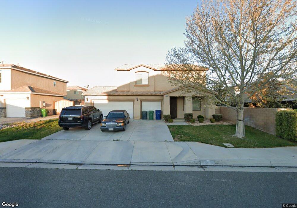
43653 57th St W Lancaster, CA 93536
West Lancaster NeighborhoodEstimated Value: $547,704 - $615,000
4
Beds
3
Baths
2,605
Sq Ft
$221/Sq Ft
Est. Value
About This Home
This home is located at 43653 57th St W, Lancaster, CA 93536 and is currently estimated at $575,426, approximately $220 per square foot. 43653 57th St W is a home located in Los Angeles County with nearby schools including Sundown Elementary School, Lancaster High School, and Fabunni Private School Inc..
Ownership History
Date
Name
Owned For
Owner Type
Purchase Details
Closed on
Sep 29, 2015
Sold by
Marable Martha Lillian
Bought by
The Martha Marable Living Trust
Current Estimated Value
Purchase Details
Closed on
Sep 22, 2005
Sold by
K Hovnanian Forecast Homes Inc
Bought by
Marable Martha Lillian
Home Financials for this Owner
Home Financials are based on the most recent Mortgage that was taken out on this home.
Original Mortgage
$111,450
Interest Rate
5.68%
Mortgage Type
Fannie Mae Freddie Mac
Create a Home Valuation Report for This Property
The Home Valuation Report is an in-depth analysis detailing your home's value as well as a comparison with similar homes in the area
Home Values in the Area
Average Home Value in this Area
Purchase History
| Date | Buyer | Sale Price | Title Company |
|---|---|---|---|
| The Martha Marable Living Trust | -- | None Available | |
| Marable Martha Lillian | $385,000 | Orange Coast Title Company |
Source: Public Records
Mortgage History
| Date | Status | Borrower | Loan Amount |
|---|---|---|---|
| Previous Owner | Marable Martha Lillian | $111,450 |
Source: Public Records
Tax History
| Year | Tax Paid | Tax Assessment Tax Assessment Total Assessment is a certain percentage of the fair market value that is determined by local assessors to be the total taxable value of land and additions on the property. | Land | Improvement |
|---|---|---|---|---|
| 2025 | $3,909 | $214,274 | $71,419 | $142,855 |
| 2024 | $3,909 | $210,073 | $70,019 | $140,054 |
| 2023 | $3,867 | $205,955 | $68,647 | $137,308 |
| 2022 | $3,774 | $201,917 | $67,301 | $134,616 |
| 2021 | $3,369 | $197,959 | $65,982 | $131,977 |
| 2019 | $3,289 | $192,089 | $64,026 | $128,063 |
| 2018 | $3,141 | $188,323 | $62,771 | $125,552 |
| 2016 | $2,972 | $181,013 | $60,335 | $120,678 |
| 2015 | $2,942 | $178,295 | $59,429 | $118,866 |
| 2014 | $2,935 | $174,803 | $58,265 | $116,538 |
Source: Public Records
Map
Nearby Homes
- 5659 W Avenue j15
- 0 St W Unit 26000550
- 0 W Avenue K Unit CV24074666
- 0 W Avenue K Unit SR25161579
- 5727 W Avenue K-2
- 5727 W Avenue k2
- 43637 59th St W
- 43830 Elena Ct
- 6147 W Avenue j15
- 0 Vac Cor Ave K4 85th
- 6135 W Avenue J 9
- 0 Vic Avenue 51st Stw K
- 6223 W Avenue j12
- 0 W Vic Avenue J6 58th St W Unit 25005682
- 43749 Tahoe Way
- 6059 Brentwood Ave
- 0 61st St W
- 44020 52nd St W
- 6048 Oak Fence Ln
- 60 W Avenue J-4
- 43647 57th St W
- 5722 W Avenue j14
- 5728 W Avenue j14
- 5741 W Avenue j15
- 43639 57th St W
- 5739 W Avenue j15
- 5736 W Avenue j14
- 43652 57th St W
- 43644 57th St W
- 43658 57th St W
- 43633 57th St W
- 5742 W Avenue j14
- 5745 W Avenue j15
- 5738 W Avenue j15
- 43704 57th St W
- 5725 W Avenue j14
- 43632 57th St W
- 5733 W Avenue j14
- 5715 W Avenue j14
- 5659 W Avenue j15
Your Personal Tour Guide
Ask me questions while you tour the home.