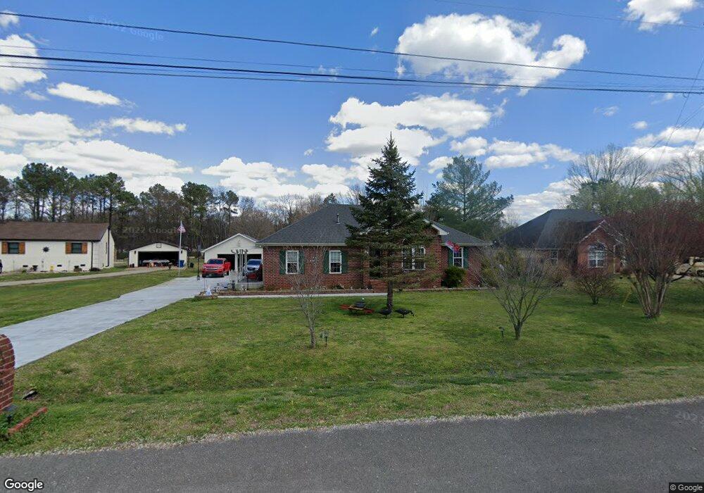
4366 Cannonwood Ct Murfreesboro, TN 37129
Estimated Value: $340,254 - $442,000
--
Bed
2
Baths
1,757
Sq Ft
$221/Sq Ft
Est. Value
About This Home
This home is located at 4366 Cannonwood Ct, Murfreesboro, TN 37129 and is currently estimated at $388,564, approximately $221 per square foot. 4366 Cannonwood Ct is a home located in Rutherford County with nearby schools including Brown's Chapel Elementary School, Stewarts Creek Middle School, and Stewarts Creek High School.
Ownership History
Date
Name
Owned For
Owner Type
Purchase Details
Closed on
May 5, 2003
Sold by
Sengsouk and Chanthavy
Bought by
Biggs Robert L and Biggs Faye E
Current Estimated Value
Home Financials for this Owner
Home Financials are based on the most recent Mortgage that was taken out on this home.
Original Mortgage
$93,900
Outstanding Balance
$40,722
Interest Rate
5.76%
Estimated Equity
$347,842
Purchase Details
Closed on
Jul 29, 1999
Sold by
Henderson Gary S
Bought by
Senqsouk and Chathavy
Home Financials for this Owner
Home Financials are based on the most recent Mortgage that was taken out on this home.
Original Mortgage
$108,180
Interest Rate
7.66%
Purchase Details
Closed on
Mar 22, 1995
Sold by
Robert Latimer
Bought by
Henderson Gary S
Create a Home Valuation Report for This Property
The Home Valuation Report is an in-depth analysis detailing your home's value as well as a comparison with similar homes in the area
Home Values in the Area
Average Home Value in this Area
Purchase History
| Date | Buyer | Sale Price | Title Company |
|---|---|---|---|
| Biggs Robert L | $119,900 | -- | |
| Senqsouk | $108,250 | -- | |
| Henderson Gary S | $83,900 | -- |
Source: Public Records
Mortgage History
| Date | Status | Borrower | Loan Amount |
|---|---|---|---|
| Open | Henderson Gary S | $93,900 | |
| Previous Owner | Henderson Gary S | $108,180 |
Source: Public Records
Tax History Compared to Growth
Tax History
| Year | Tax Paid | Tax Assessment Tax Assessment Total Assessment is a certain percentage of the fair market value that is determined by local assessors to be the total taxable value of land and additions on the property. | Land | Improvement |
|---|---|---|---|---|
| 2025 | $1,379 | $73,525 | $13,750 | $59,775 |
| 2024 | $1,379 | $73,525 | $13,750 | $59,775 |
| 2023 | $1,379 | $73,525 | $13,750 | $59,775 |
| 2022 | $1,188 | $73,525 | $13,750 | $59,775 |
| 2021 | $1,131 | $50,975 | $9,250 | $41,725 |
| 2020 | $1,131 | $50,975 | $9,250 | $41,725 |
| 2019 | $1,131 | $50,975 | $9,250 | $41,725 |
| 2018 | $1,070 | $50,975 | $0 | $0 |
| 2017 | $993 | $37,050 | $0 | $0 |
| 2016 | $993 | $37,050 | $0 | $0 |
| 2015 | $993 | $37,050 | $0 | $0 |
| 2014 | $921 | $37,050 | $0 | $0 |
| 2013 | -- | $36,250 | $0 | $0 |
Source: Public Records
Map
Nearby Homes
- 4356 Cannonwood Ct
- 4376 Cannonwood Ct
- 4386 Cannonwood Ct
- 4346 Cannonwood Ct
- 4365 Cannonwood Ct
- 4355 Cannonwood Ct
- 4375 Cannonwood Ct
- 4385 Cannonwood Ct
- 4343 Cannonwood Ct
- 4336 Cannonwood Ct
- 4326 Cannonwood Ct
- 4323 Cannonwood Ct
- 5256 Blackman Rd
- 5226 Blackman Rd
- 4316 Cannonwood Ct
- 5236 Blackman Rd
- 5216 Blackman Rd
- 5304 Blackman Rd
- 5314 Blackman Rd
- 5206 Blackman Rd