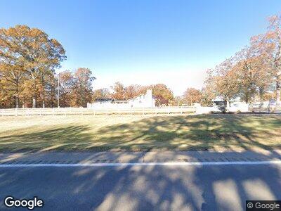
Estimated Value: $119,000 - $298,675
--
Bed
3
Baths
2,301
Sq Ft
$91/Sq Ft
Est. Value
About This Home
This home is located at 4366 Highway 79, Roe, AR 72134 and is currently estimated at $208,838, approximately $90 per square foot. 4366 Highway 79 is a home with nearby schools including Clarendon Elementary School and Clarendon High School.
Ownership History
Date
Name
Owned For
Owner Type
Purchase Details
Closed on
Dec 20, 2012
Bought by
Hayes Richard and Hayes Sarah
Current Estimated Value
Purchase Details
Closed on
May 24, 2005
Bought by
Hayes Richard and Hayes Sarah
Purchase Details
Closed on
Mar 31, 2004
Bought by
Black Warrior Real Estate Llc
Purchase Details
Closed on
Mar 5, 2004
Bought by
Black Warrior Real Estate Llc
Purchase Details
Closed on
Sep 26, 2003
Bought by
White Joe
Create a Home Valuation Report for This Property
The Home Valuation Report is an in-depth analysis detailing your home's value as well as a comparison with similar homes in the area
Home Values in the Area
Average Home Value in this Area
Purchase History
| Date | Buyer | Sale Price | Title Company |
|---|---|---|---|
| Hayes Richard | $1,000 | -- | |
| Hayes Richard | $1,000 | -- | |
| Hayes Richard | $300,000 | -- | |
| Black Warrior Real Estate Llc | -- | -- | |
| Black Warrior Real Estate Llc | -- | -- | |
| White Joe | $200,000 | -- |
Source: Public Records
Tax History Compared to Growth
Tax History
| Year | Tax Paid | Tax Assessment Tax Assessment Total Assessment is a certain percentage of the fair market value that is determined by local assessors to be the total taxable value of land and additions on the property. | Land | Improvement |
|---|---|---|---|---|
| 2024 | $1,478 | $41,330 | $2,690 | $38,640 |
| 2023 | $1,934 | $41,330 | $2,690 | $38,640 |
| 2022 | $1,562 | $41,330 | $2,690 | $38,640 |
| 2021 | $1,523 | $41,330 | $2,690 | $38,640 |
| 2020 | $1,448 | $41,330 | $2,690 | $38,640 |
| 2019 | $1,343 | $38,320 | $2,600 | $35,720 |
| 2018 | $1,342 | $38,320 | $2,600 | $35,720 |
| 2017 | $1,518 | $38,320 | $2,600 | $35,720 |
| 2016 | -- | $38,320 | $2,600 | $35,720 |
| 2014 | -- | $32,940 | $2,480 | $30,460 |
| 2013 | -- | $32,940 | $2,480 | $30,460 |
Source: Public Records
Map
Nearby Homes
- 18442 Hwy 33
- 10 S Ives Ln
- 220 N 2nd St
- 516 Park St
- Lots 17-20 Loomis Landing Rd
- 9434 Hwy 33
- 108 N Robinson St
- 16 Cooks Lake Rd
- 169 E 2nd St
- 301 S Prairie St
- 1809 N Maple St
- 304 Lee Place
- 1108 N Porter St
- 1004 N Maple St
- 401 N Chester St
- 505 W Cleveland St
- 910 N Buerkle St
- 209 S Rose St
- 00 S Park Ave
- 1317 Upper Maddox Bay Rd
