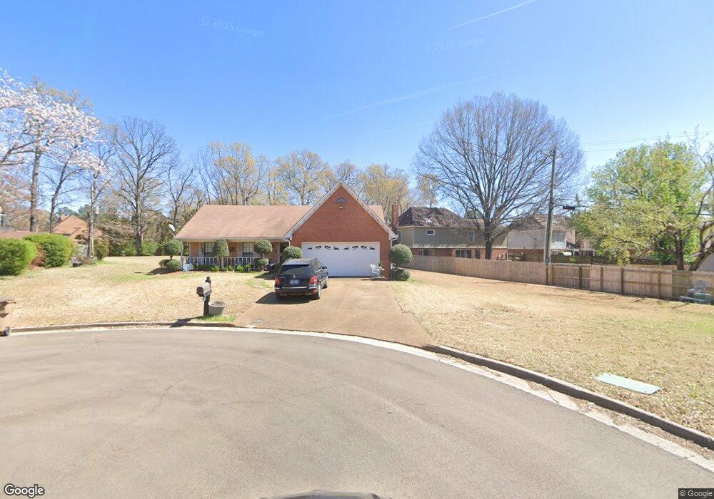
4368 High Ridge Point Memphis, TN 38125
Southern Shelby County NeighborhoodEstimated Value: $218,000 - $252,000
3
Beds
2
Baths
1,490
Sq Ft
$158/Sq Ft
Est. Value
About This Home
This home is located at 4368 High Ridge Point, Memphis, TN 38125 and is currently estimated at $236,165, approximately $158 per square foot. 4368 High Ridge Point is a home located in Shelby County with nearby schools including Lowrance Elementary School, Southwind High School, and Power Center Academy - Southeast.
Ownership History
Date
Name
Owned For
Owner Type
Purchase Details
Closed on
Apr 12, 2023
Sold by
Johnson John W
Bought by
Johnson John W and Johnson Ann M
Current Estimated Value
Purchase Details
Closed on
Aug 29, 1996
Sold by
Wilkinson Charles C and Wilkinson Elizabeth S
Bought by
Johnson John W
Home Financials for this Owner
Home Financials are based on the most recent Mortgage that was taken out on this home.
Original Mortgage
$75,600
Interest Rate
7%
Create a Home Valuation Report for This Property
The Home Valuation Report is an in-depth analysis detailing your home's value as well as a comparison with similar homes in the area
Home Values in the Area
Average Home Value in this Area
Purchase History
| Date | Buyer | Sale Price | Title Company |
|---|---|---|---|
| Johnson John W | -- | Home Surety Title & Escrow | |
| Johnson John W | $94,500 | -- |
Source: Public Records
Mortgage History
| Date | Status | Borrower | Loan Amount |
|---|---|---|---|
| Previous Owner | Johnson John W | $75,600 |
Source: Public Records
Tax History Compared to Growth
Tax History
| Year | Tax Paid | Tax Assessment Tax Assessment Total Assessment is a certain percentage of the fair market value that is determined by local assessors to be the total taxable value of land and additions on the property. | Land | Improvement |
|---|---|---|---|---|
| 2025 | $1,461 | $59,125 | $17,425 | $41,700 |
| 2024 | $1,461 | $43,100 | $8,425 | $34,675 |
| 2023 | $1,461 | $43,100 | $8,425 | $34,675 |
| 2022 | $1,461 | $43,100 | $8,425 | $34,675 |
| 2021 | $1,487 | $43,100 | $8,425 | $34,675 |
| 2020 | $1,286 | $31,750 | $8,425 | $23,325 |
| 2019 | $1,286 | $31,750 | $8,425 | $23,325 |
| 2018 | $1,286 | $31,750 | $8,425 | $23,325 |
| 2017 | $1,305 | $31,750 | $8,425 | $23,325 |
| 2016 | $1,202 | $27,500 | $0 | $0 |
| 2014 | $1,202 | $27,500 | $0 | $0 |
Source: Public Records
Map
Nearby Homes
- 7421 Richmond Rd
- 7527 Wilsford Cove
- 4310 Coral Creek Ln
- 7286 New Britain Dr
- 4386 S Germantown Rd
- 7561 Shelby Cross Cir
- 7321 Stonington Dr
- 4294 Thunderstone Cir W
- 4512 S Germantown Rd
- 4569 Cardiff Cove
- 4351 Spring Oak Cove
- 4471 Hughes Meadow Dr
- 4735 Harvest Knoll Cove N
- 7218 Barnstable Rd
- 4646 Sweet Whisper Ln
- 4056 Clovis Cove
- 4764 Buttermilk Dr
- 7579 Baysweet Dr
- 4768 Gertrude Dr
- 7124 Old Dr N
- 4379 Richwood Place
- 7475 Cades Cove
- 4387 Richwood Place
- 7485 Cades Cove
- 4373 Richwood Place
- 4396 Walden Cove
- 4369 High Ridge Point Cove
- 4369 High Ridge Point
- 4392 Walden Cove
- 4386 Richwood Place
- 4363 High Ridge Point
- 7525 Split Rail Cove
- 4397 Richwood Place
- 4353 High Ridge Point
- 4392 Richwood Place
- 4388 Old Forest Rd
- 4400 Walden Cove
- 4388 Walden Cove
- 7484 Cades Cove
- 4347 High Ridge Point Cove