Estimated Value: $246,815 - $282,000
3
Beds
1
Bath
1,304
Sq Ft
$199/Sq Ft
Est. Value
About This Home
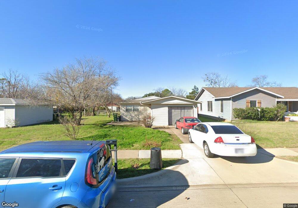
This home is located at 437 Michael Blvd, Hurst, TX 76053 and is currently estimated at $258,954, approximately $198 per square foot. 437 Michael Blvd is a home located in Tarrant County with nearby schools including Bellaire Elementary School, Hurst J High School, and L.D. Bell High School.
Ownership History
Date
Name
Owned For
Owner Type
Purchase Details
Closed on
Apr 22, 2019
Sold by
Fm Test Solutions Llc
Bought by
Belec Mathew and Belec Stacy
Current Estimated Value
Home Financials for this Owner
Home Financials are based on the most recent Mortgage that was taken out on this home.
Original Mortgage
$155,200
Outstanding Balance
$136,448
Interest Rate
4.3%
Mortgage Type
New Conventional
Estimated Equity
$122,506
Purchase Details
Closed on
Aug 3, 2018
Sold by
Henken Joyce G
Bought by
Fm Test Solutions Llc
Home Financials for this Owner
Home Financials are based on the most recent Mortgage that was taken out on this home.
Original Mortgage
$81,825
Interest Rate
4.5%
Mortgage Type
Purchase Money Mortgage
Purchase Details
Closed on
Oct 26, 1998
Sold by
Price Kenneth W and Price Elizabeth A
Bought by
Henken Joyce G
Purchase Details
Closed on
Jun 24, 1994
Sold by
Grant John G and Grant Rhonda L
Bought by
Price Kenneth W and Price Elizabeth A
Create a Home Valuation Report for This Property
The Home Valuation Report is an in-depth analysis detailing your home's value as well as a comparison with similar homes in the area
Home Values in the Area
Average Home Value in this Area
Purchase History
| Date | Buyer | Sale Price | Title Company |
|---|---|---|---|
| Belec Mathew | -- | None Available | |
| Fm Test Solutions Llc | -- | Chicago Title | |
| Henken Joyce G | -- | Alamo Title Company | |
| Price Kenneth W | -- | First Southwestern Title Age |
Source: Public Records
Mortgage History
| Date | Status | Borrower | Loan Amount |
|---|---|---|---|
| Open | Belec Mathew | $155,200 | |
| Previous Owner | Fm Test Solutions Llc | $81,825 | |
| Closed | Price Kenneth W | $0 |
Source: Public Records
Tax History
| Year | Tax Paid | Tax Assessment Tax Assessment Total Assessment is a certain percentage of the fair market value that is determined by local assessors to be the total taxable value of land and additions on the property. | Land | Improvement |
|---|---|---|---|---|
| 2025 | $2,917 | $261,683 | $50,000 | $211,683 |
| 2024 | $2,917 | $261,683 | $50,000 | $211,683 |
| 2023 | $3,879 | $237,171 | $35,000 | $202,171 |
| 2022 | $4,052 | $206,000 | $35,000 | $171,000 |
| 2021 | $3,859 | $160,000 | $35,000 | $125,000 |
| 2020 | $3,849 | $160,000 | $35,000 | $125,000 |
| 2019 | $3,229 | $131,930 | $35,000 | $96,930 |
| 2018 | $2,384 | $97,393 | $15,000 | $82,393 |
| 2017 | $2,176 | $85,987 | $15,000 | $70,987 |
| 2016 | $2,125 | $83,976 | $15,000 | $68,976 |
| 2015 | $1,707 | $65,100 | $15,000 | $50,100 |
| 2014 | $1,707 | $65,100 | $15,000 | $50,100 |
Source: Public Records
Map
Nearby Homes
- 42 Page St
- 413 Wanda Way
- 308 Wanda Way
- 705 Timbercreek Dr
- 212 E Ellen Ave
- 740 Shady Ln
- 312 E Ellen Ave
- 260 Corinna Ct
- 108 Donald Dr
- 205 Corinna Ct
- 552 Norwood Dr
- 1302 Woodridge Cir
- 4106 Hollow Oak Dr
- 47 Donald Ct
- 408 Harrison Ln
- 609 Norwood Dr
- 1306 Driftwood Dr
- 1309 Driftwood Dr
- 701 Harrison Ln
- 231 Elm St
- 441 Michael Blvd
- 433 Michael Blvd
- 445 Michael Blvd
- 429 Michael Blvd
- 212 Page Ct
- 216 Page Ct
- 208 Page Ct
- 436 Michael Blvd
- 449 Michael Blvd
- 432 Michael Blvd
- 204 Page Ct
- 425 Michael Blvd
- 428 Michael Blvd
- 453 Michael Blvd
- 448 Michael Blvd
- 504 Brookfield Dr
- 200 Page Ct
- 424 Michael Blvd
- 457 Michael Blvd
- 508 Brookfield Dr
Your Personal Tour Guide
Ask me questions while you tour the home.